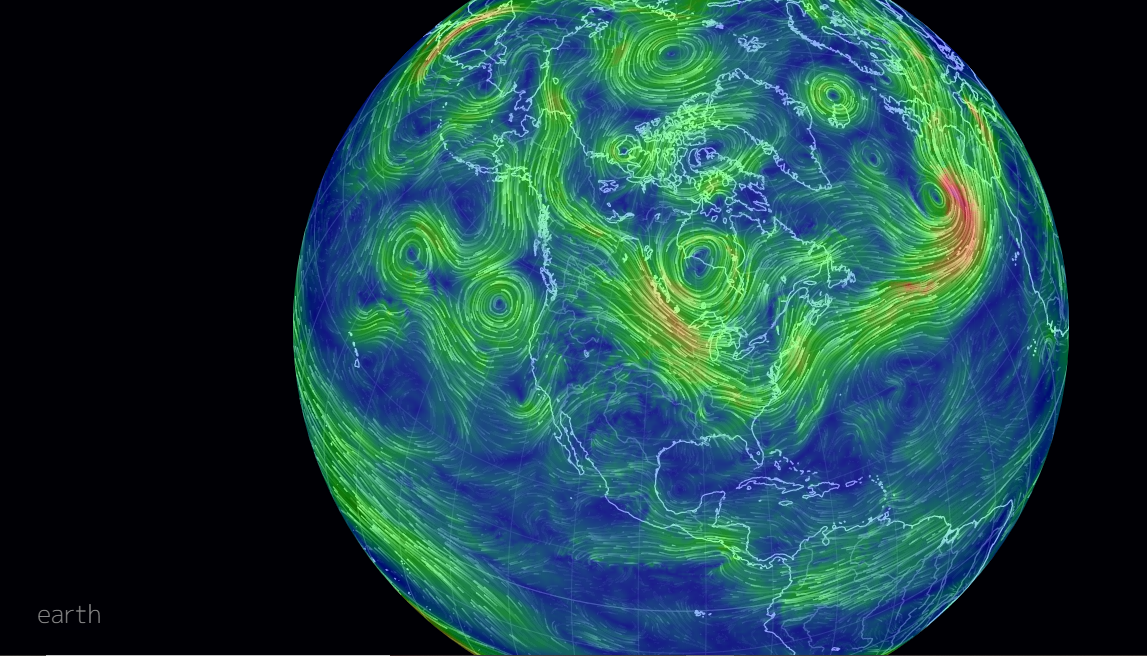
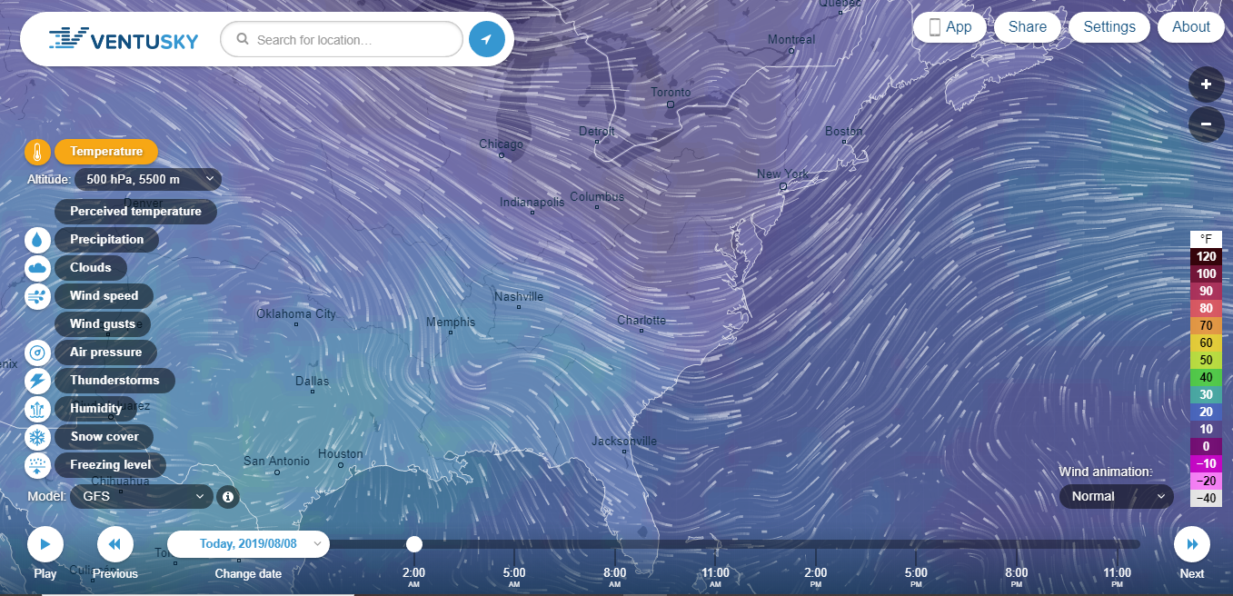
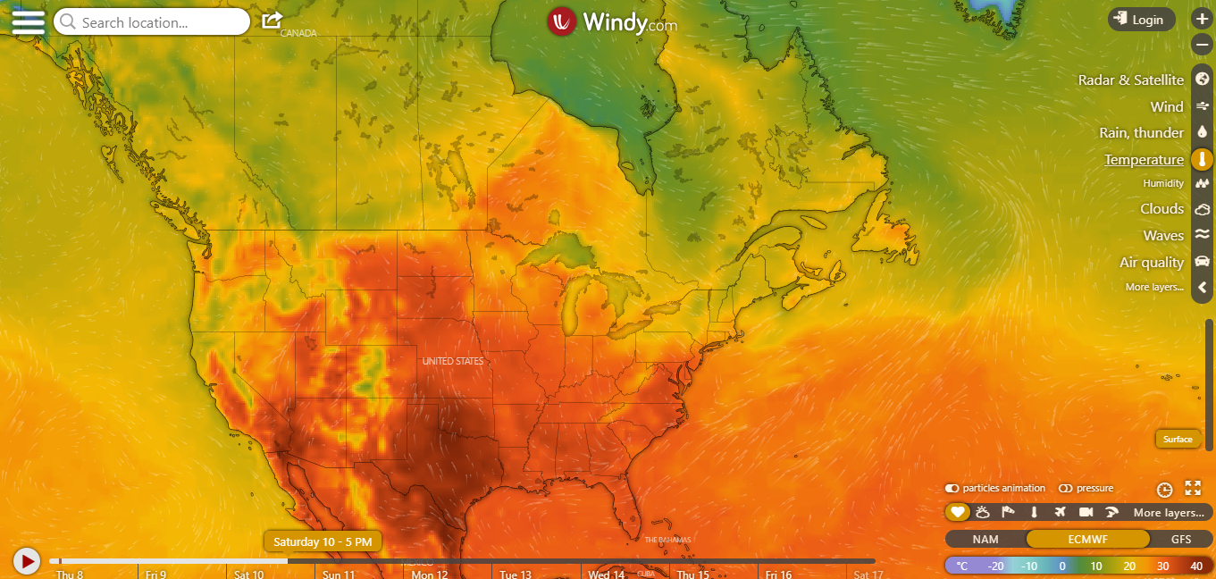
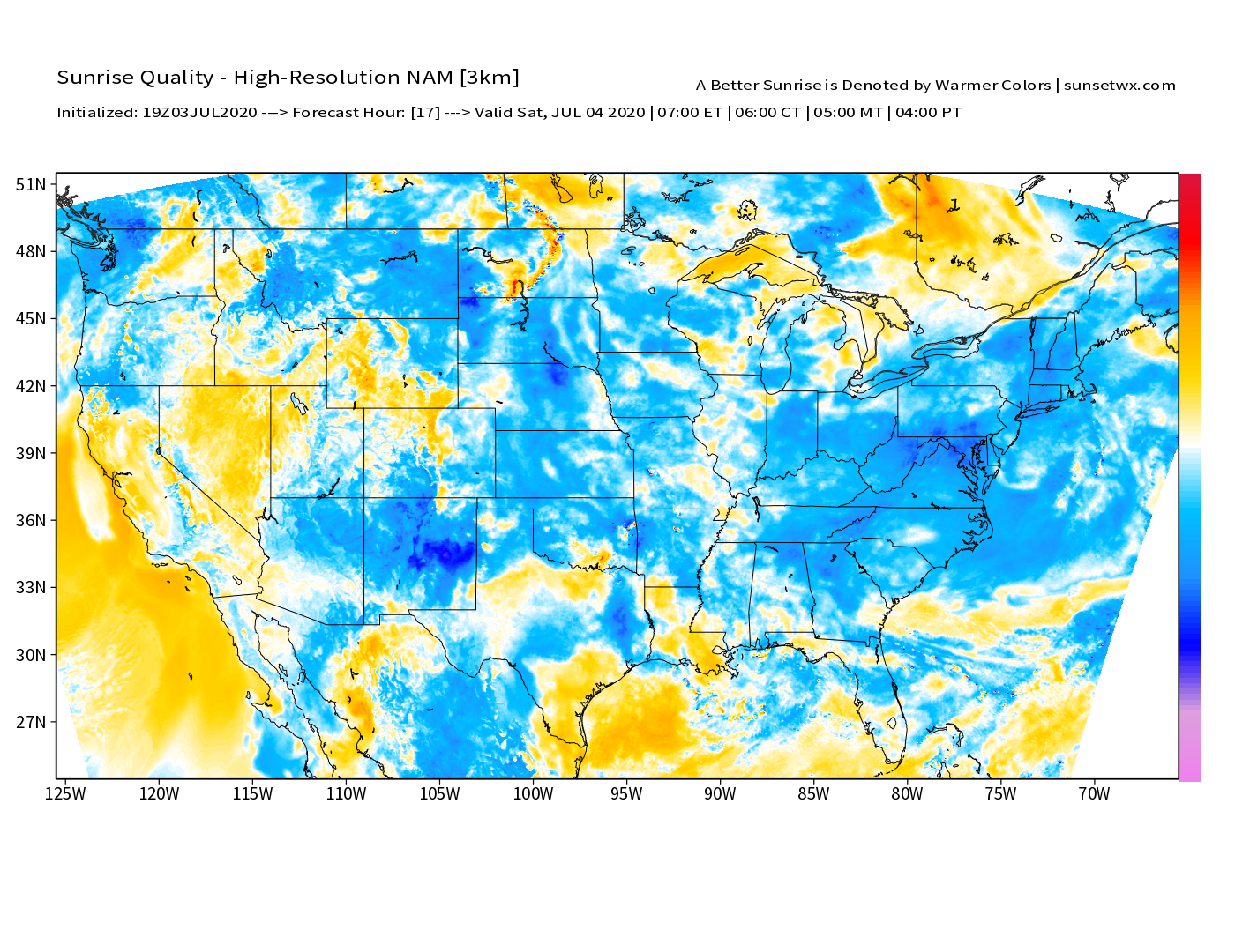
Modern Visualizations

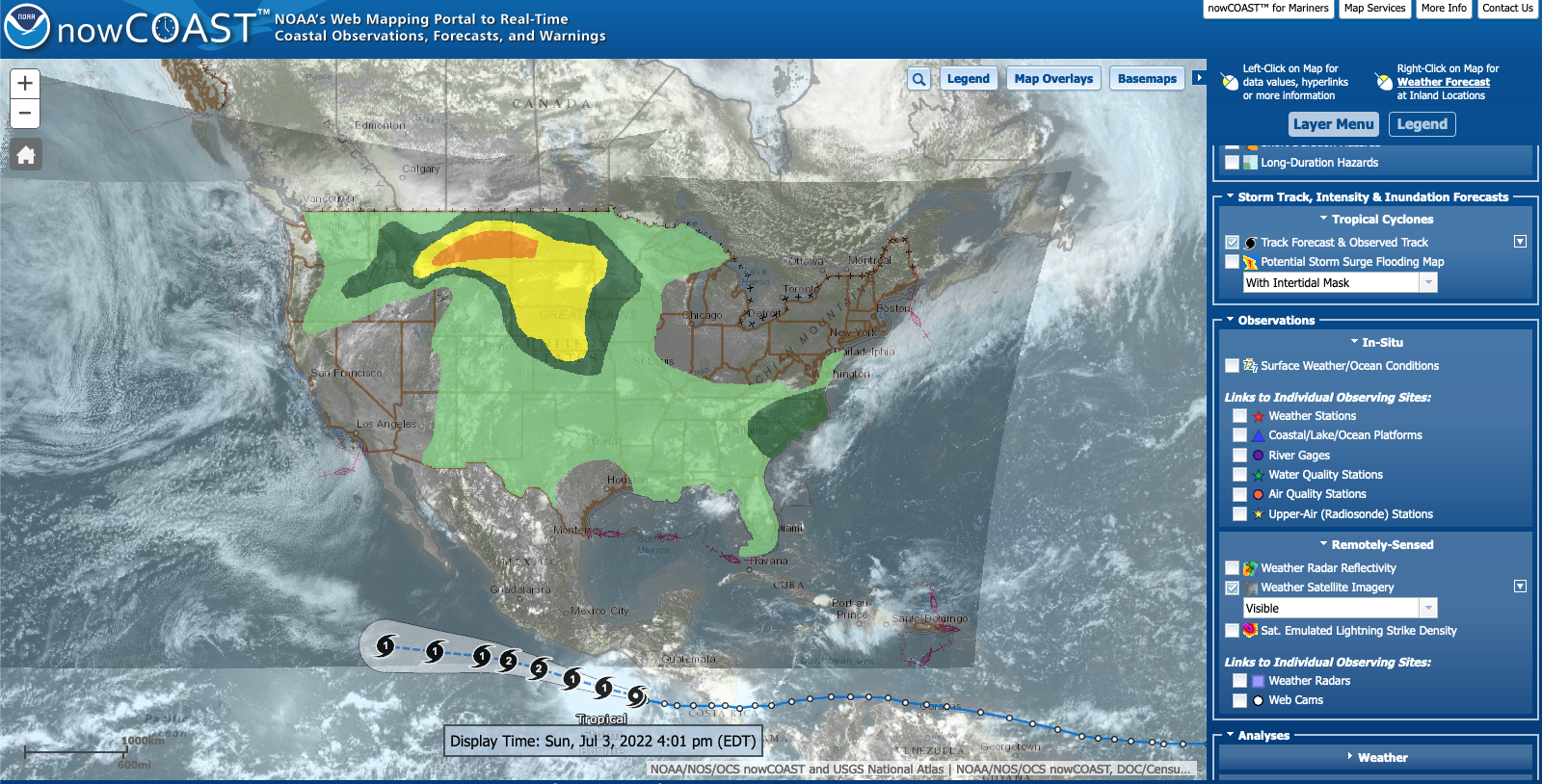
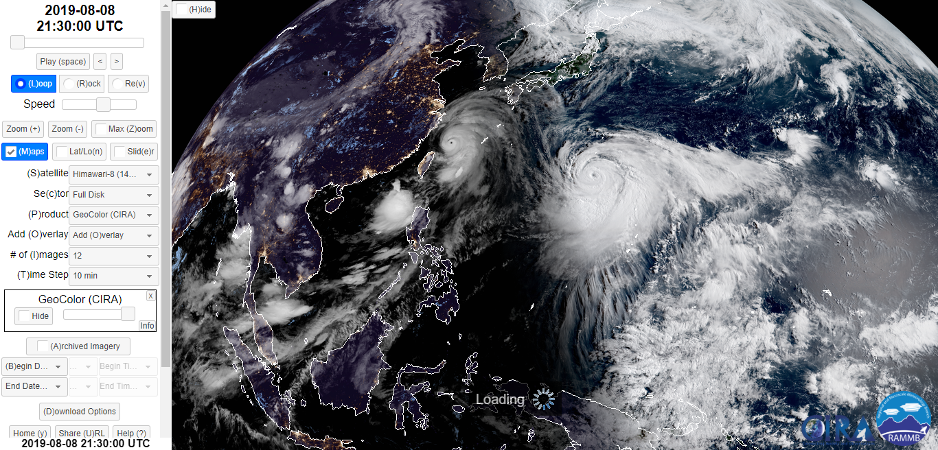
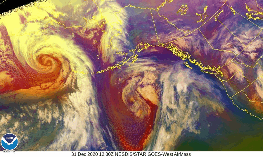
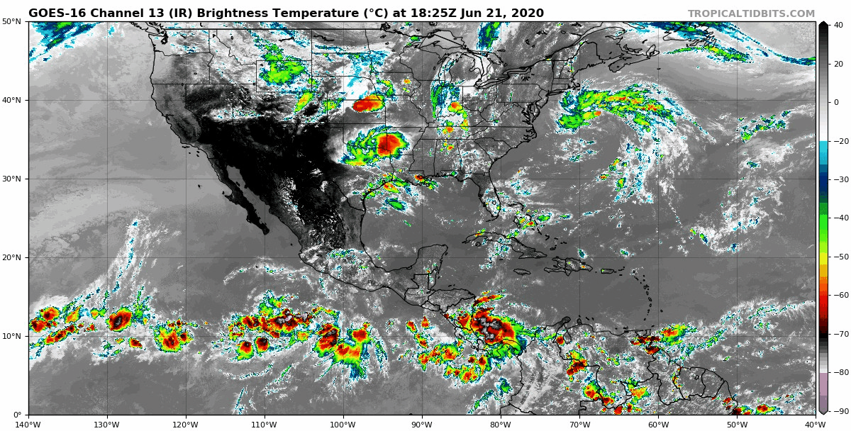
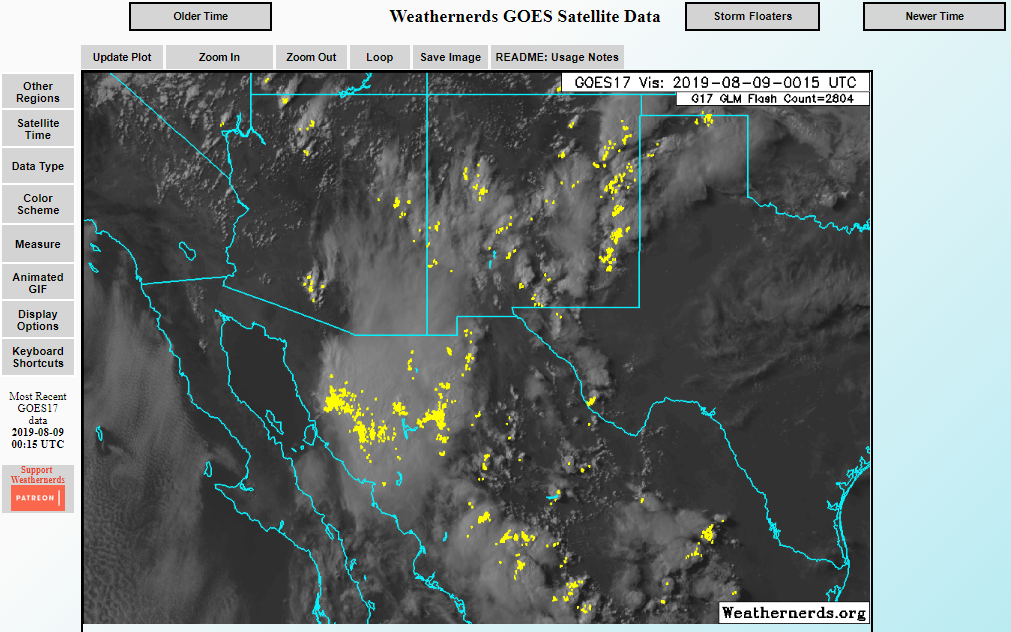
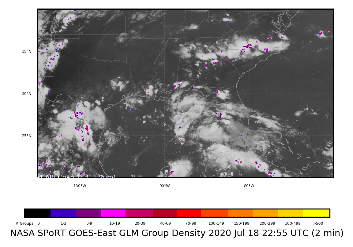
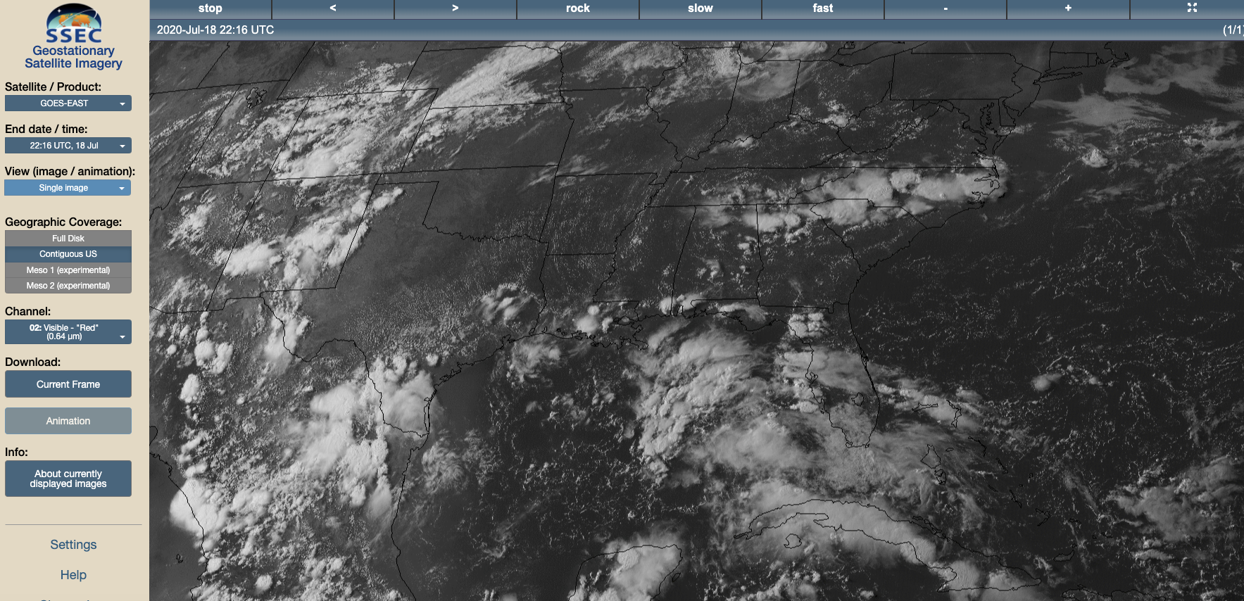
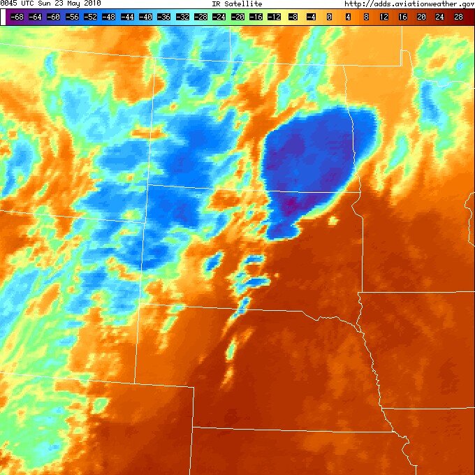
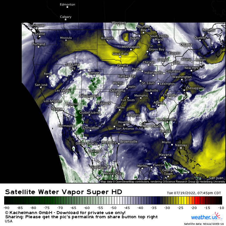
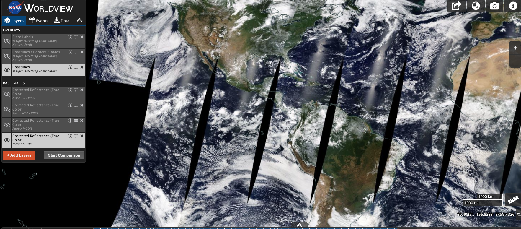
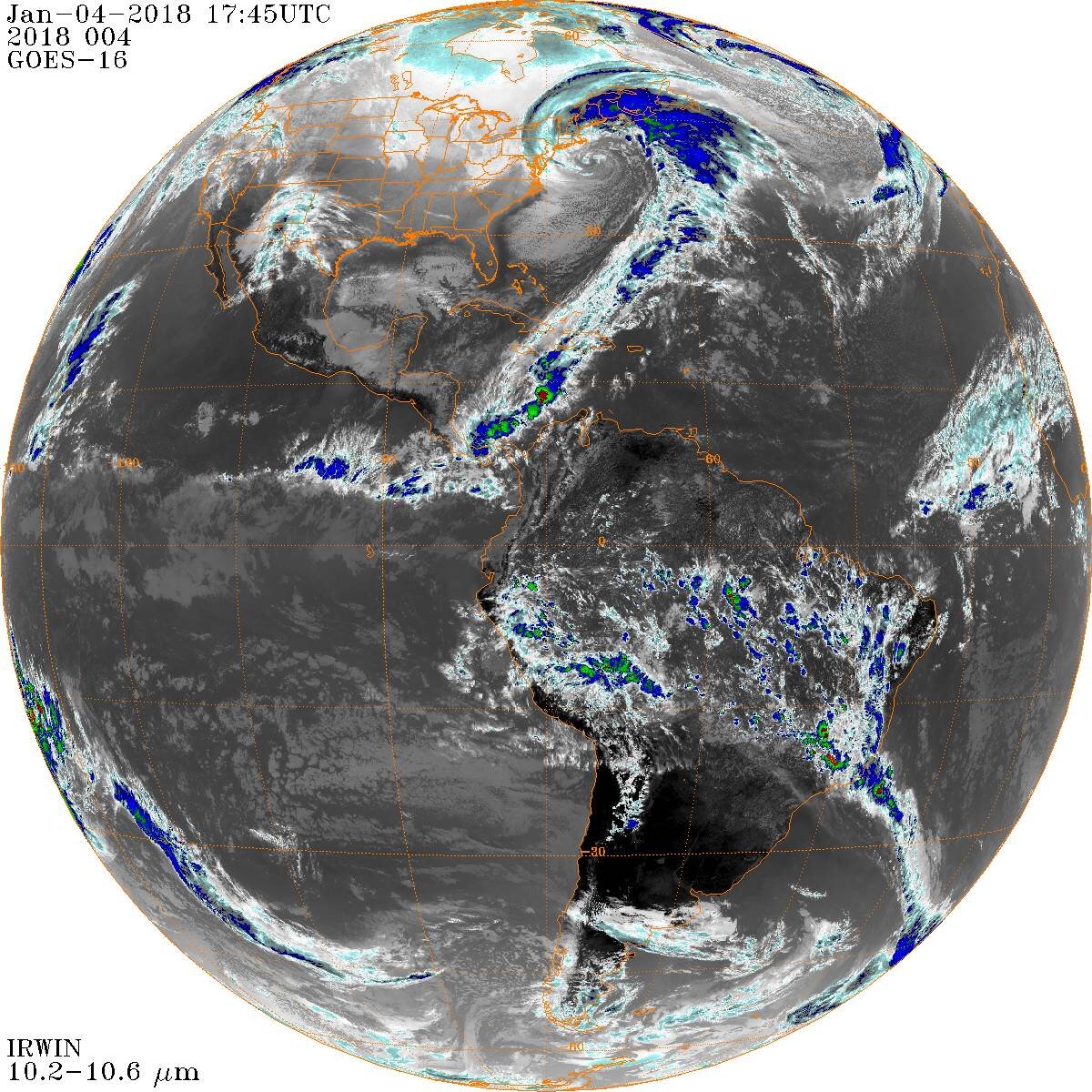
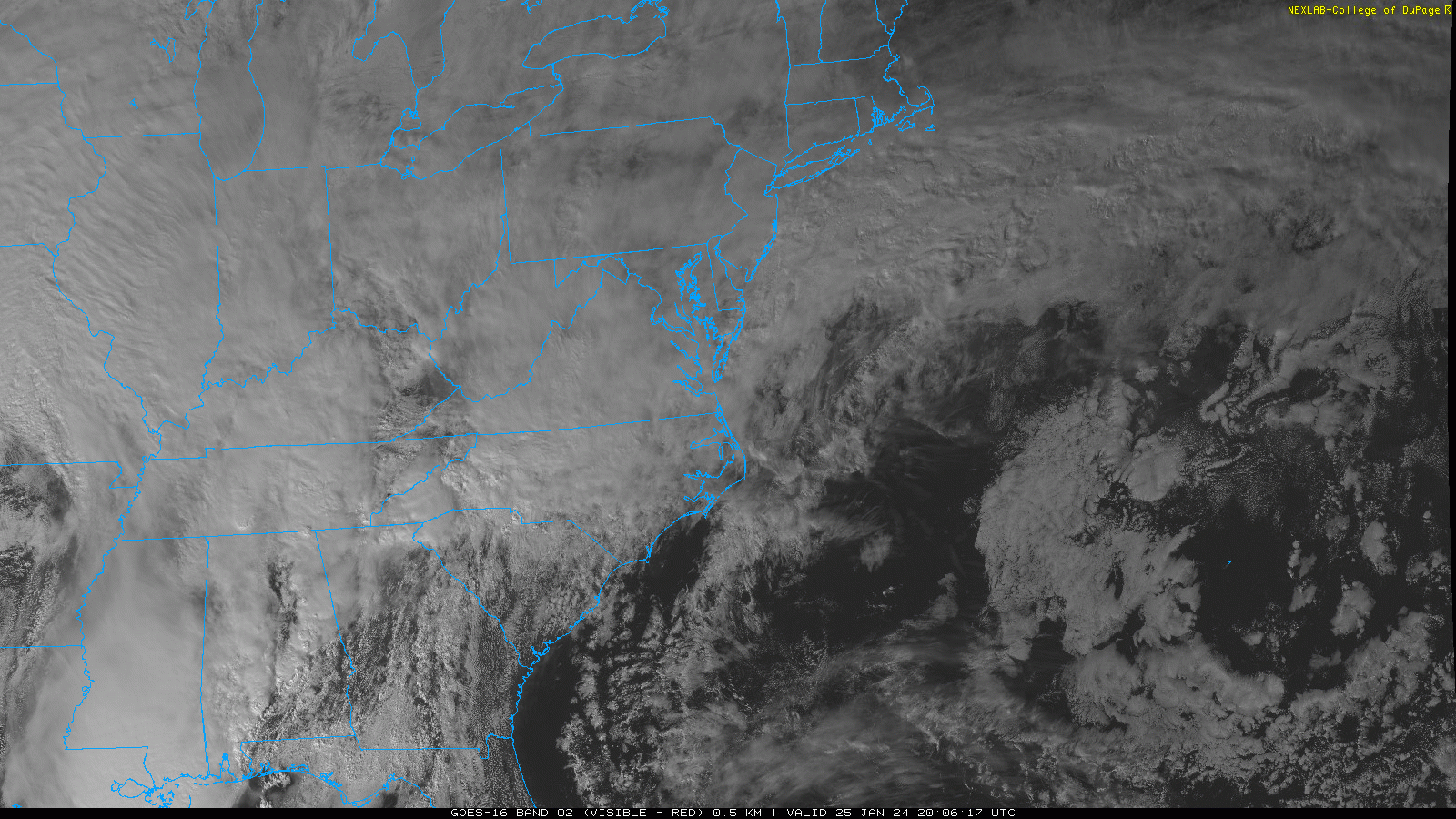
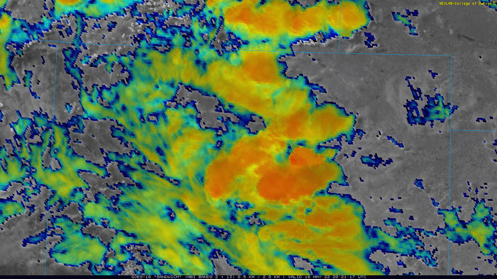
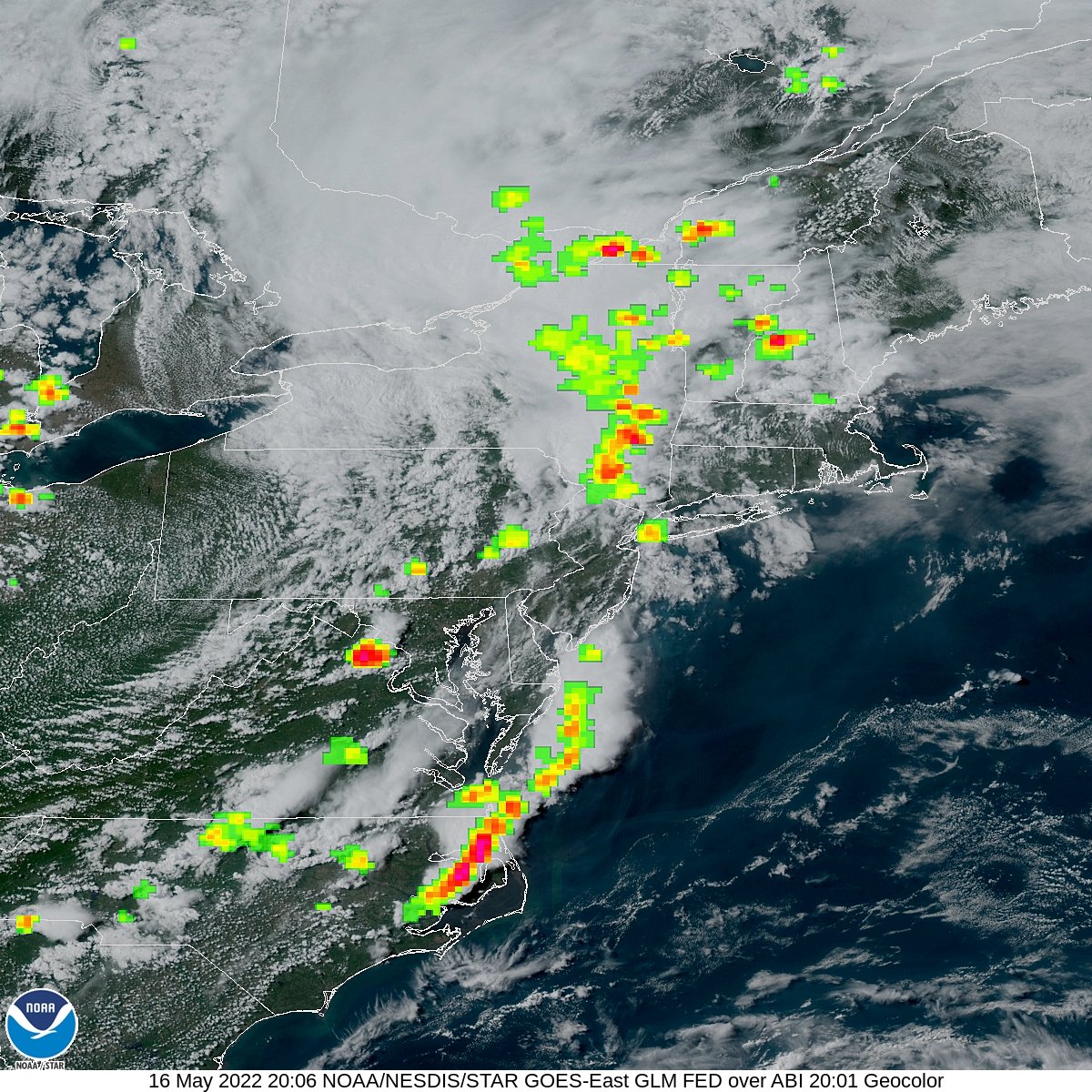
Satellite
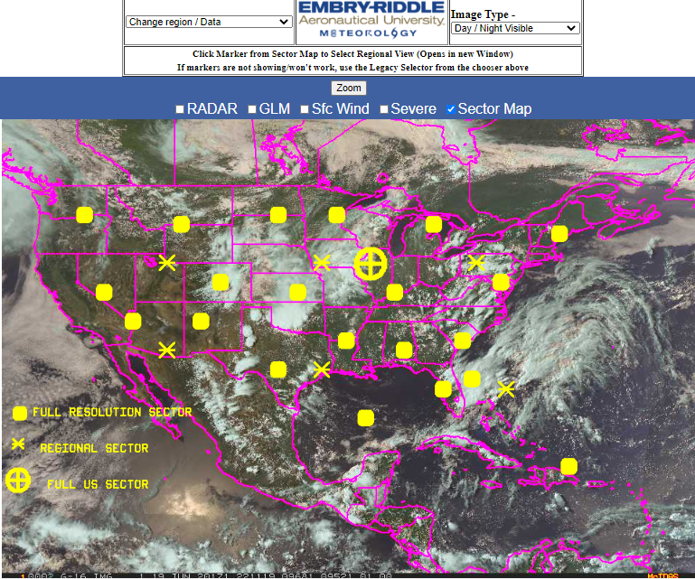
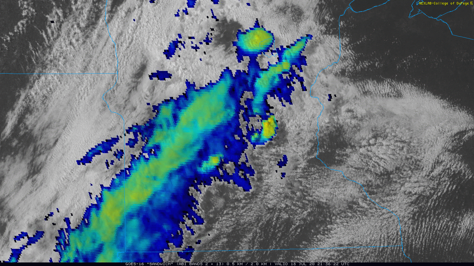
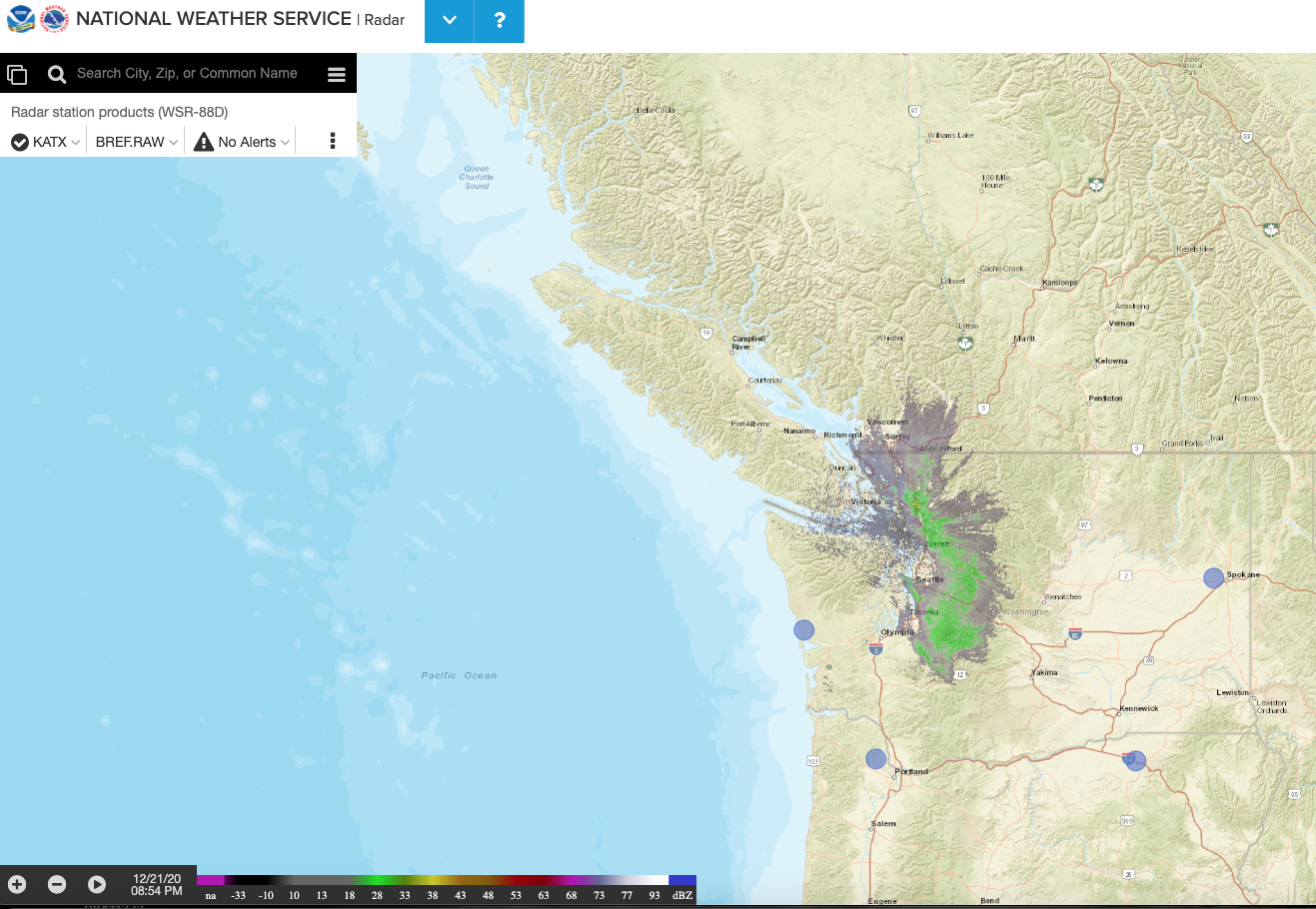
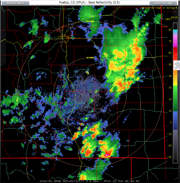
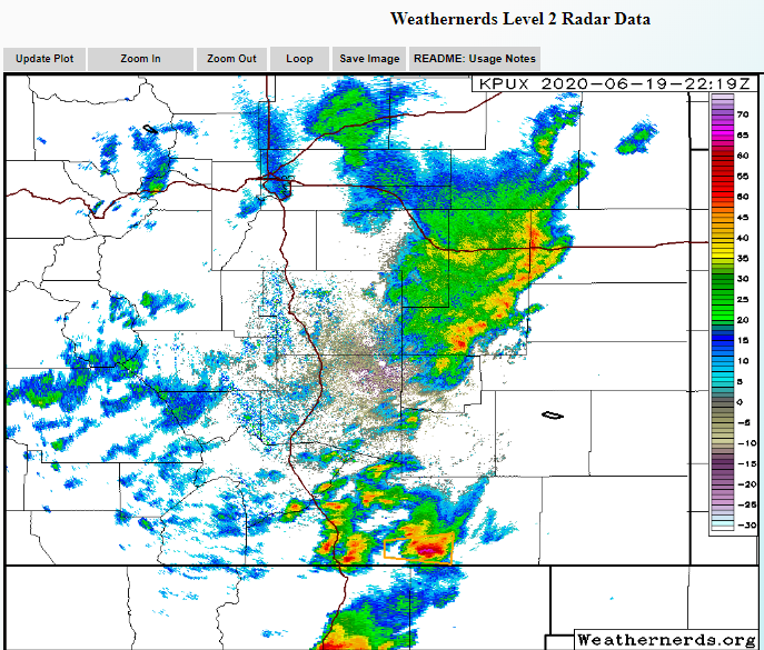
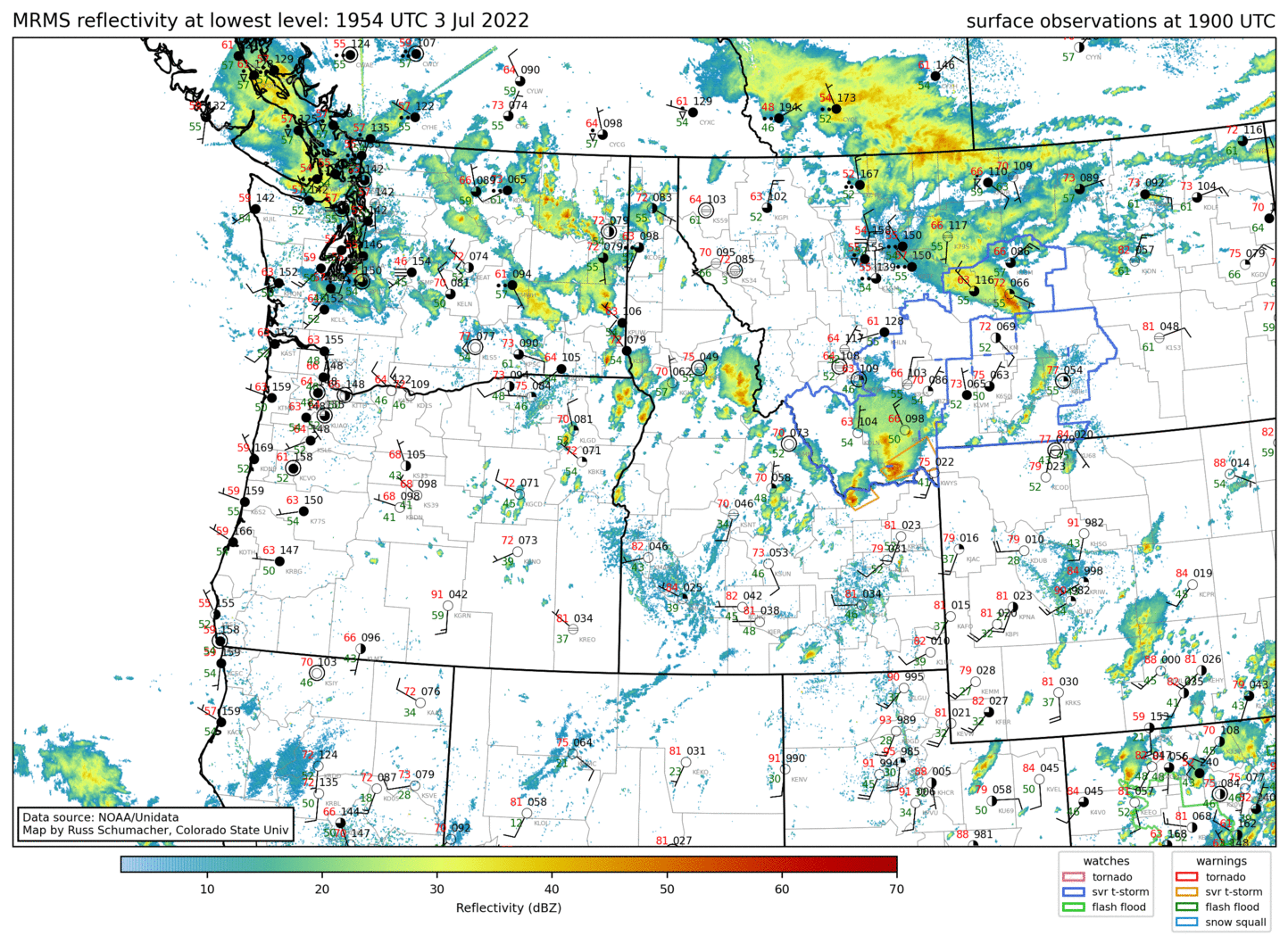
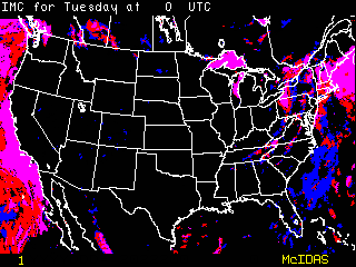
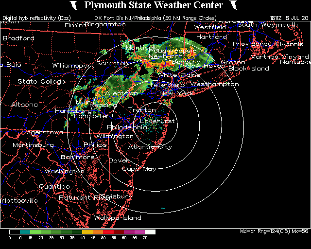
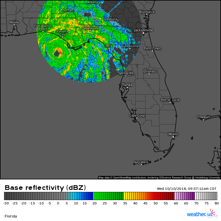
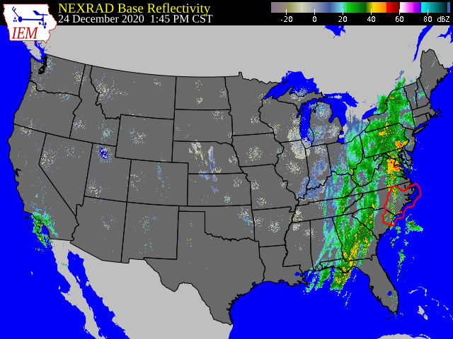
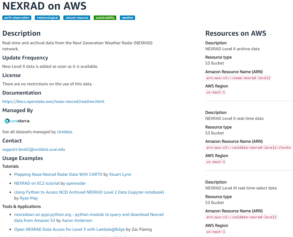
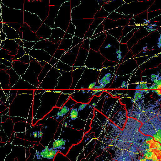
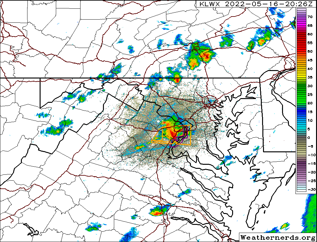
Radar
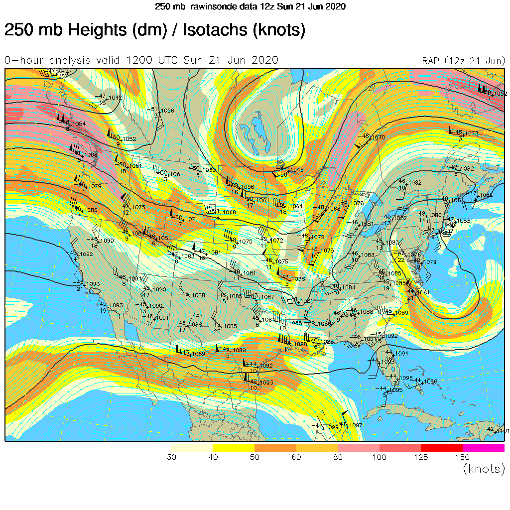
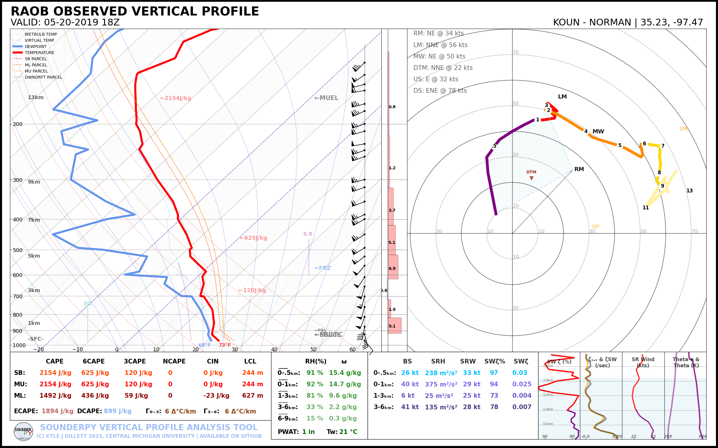
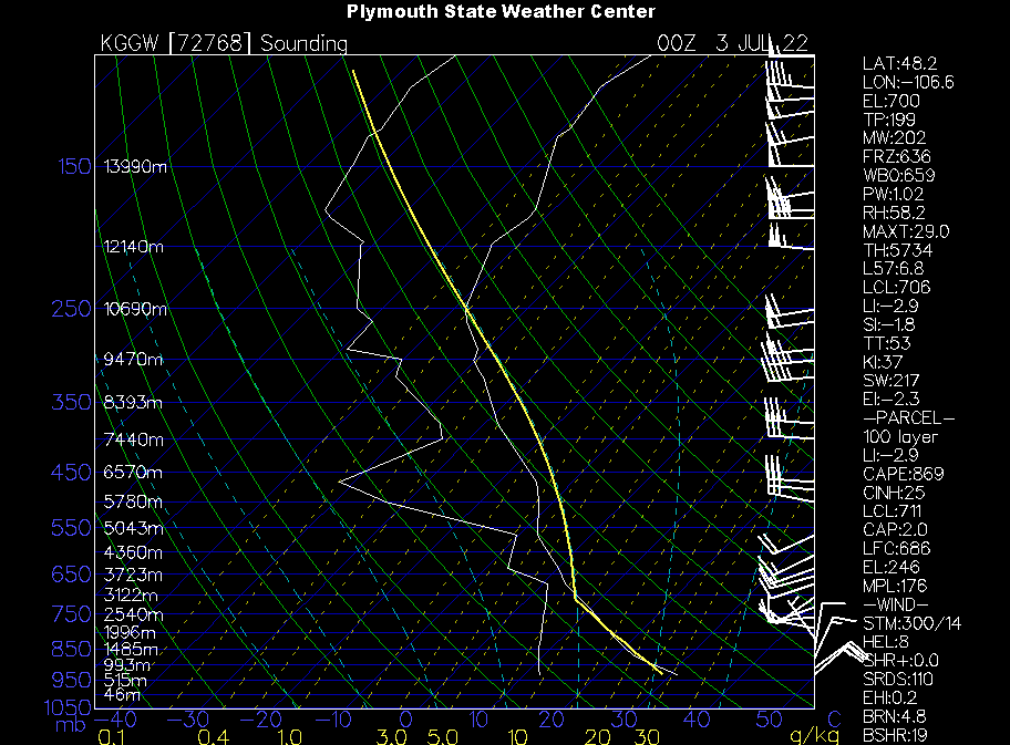
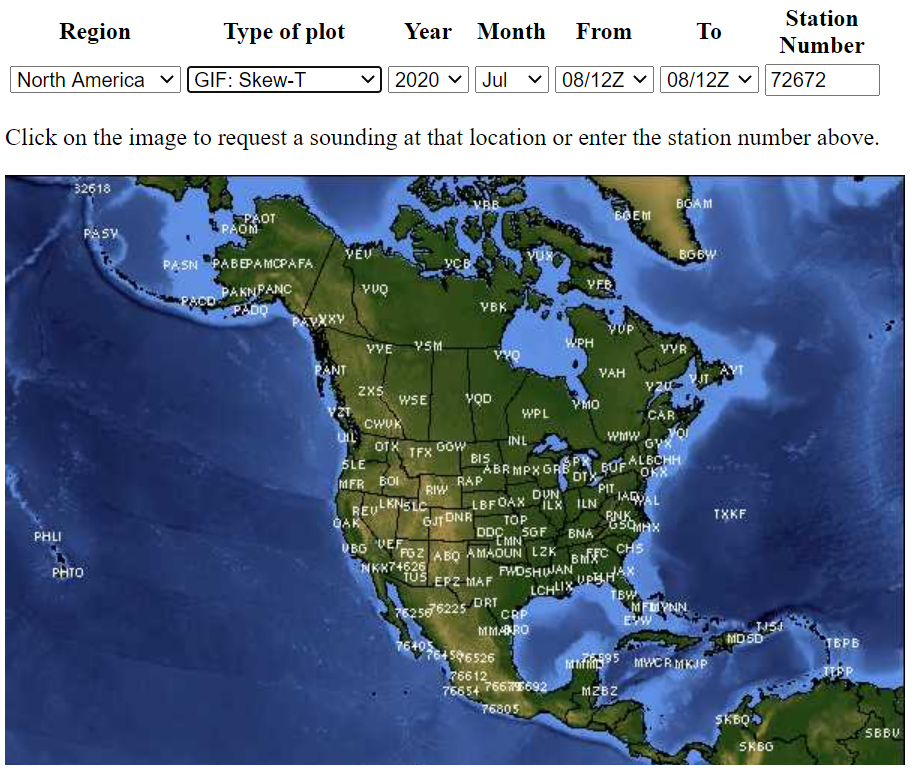
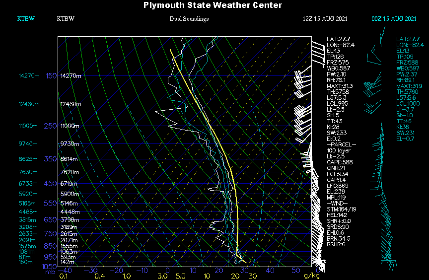
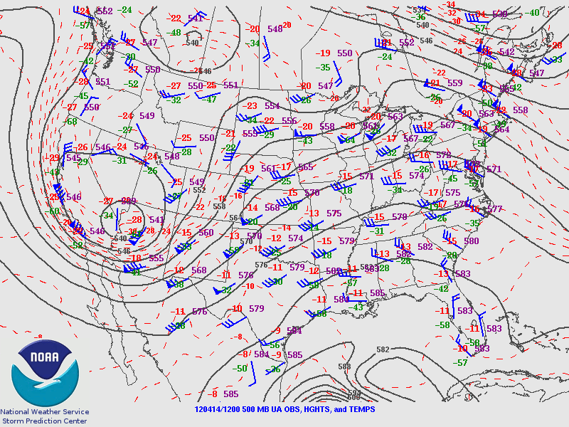
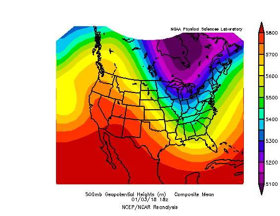
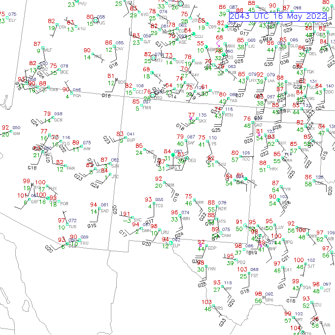
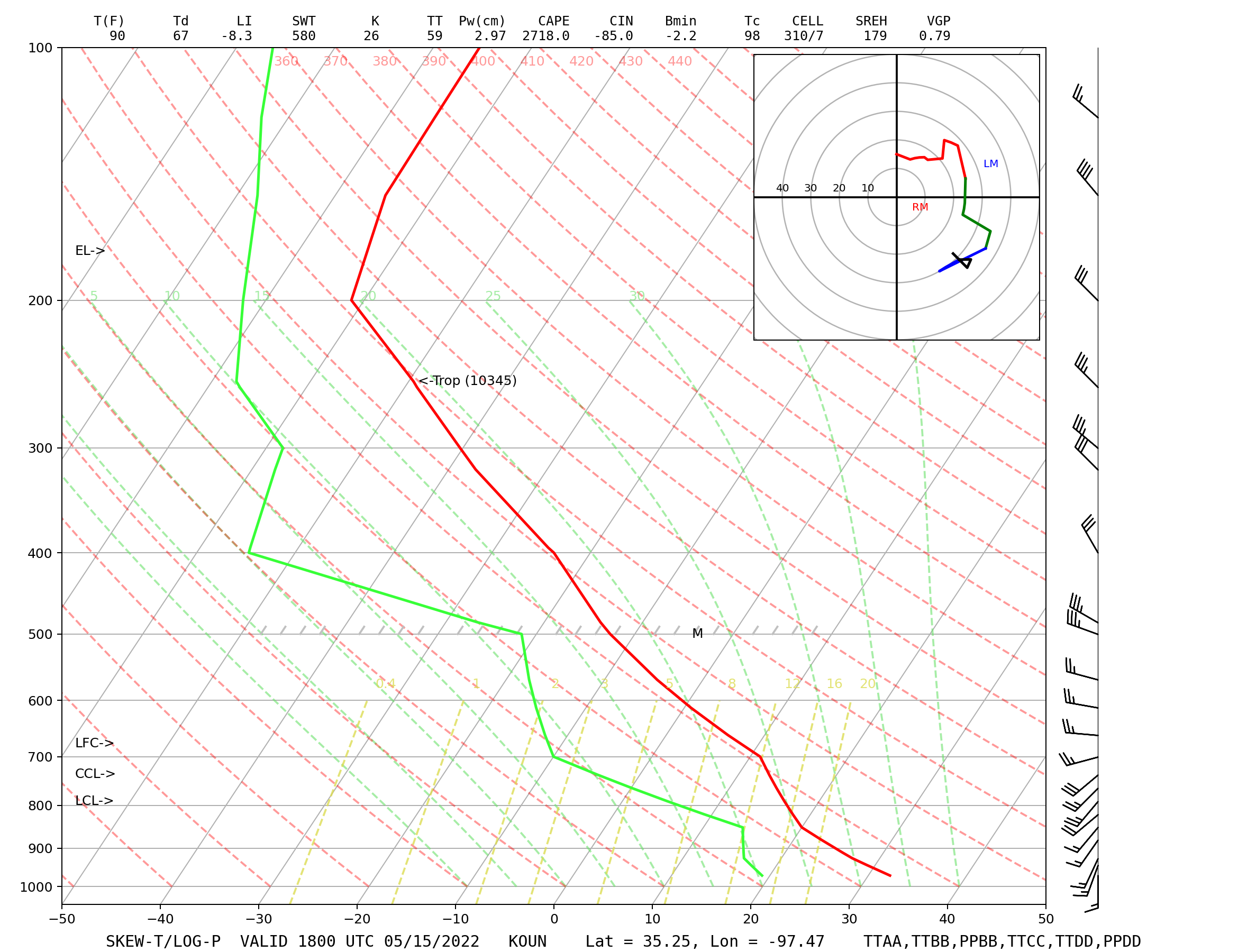
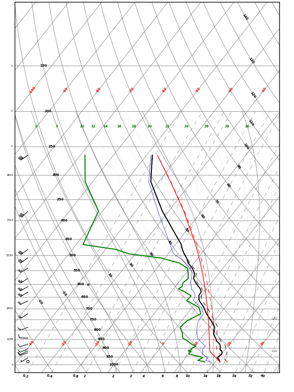
Upper-Air Charts and Radiosonde Data


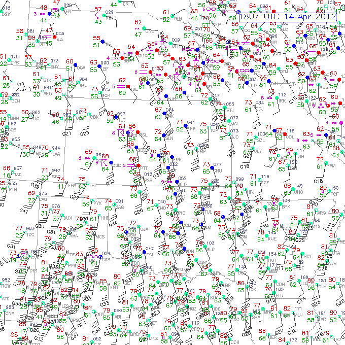
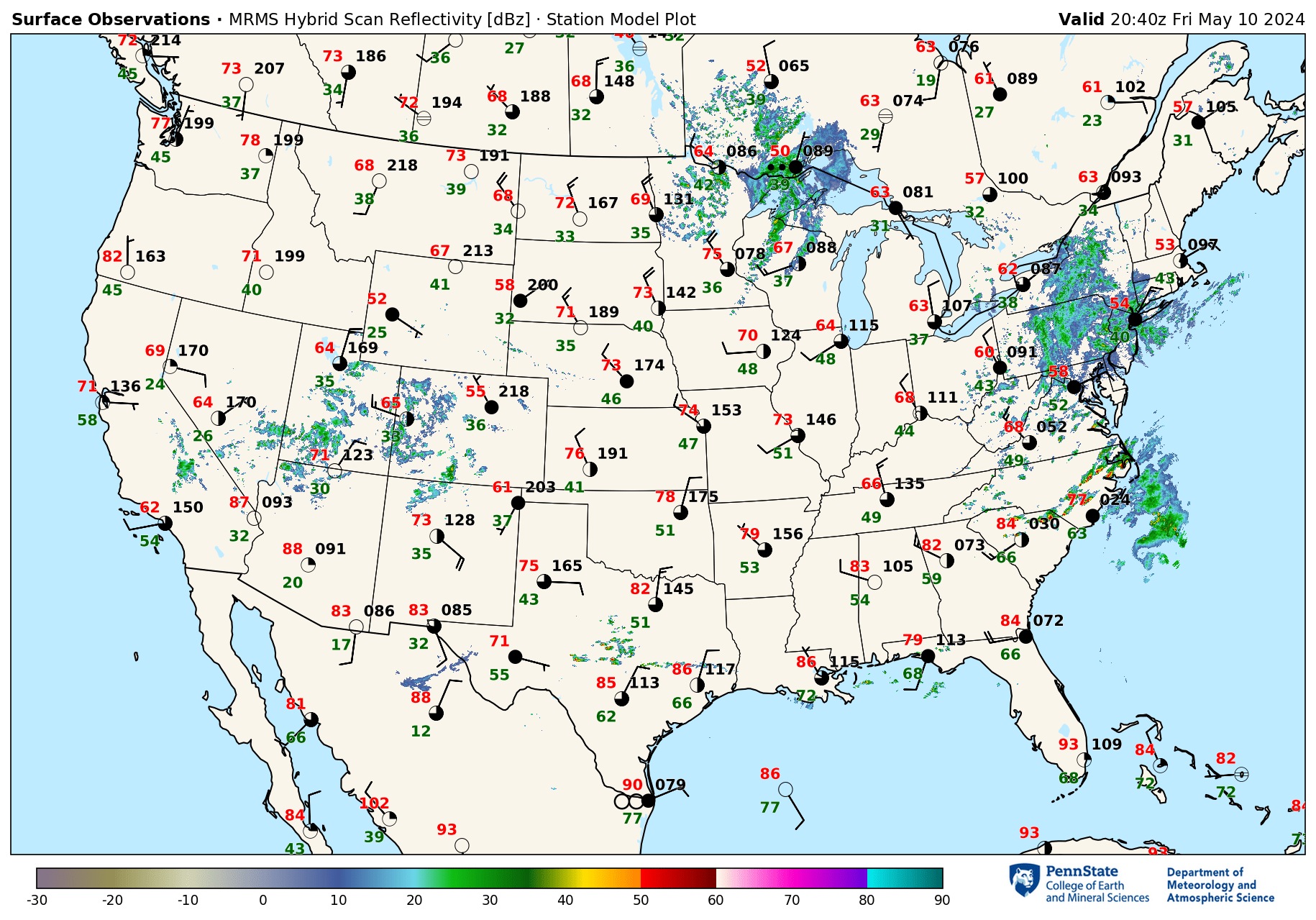
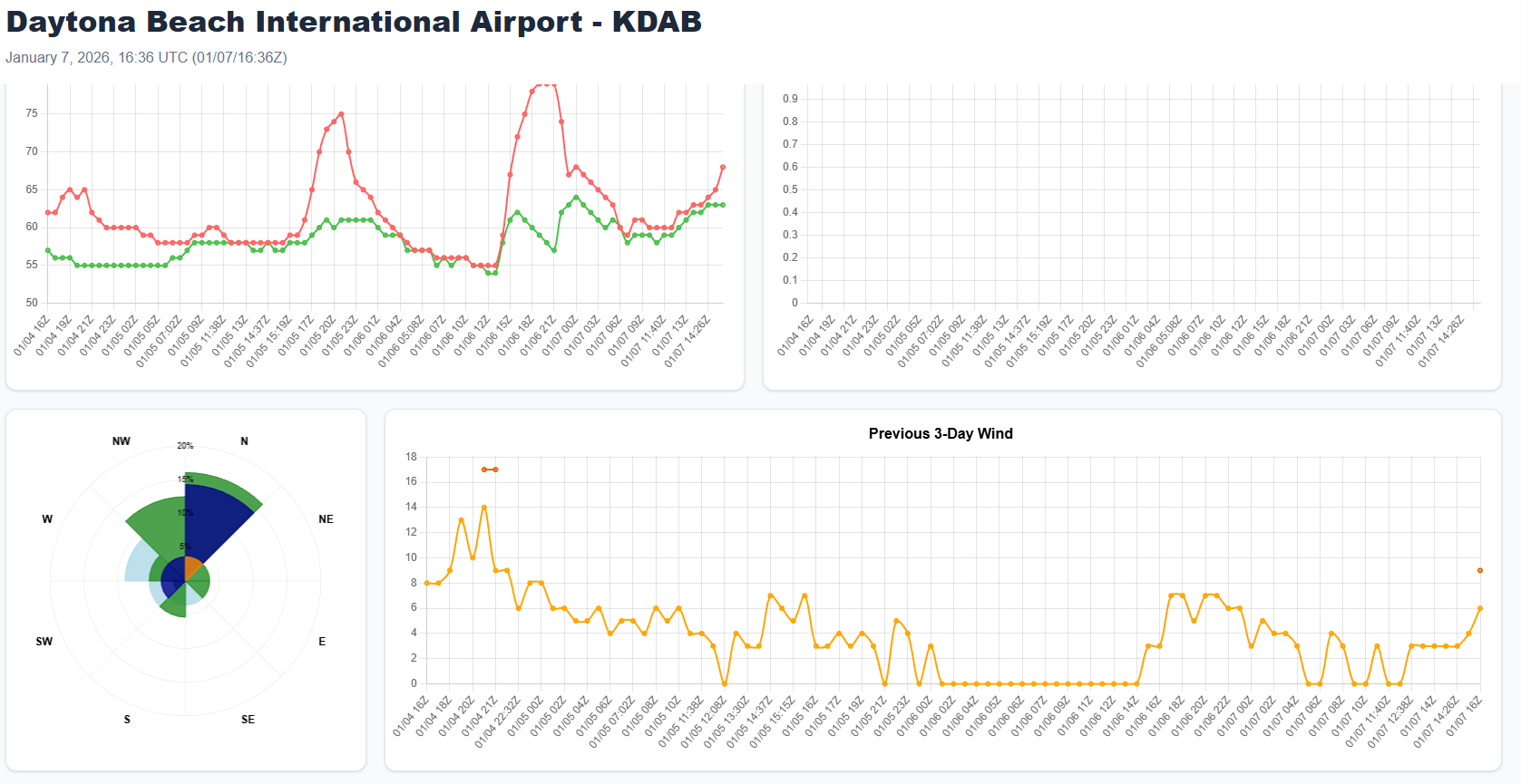
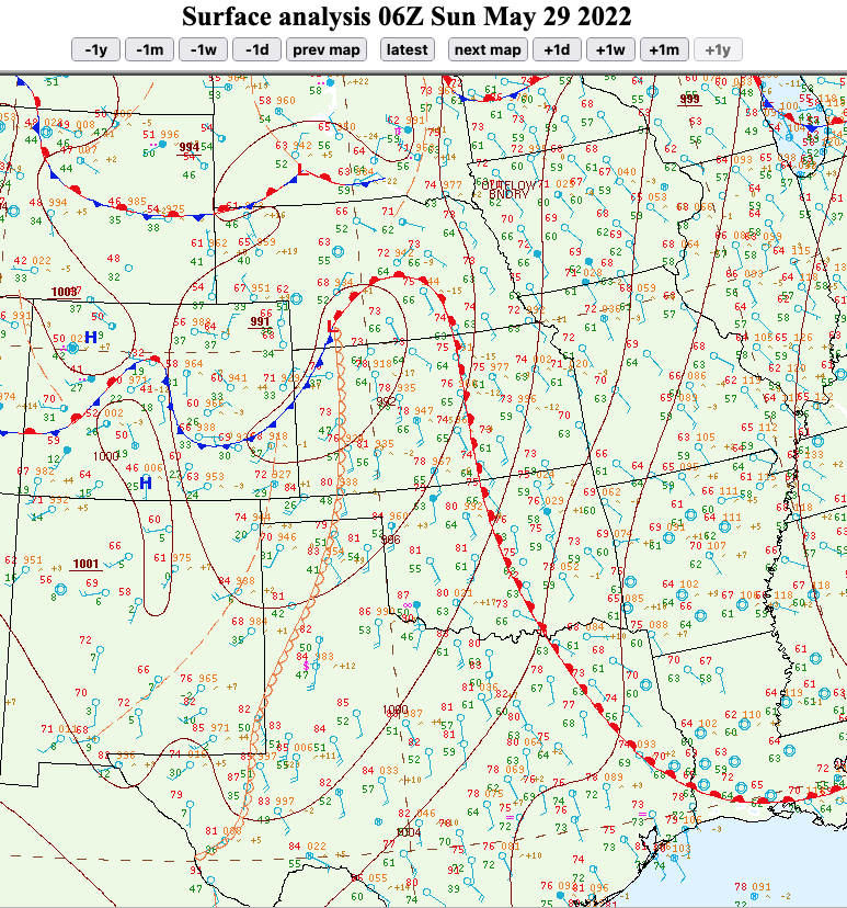
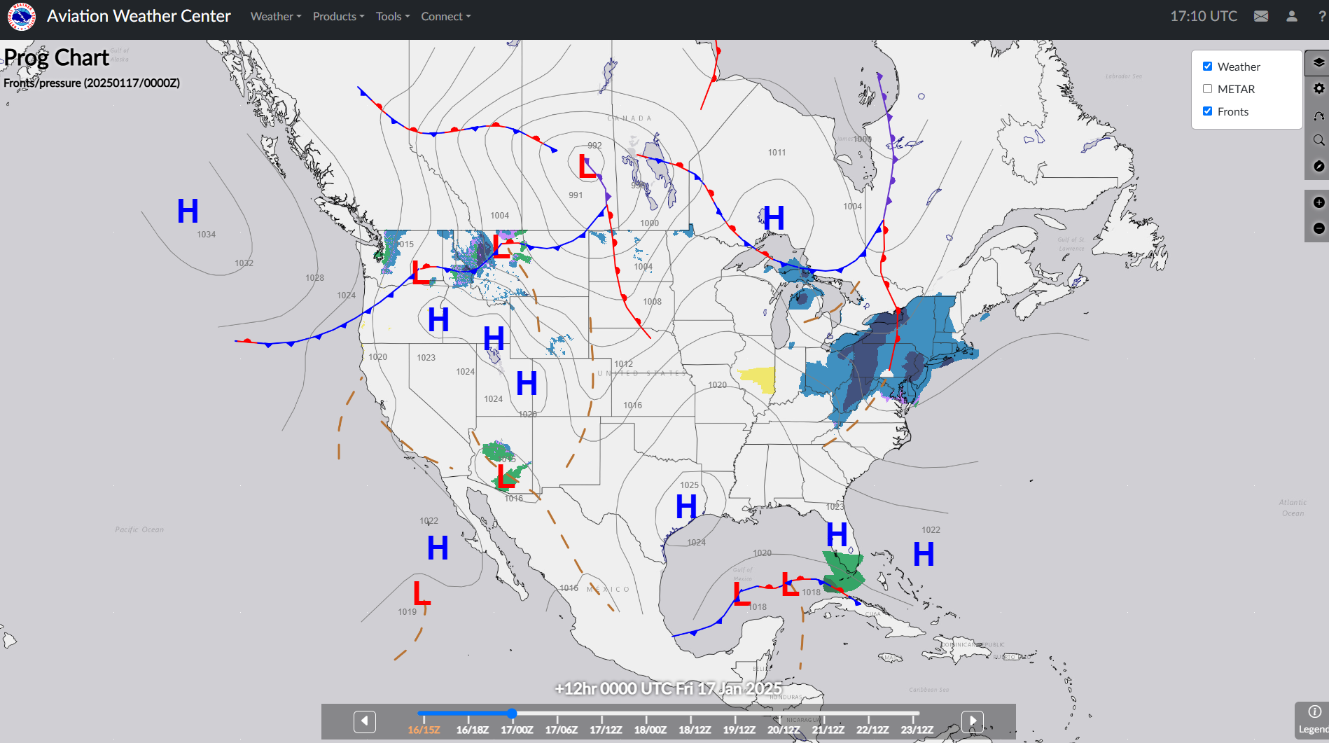
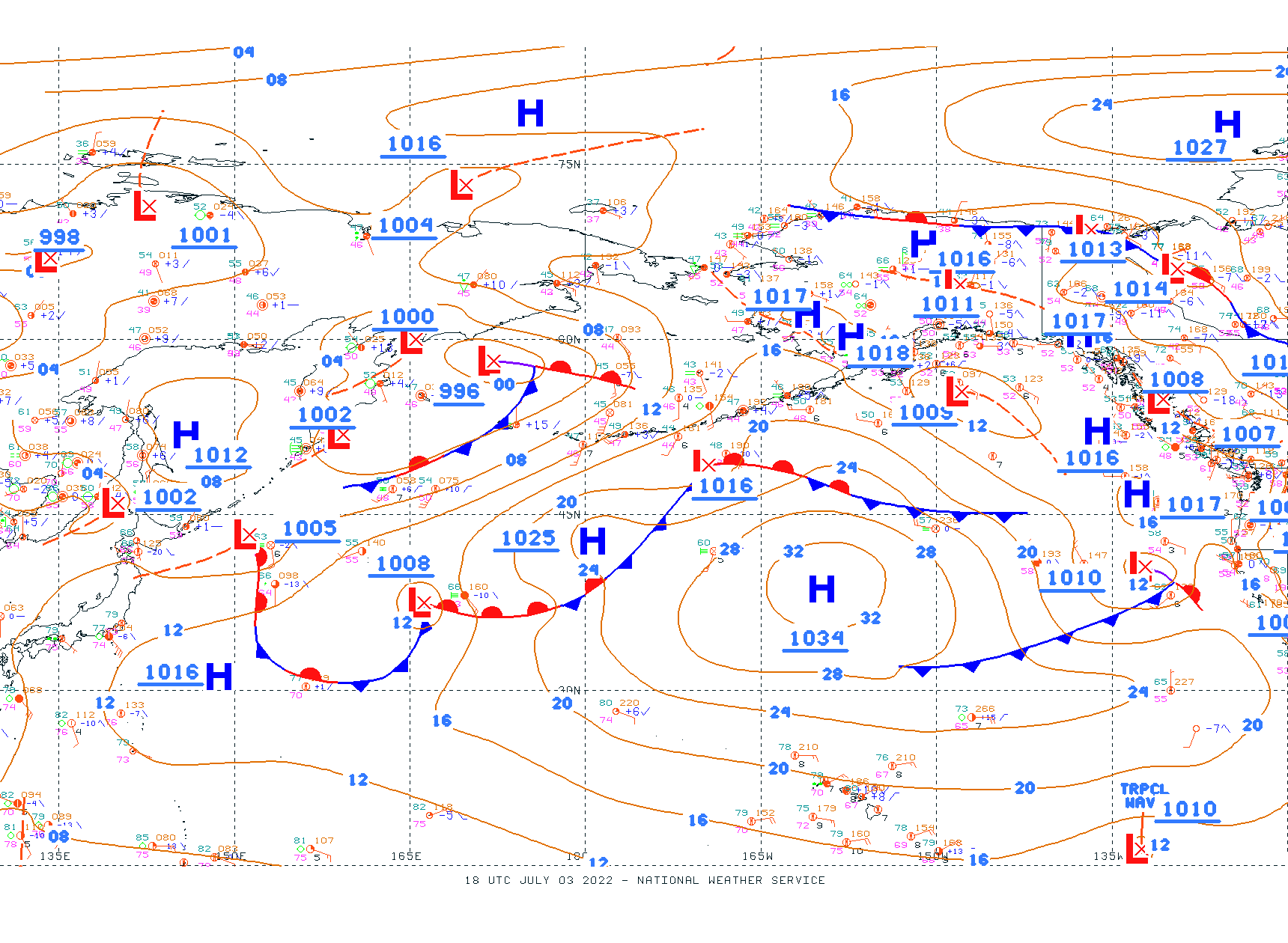
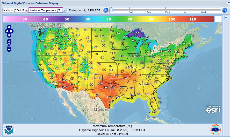
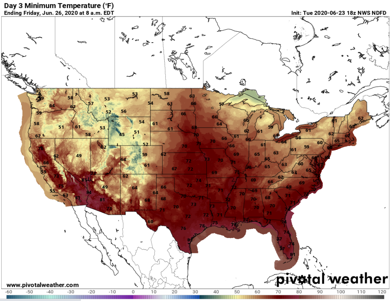
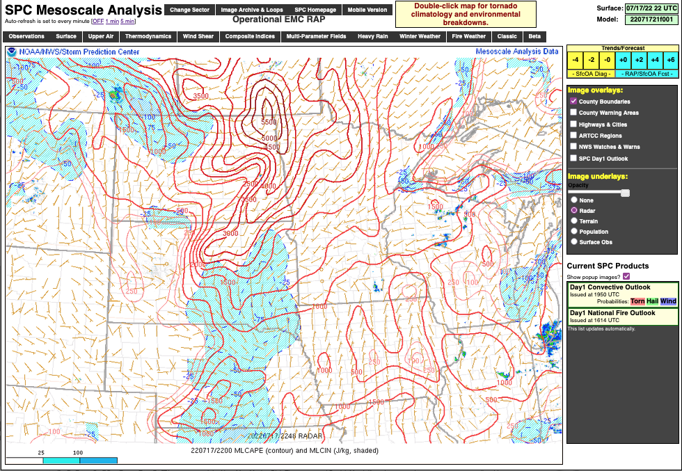
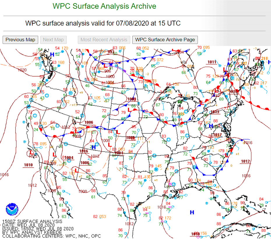
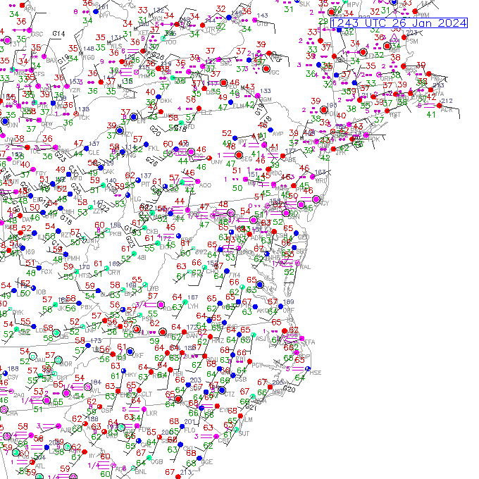
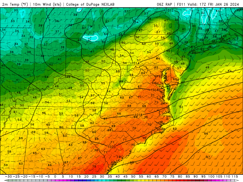
Surface Data and Analyses


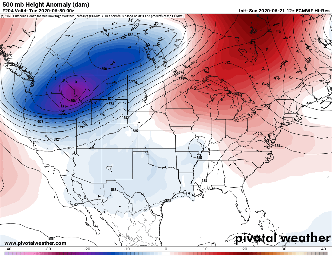
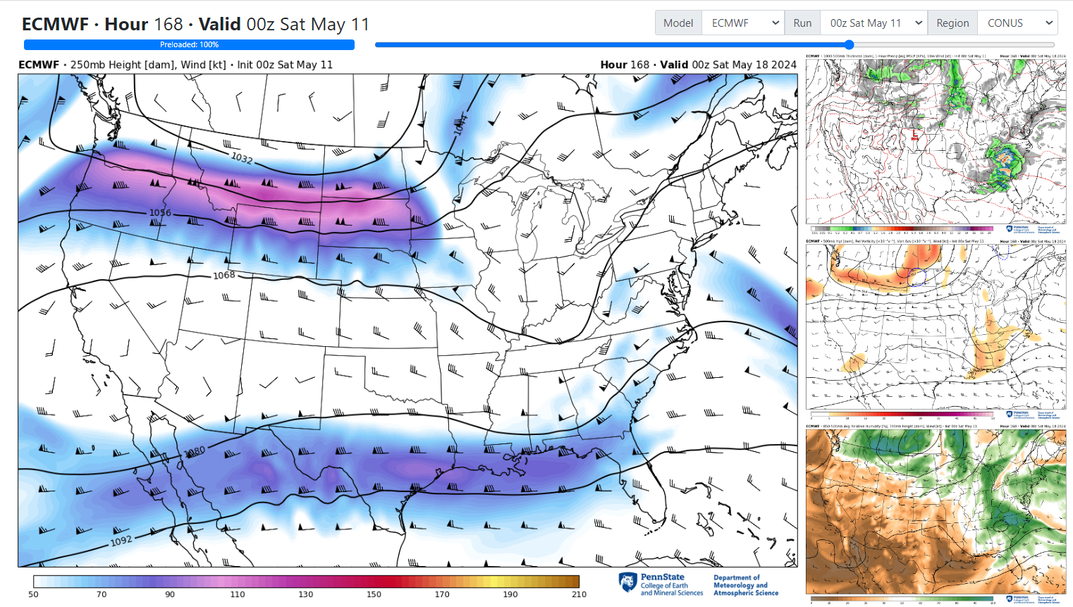
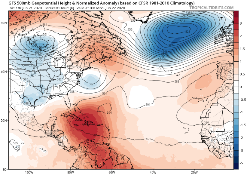
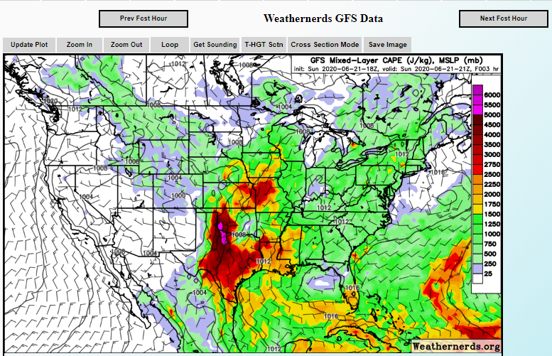
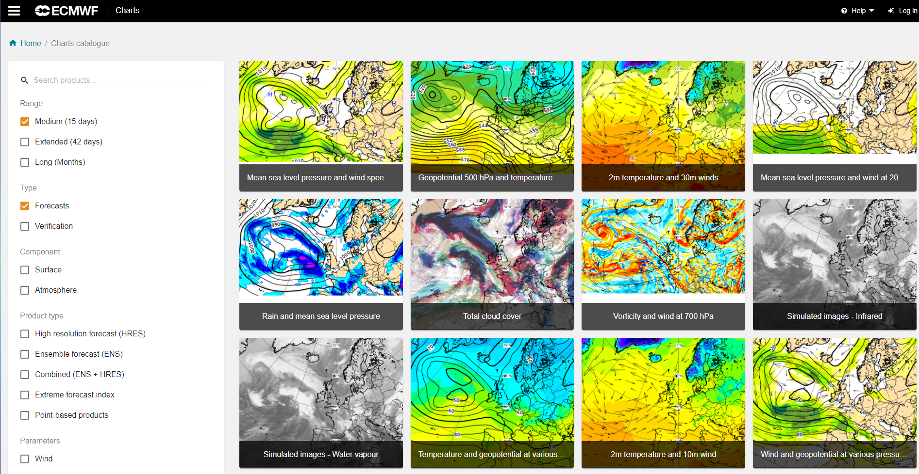
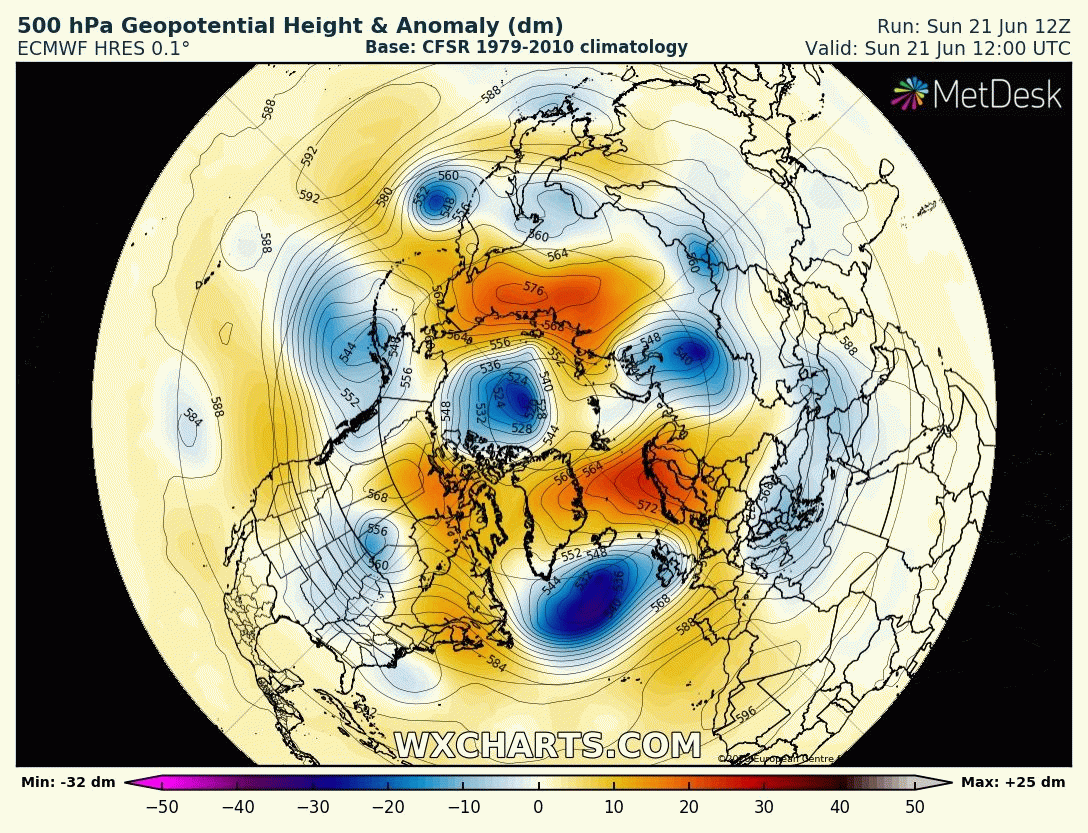
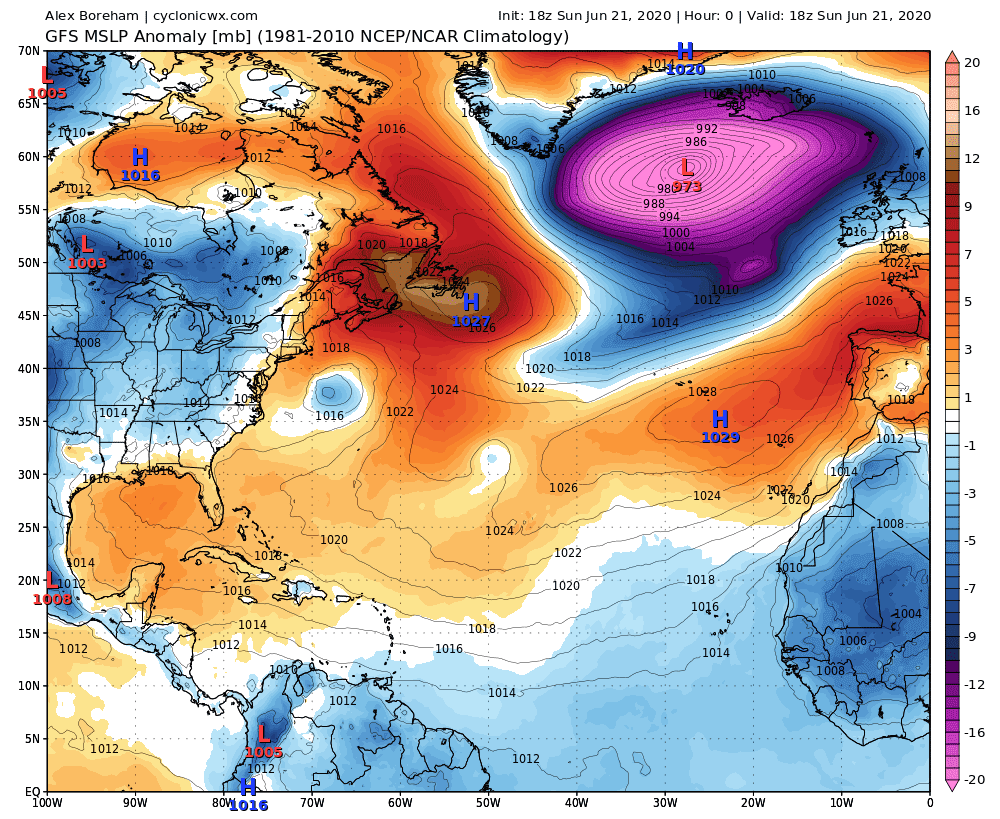
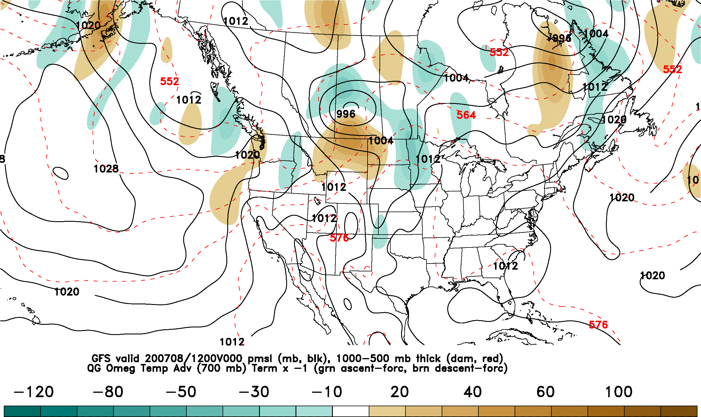
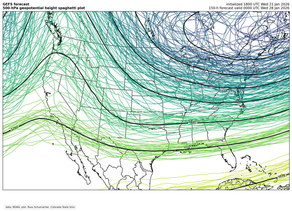
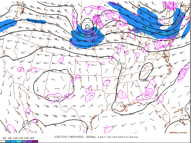
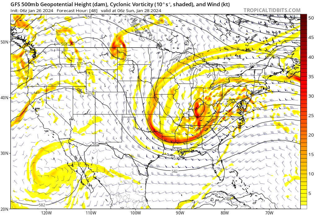
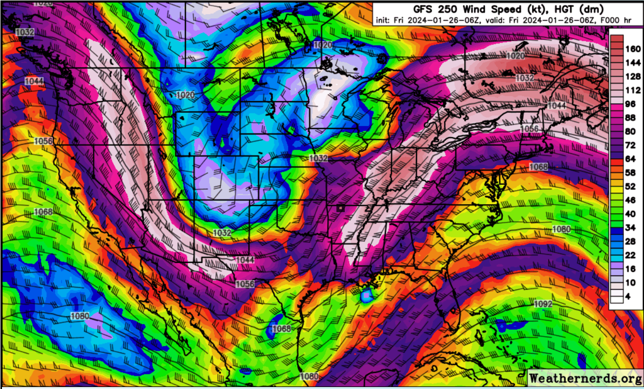
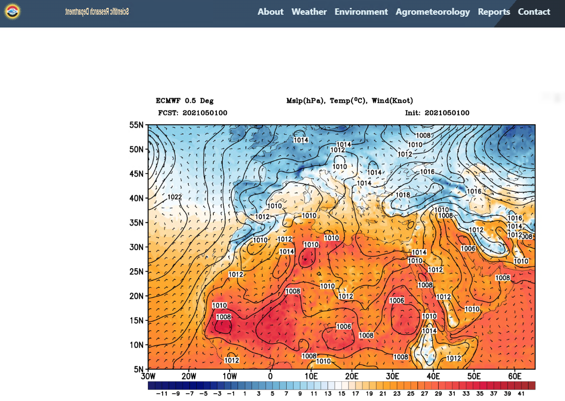
Forecast Model Graphics

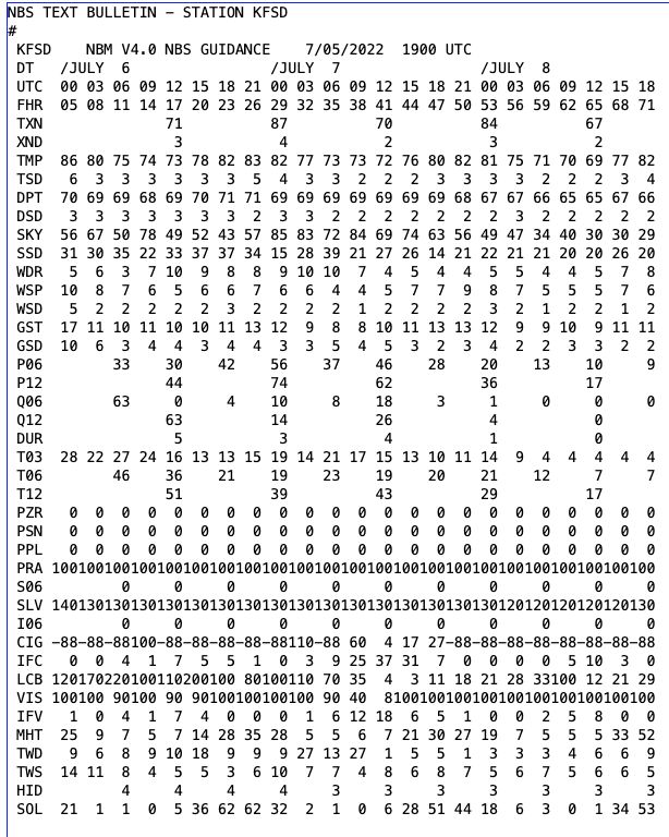
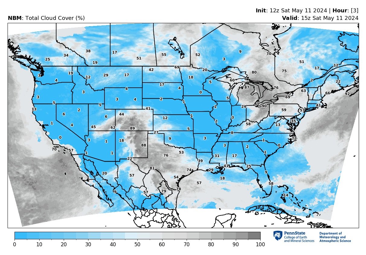
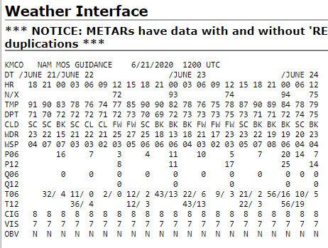
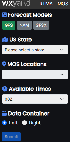
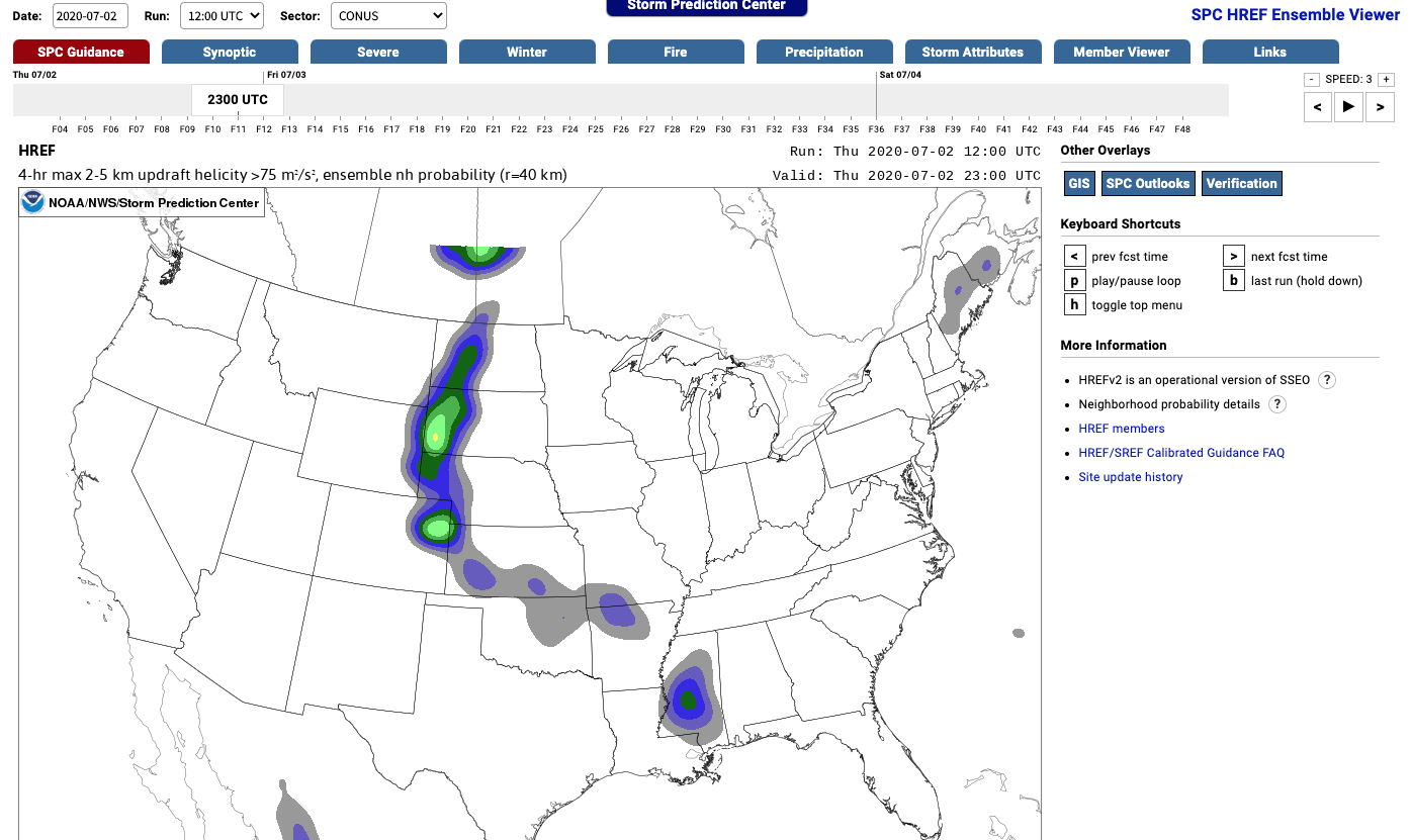
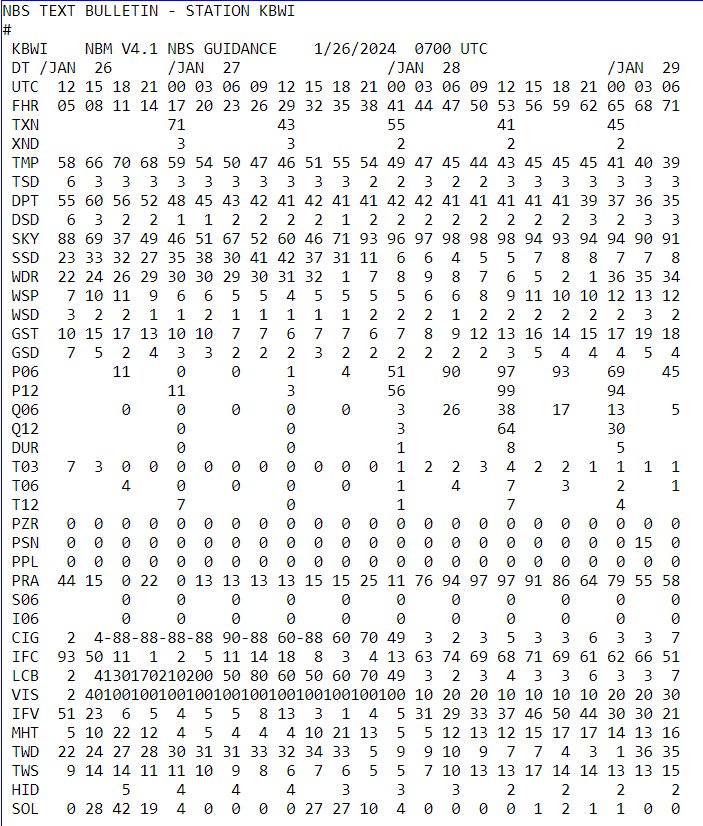
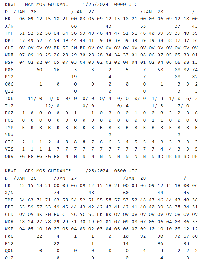
Post-Processed Model Guidance


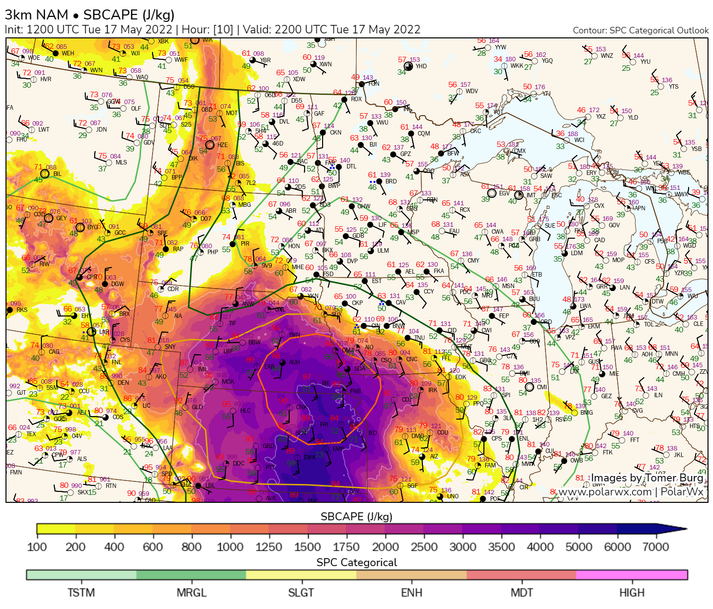
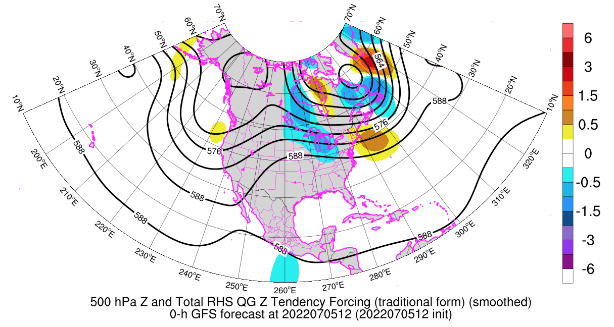
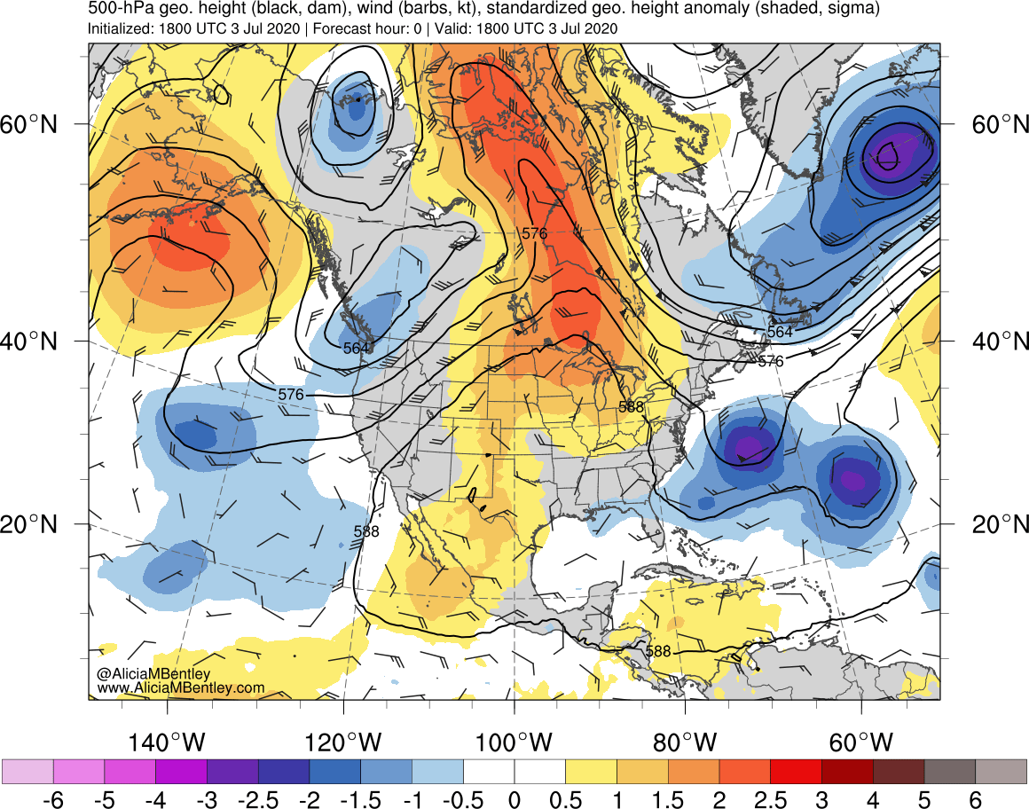
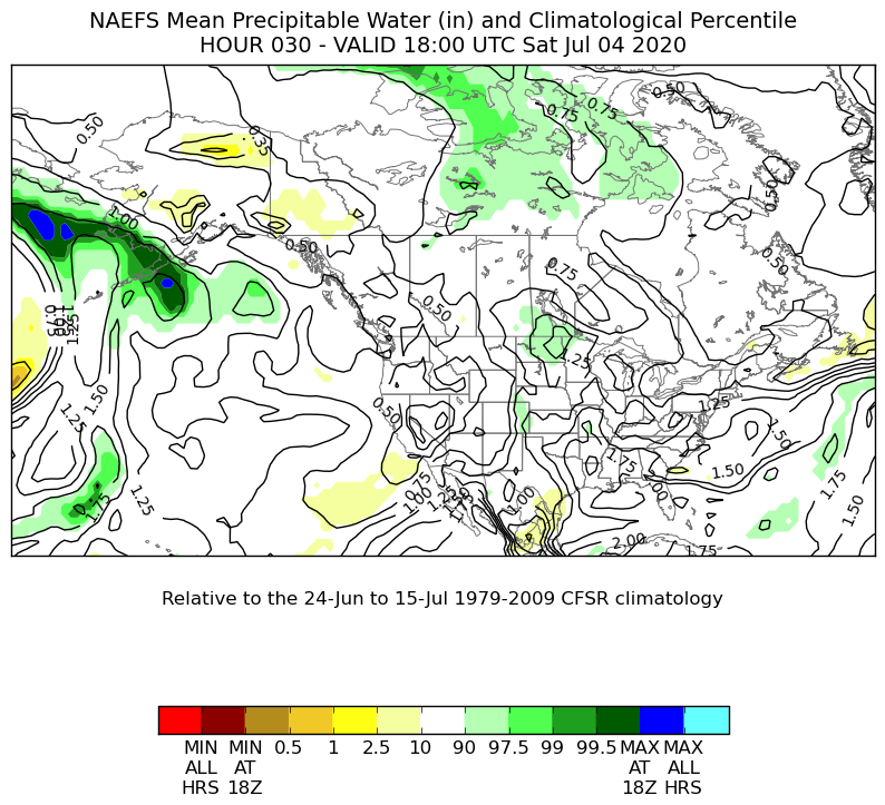
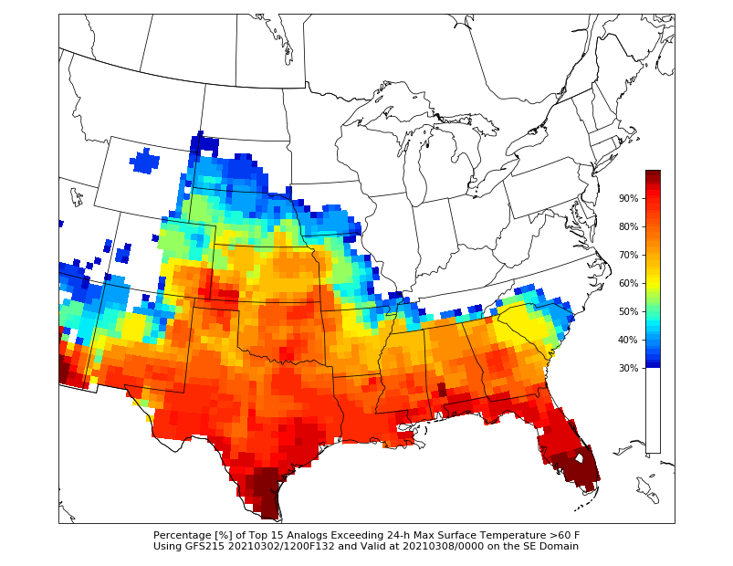
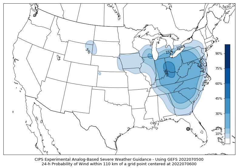
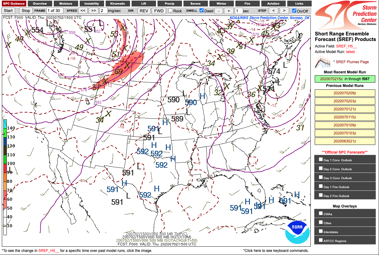
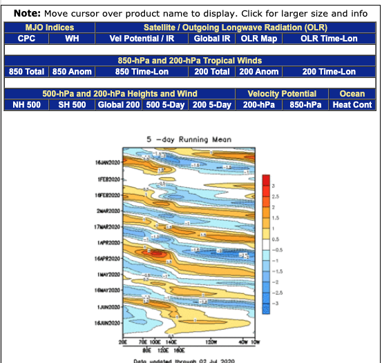
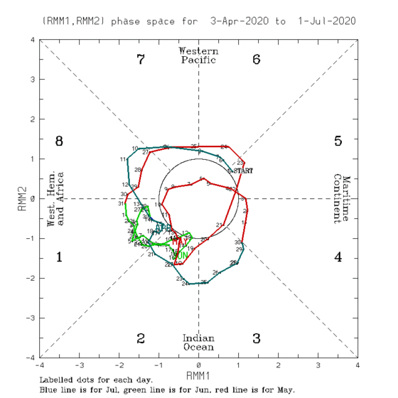
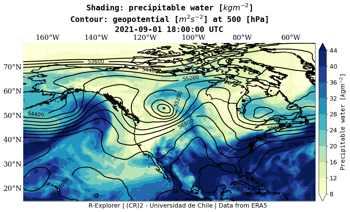
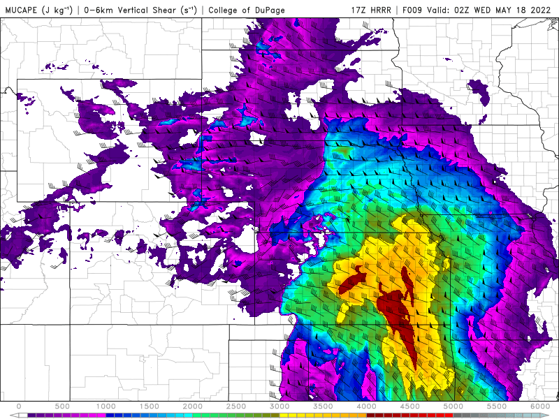
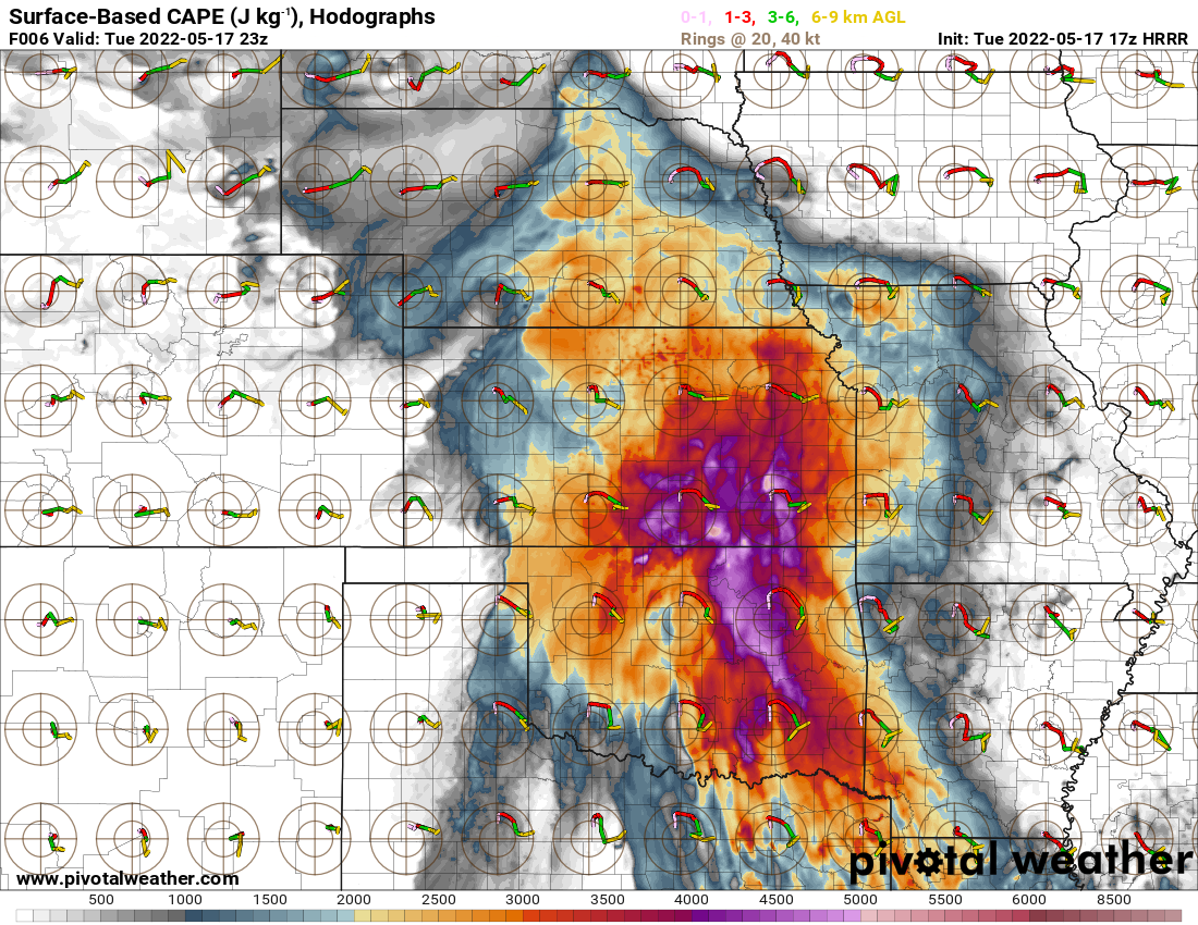
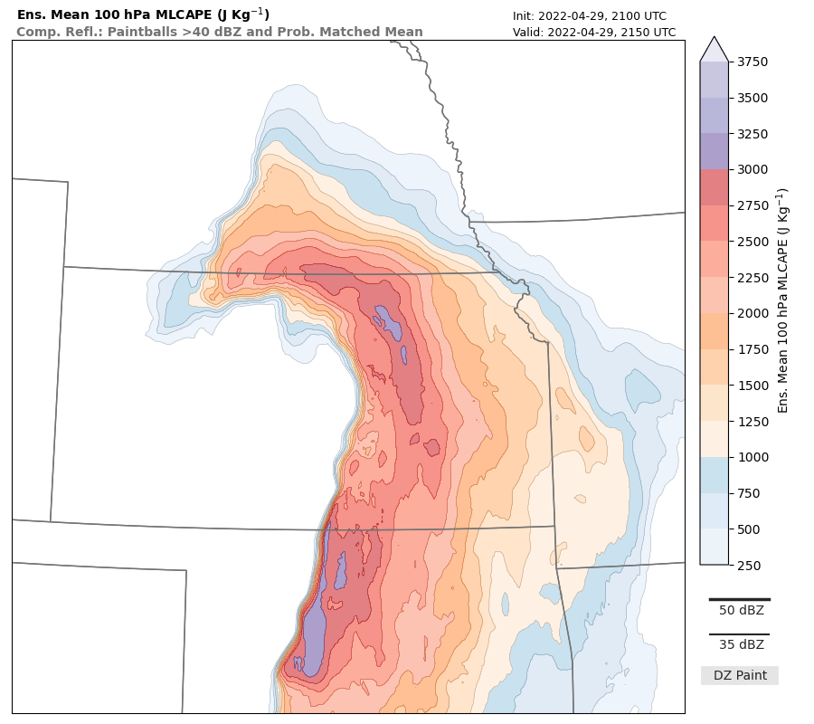
Special Model Diagnostics
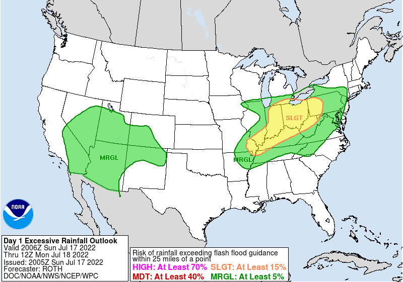
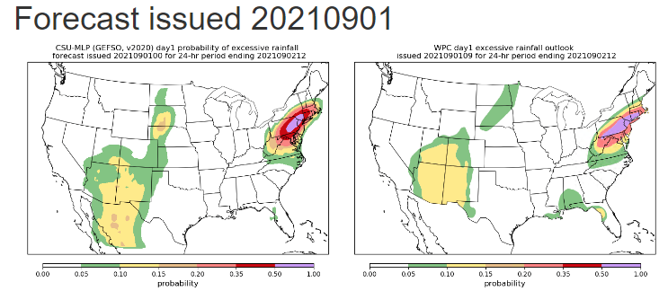
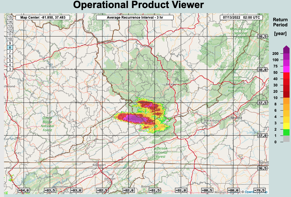
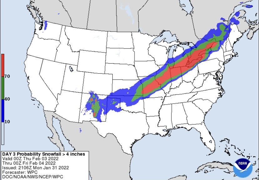
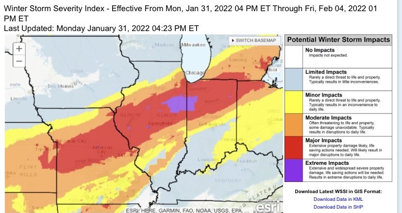
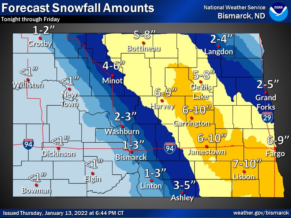
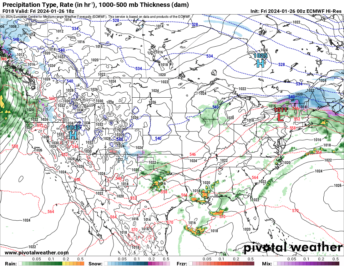
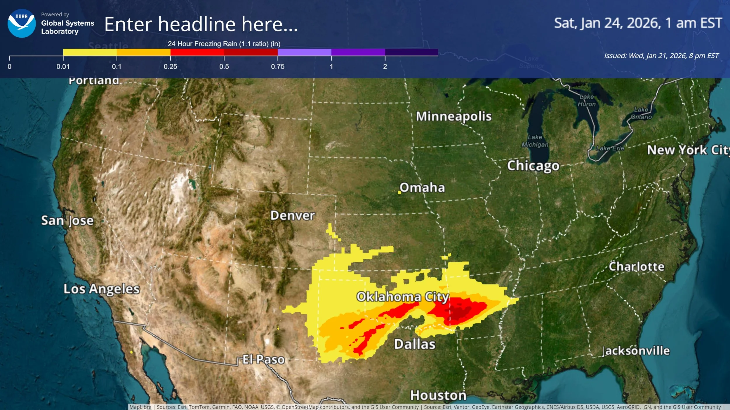
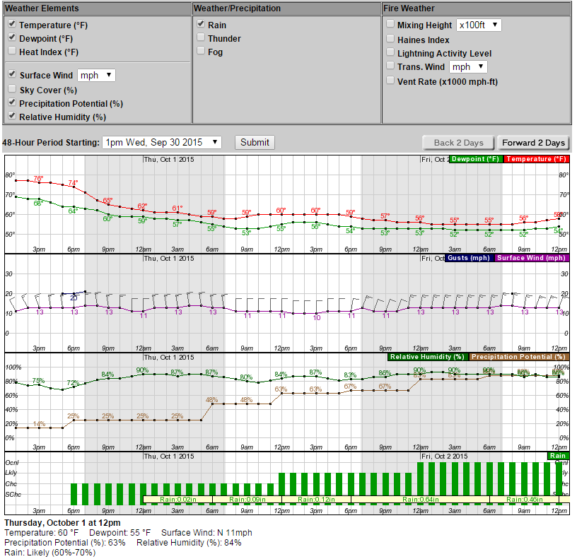
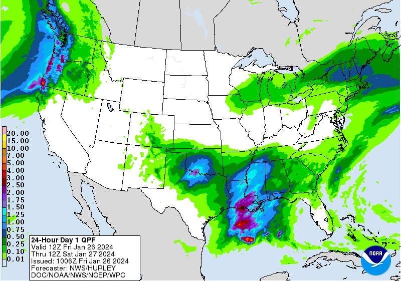
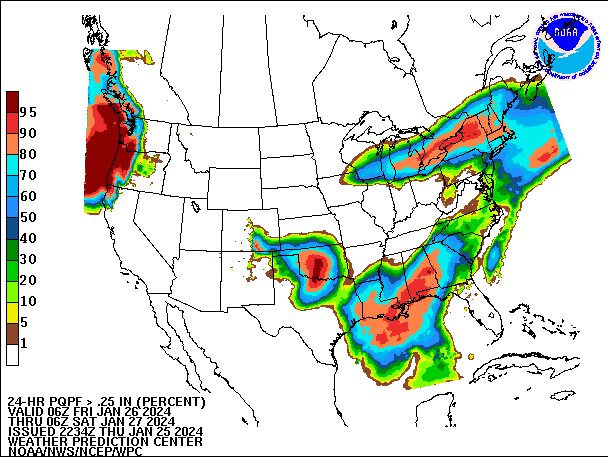
Short-Range, Precipitation, Winter Weather

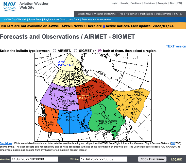
Aviation

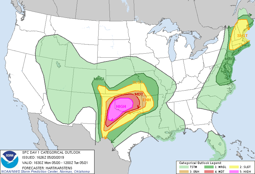
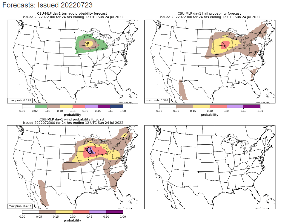
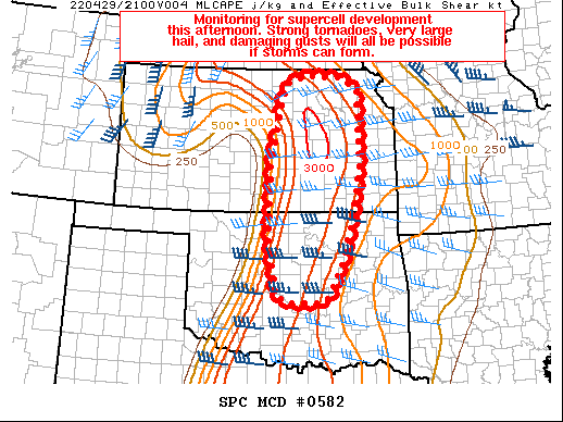
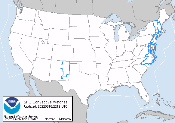
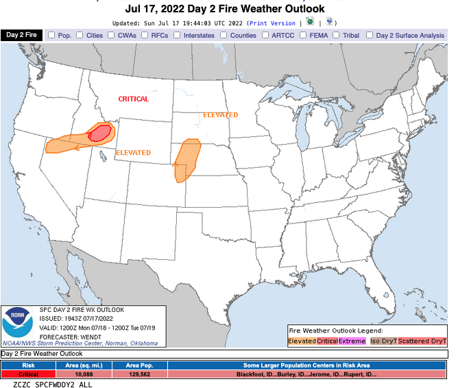
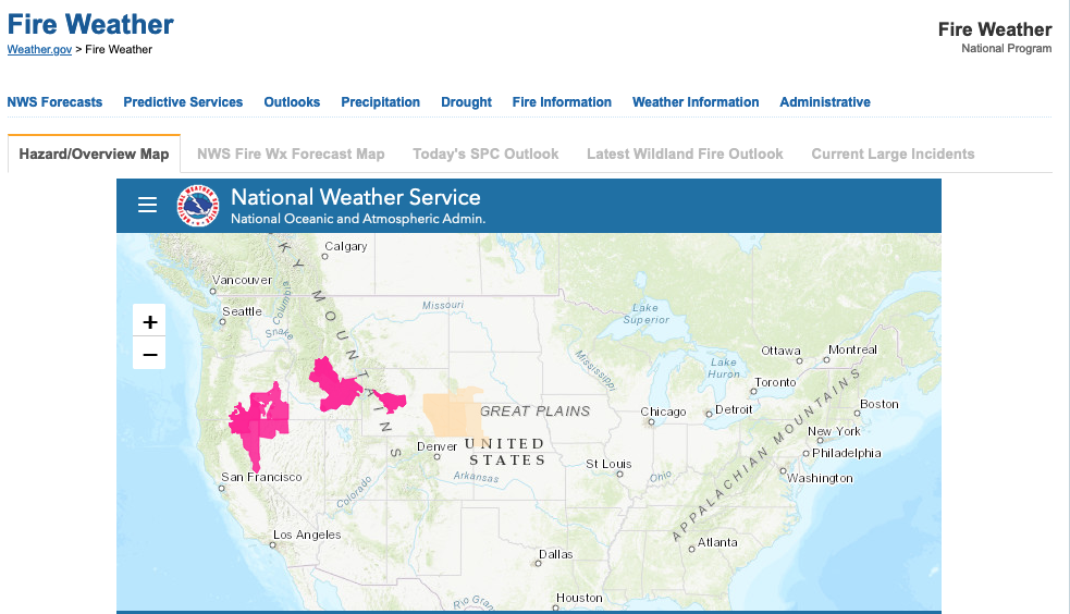
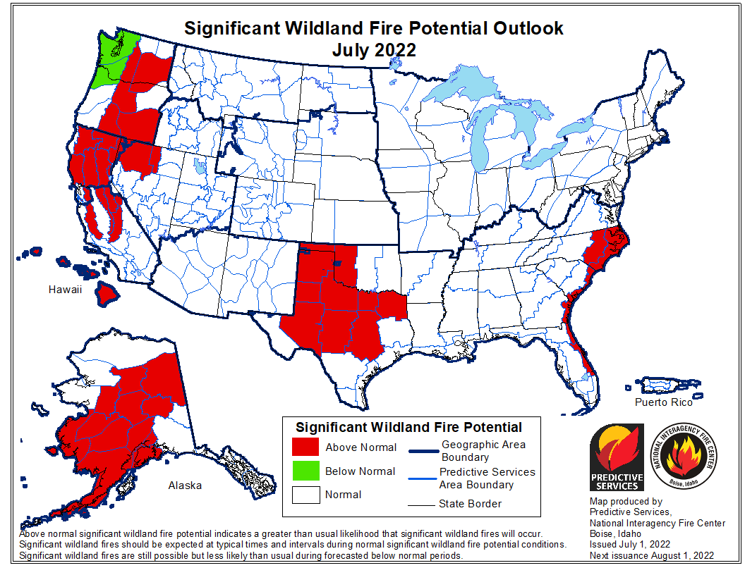
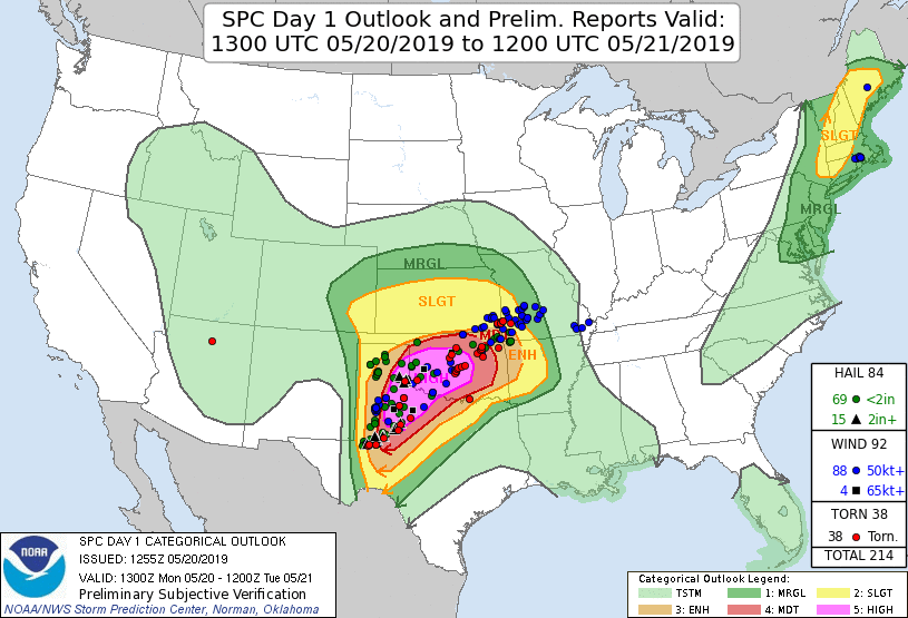
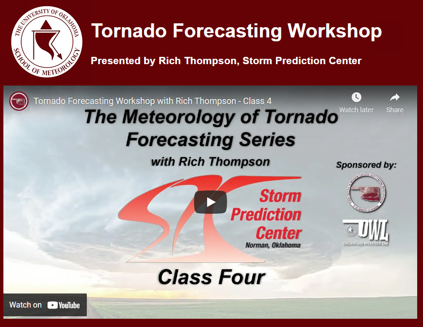
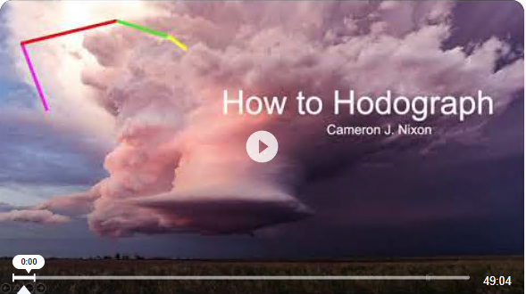
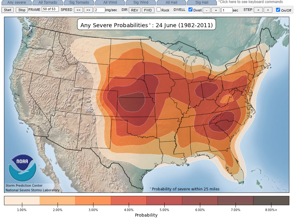
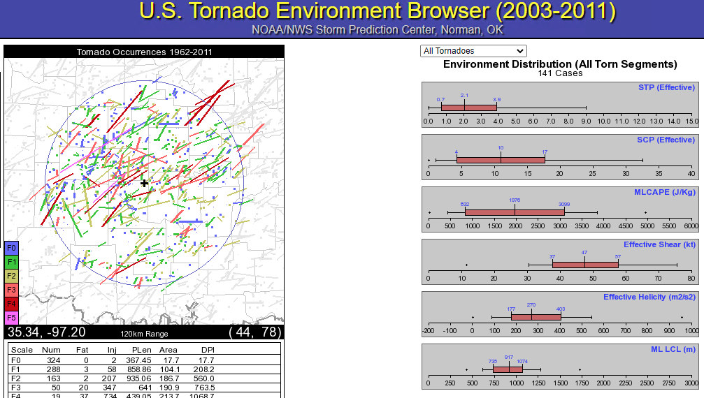
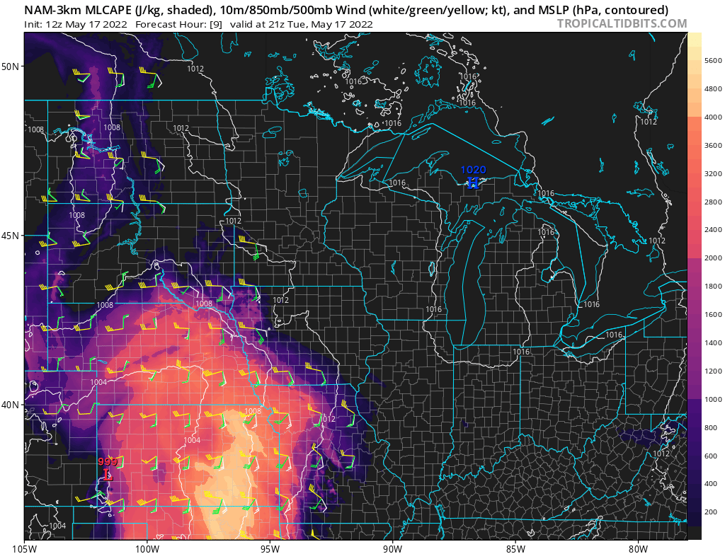
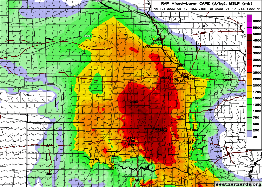
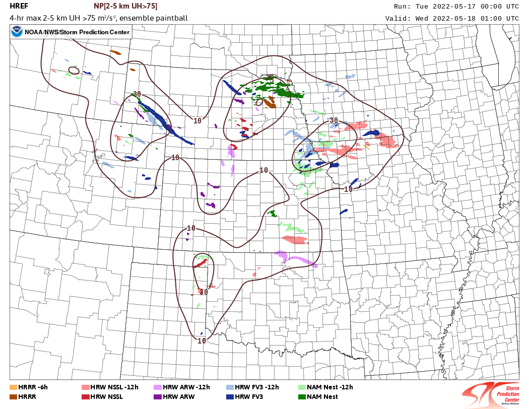
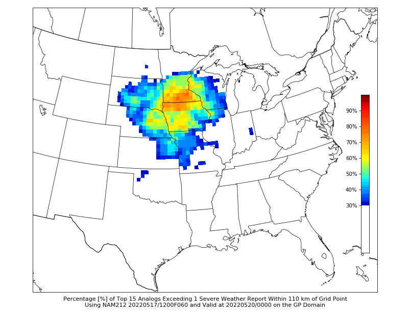
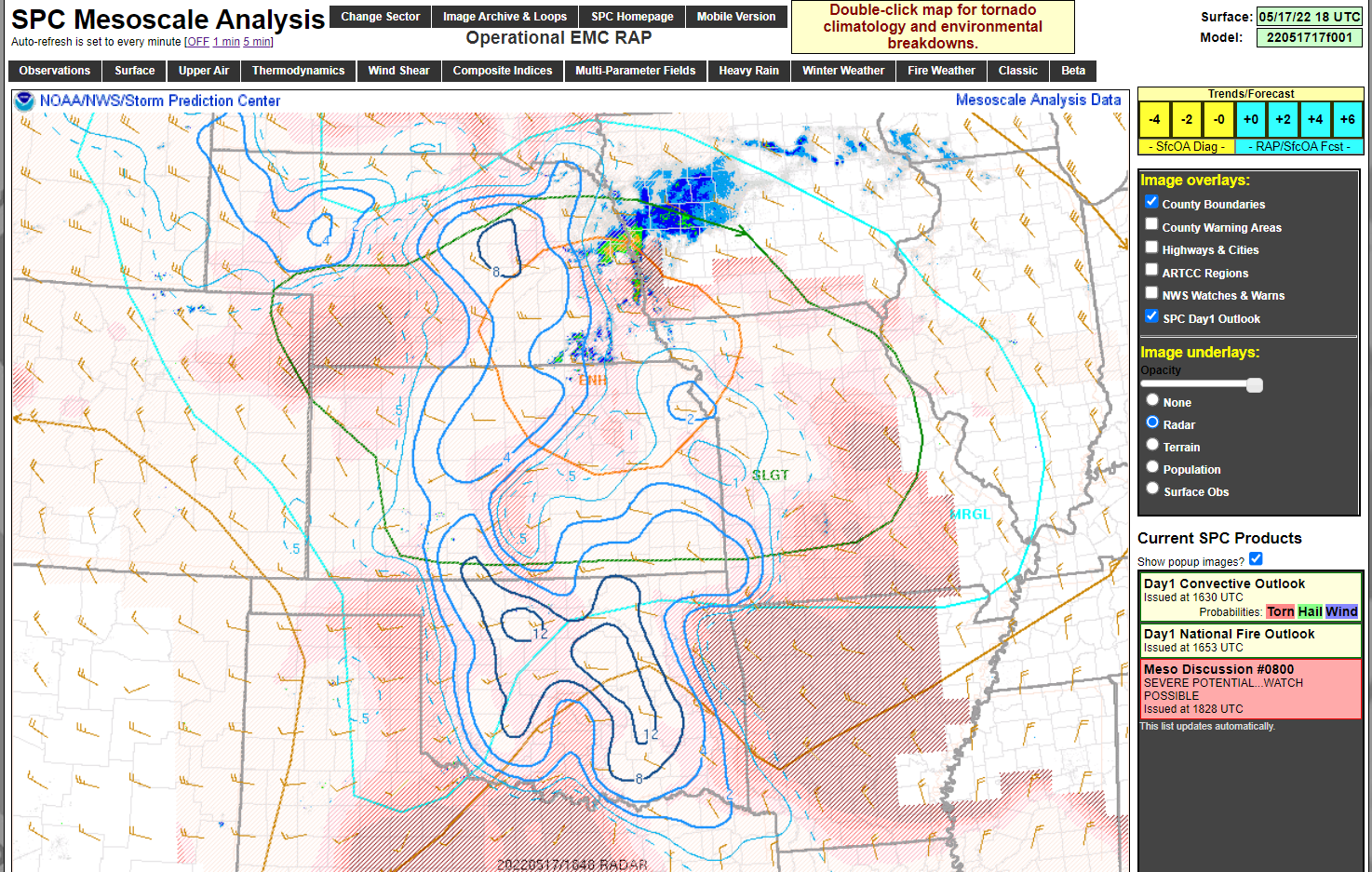
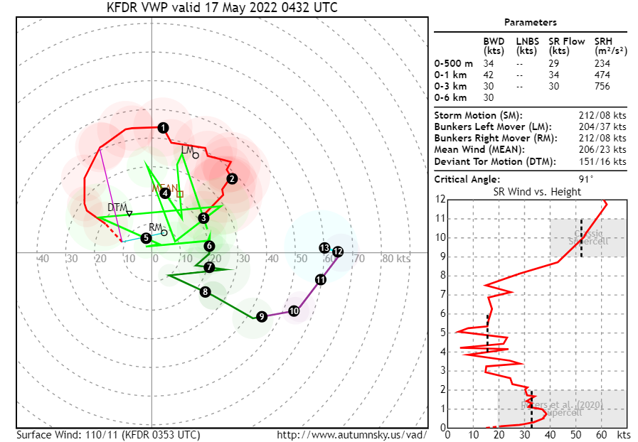
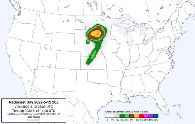
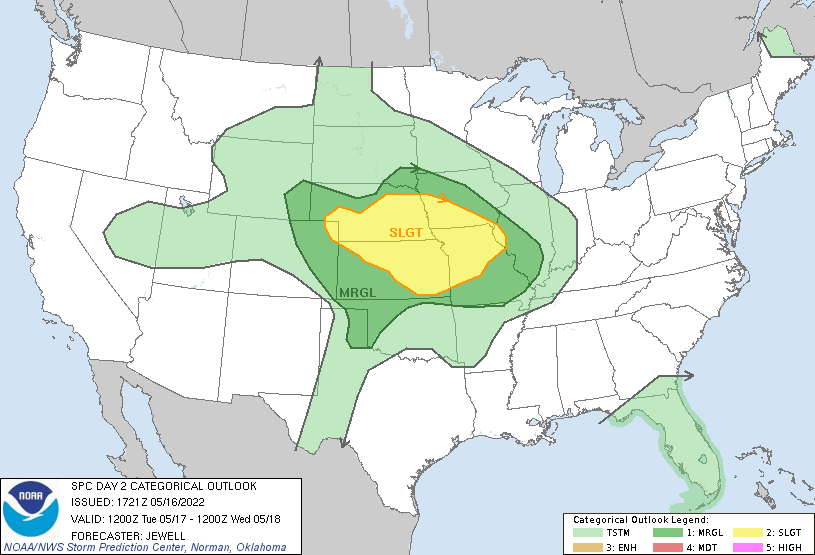
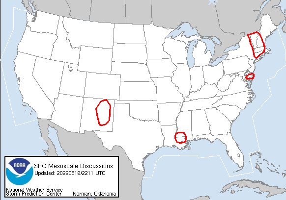
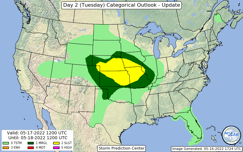
Severe and Fire Weather
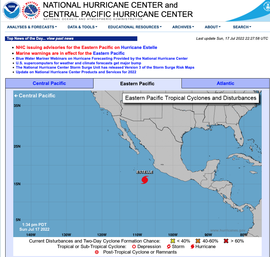
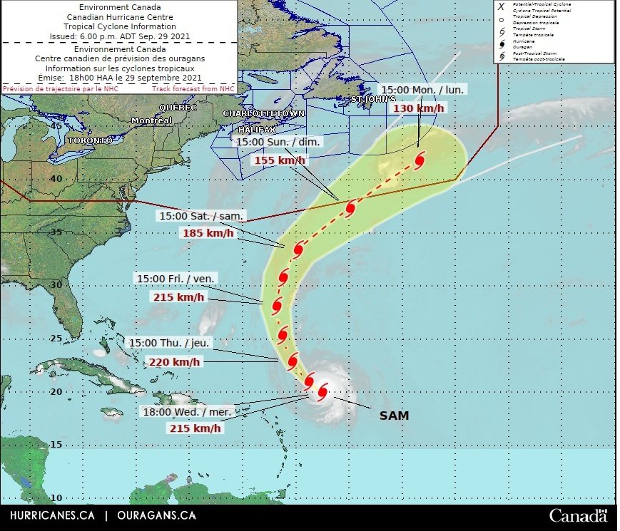
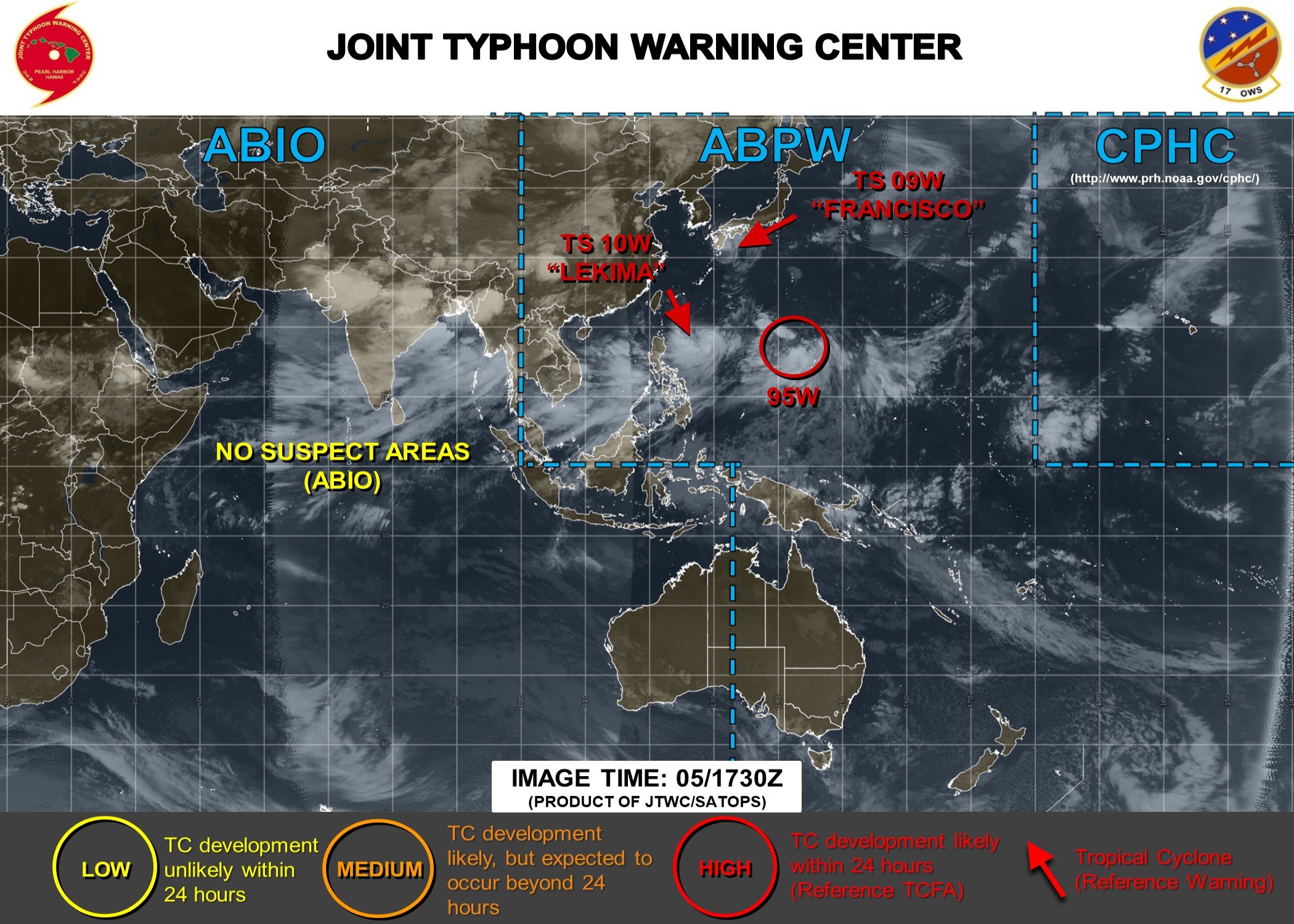
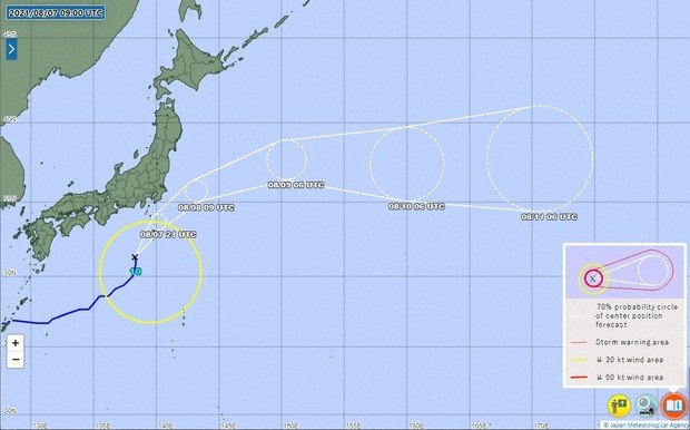
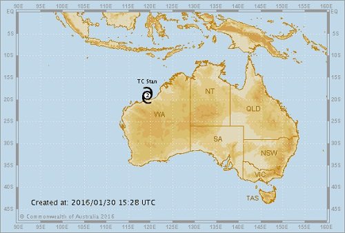
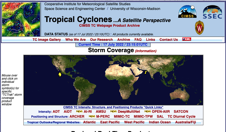
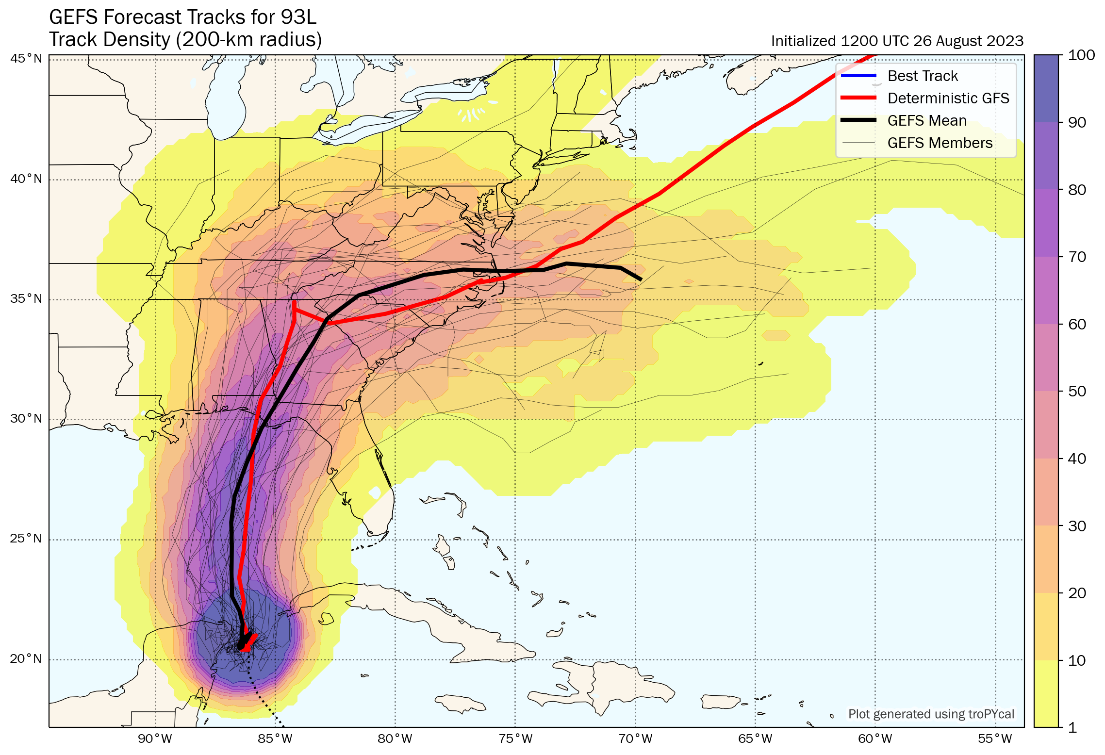
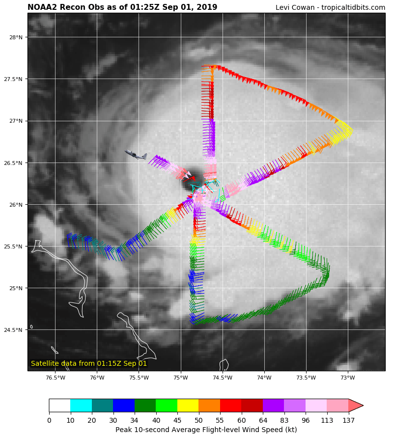
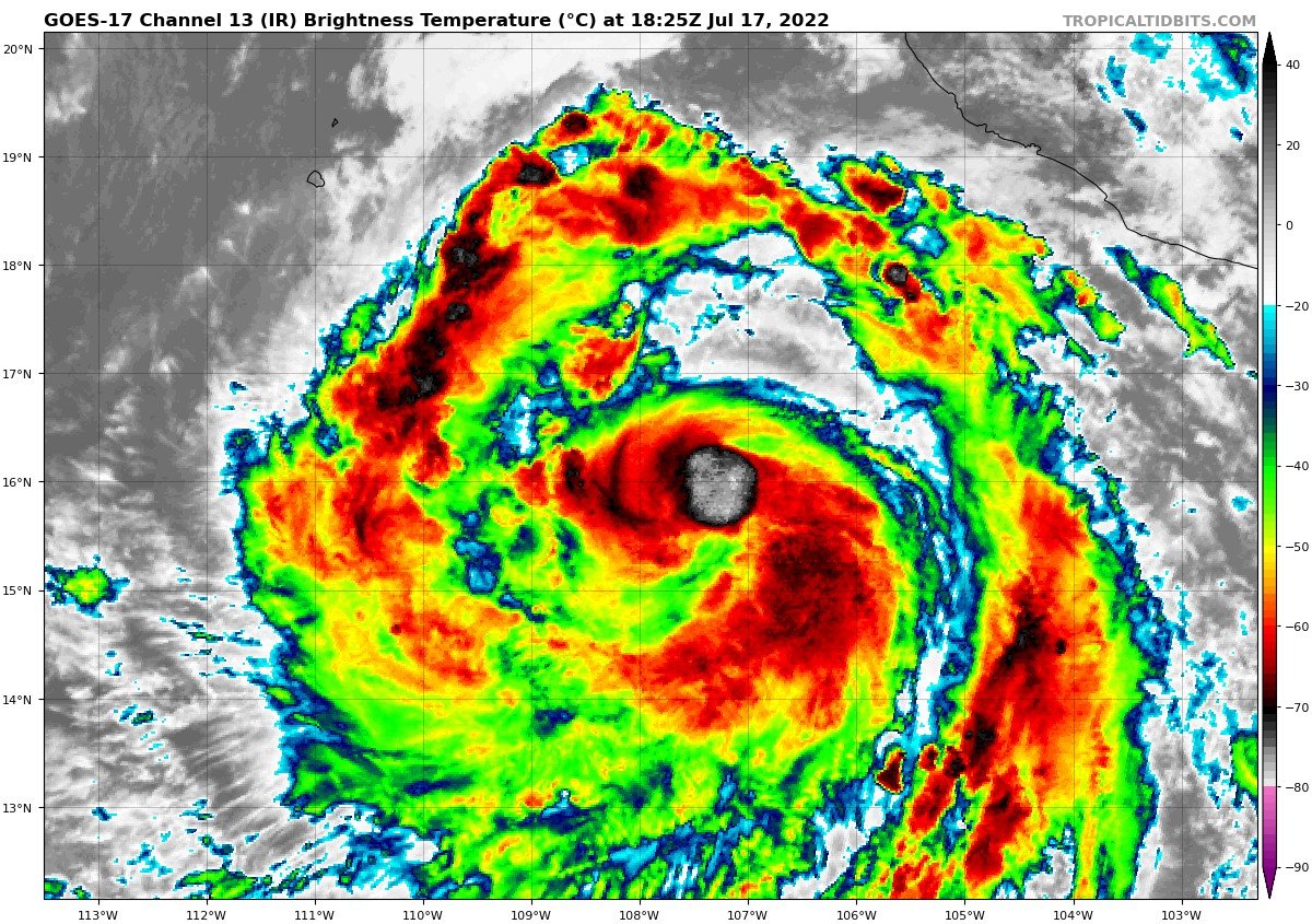
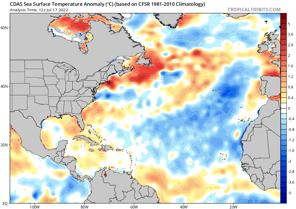
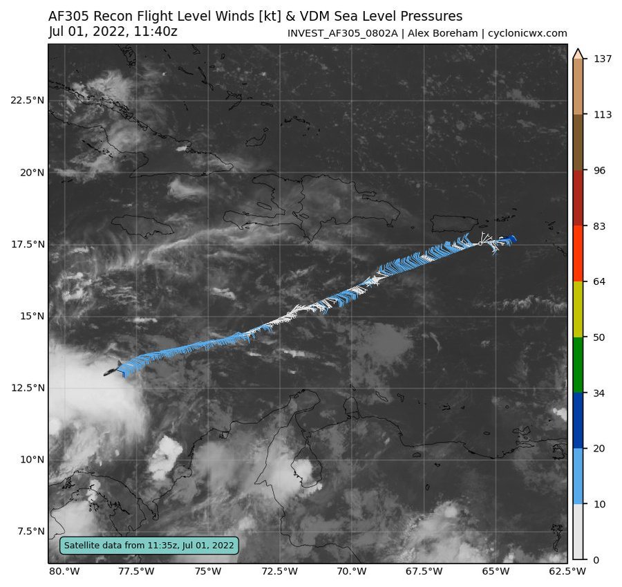
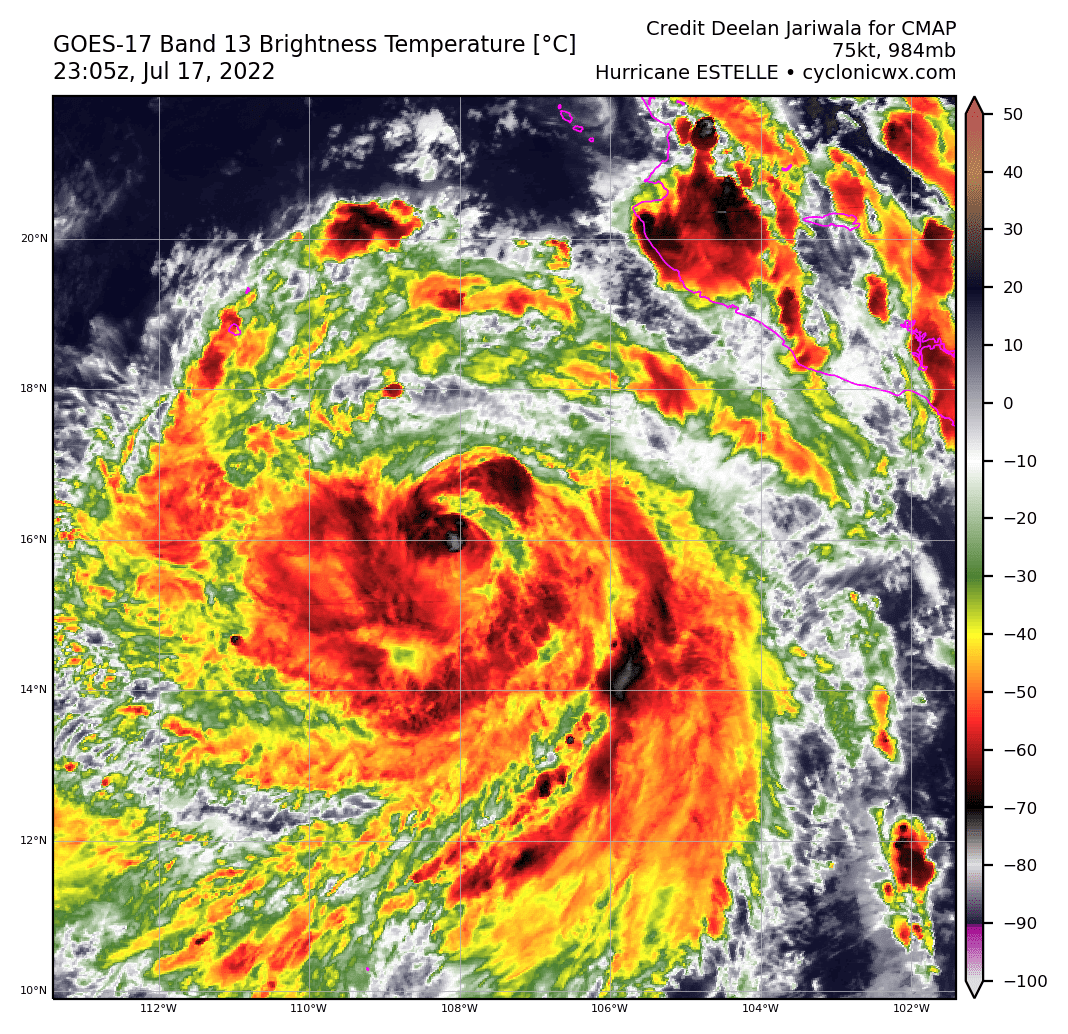
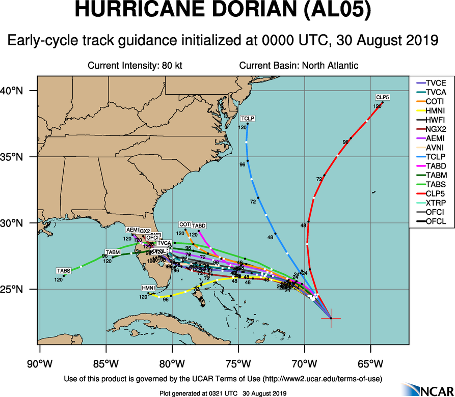
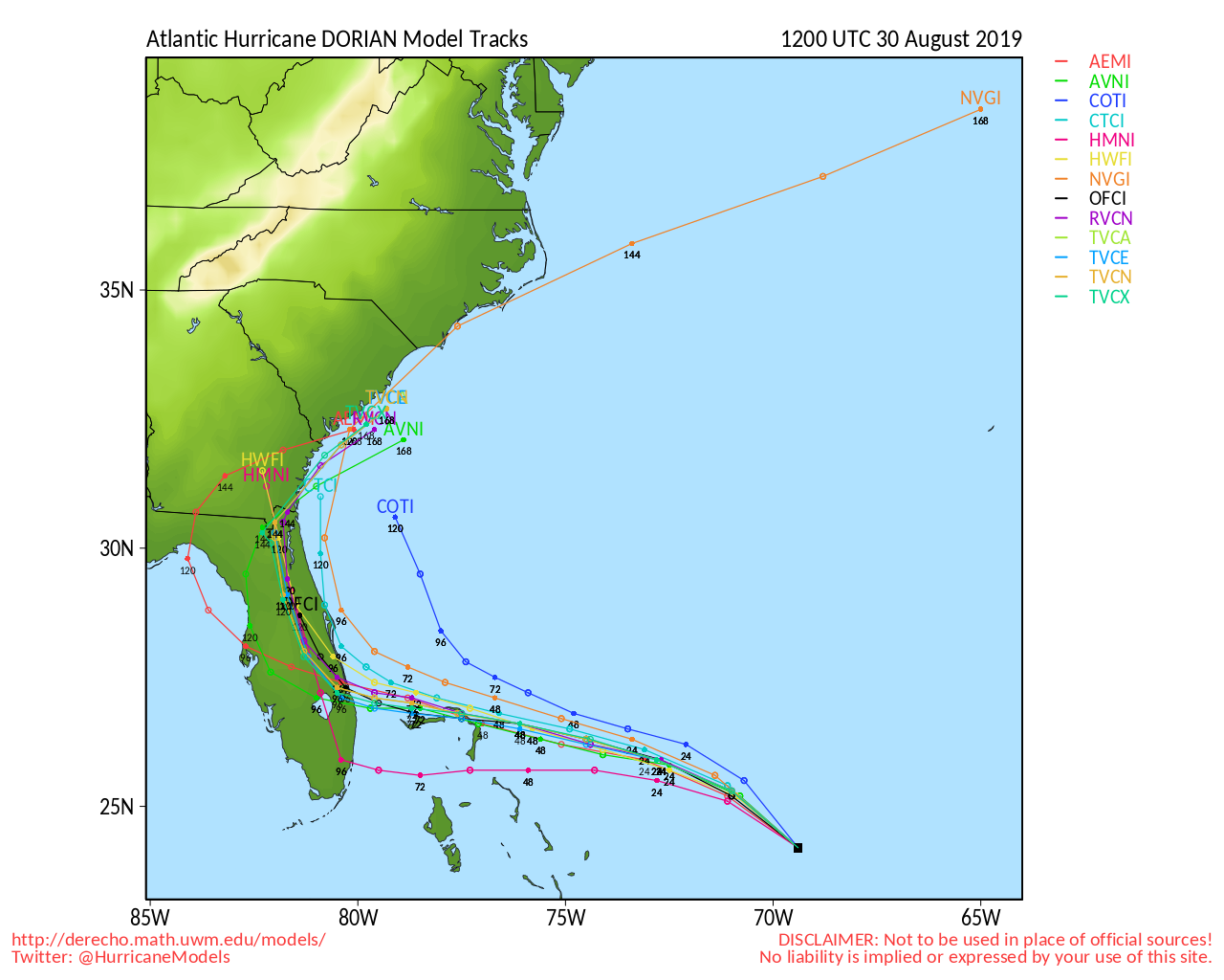
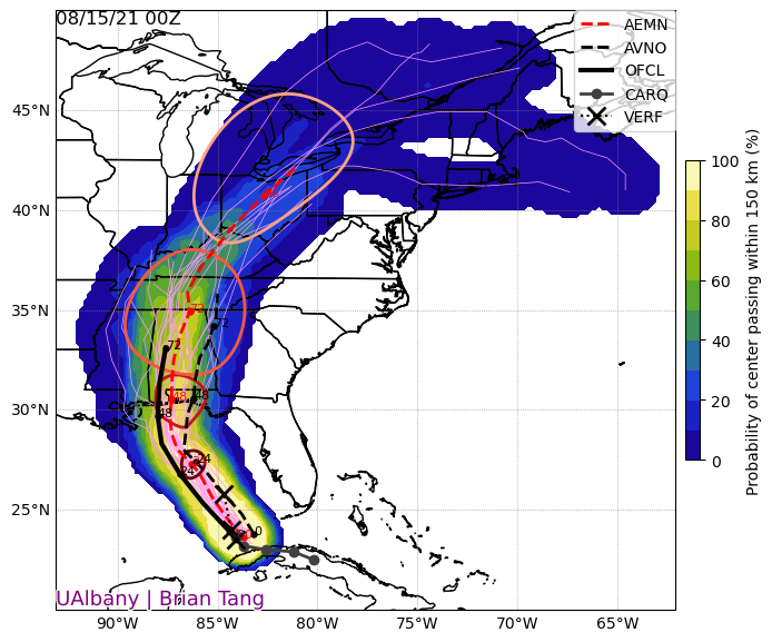
Tropical Cyclones


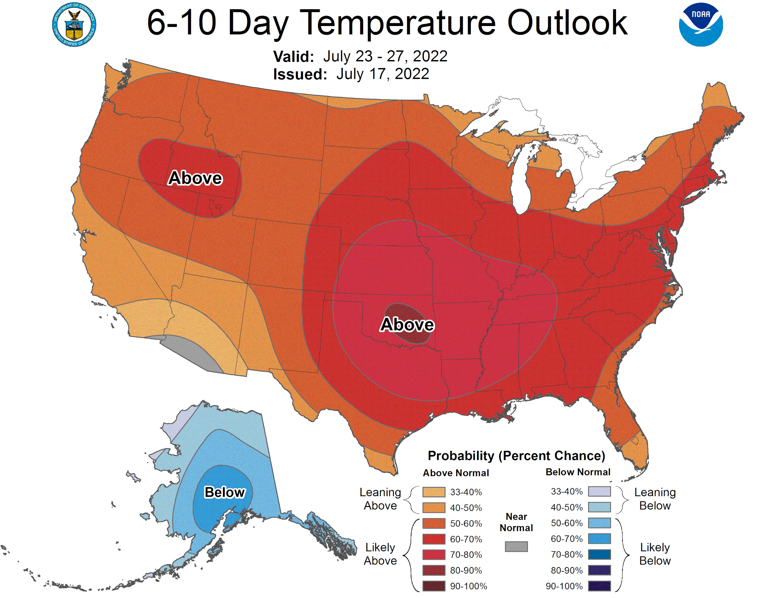
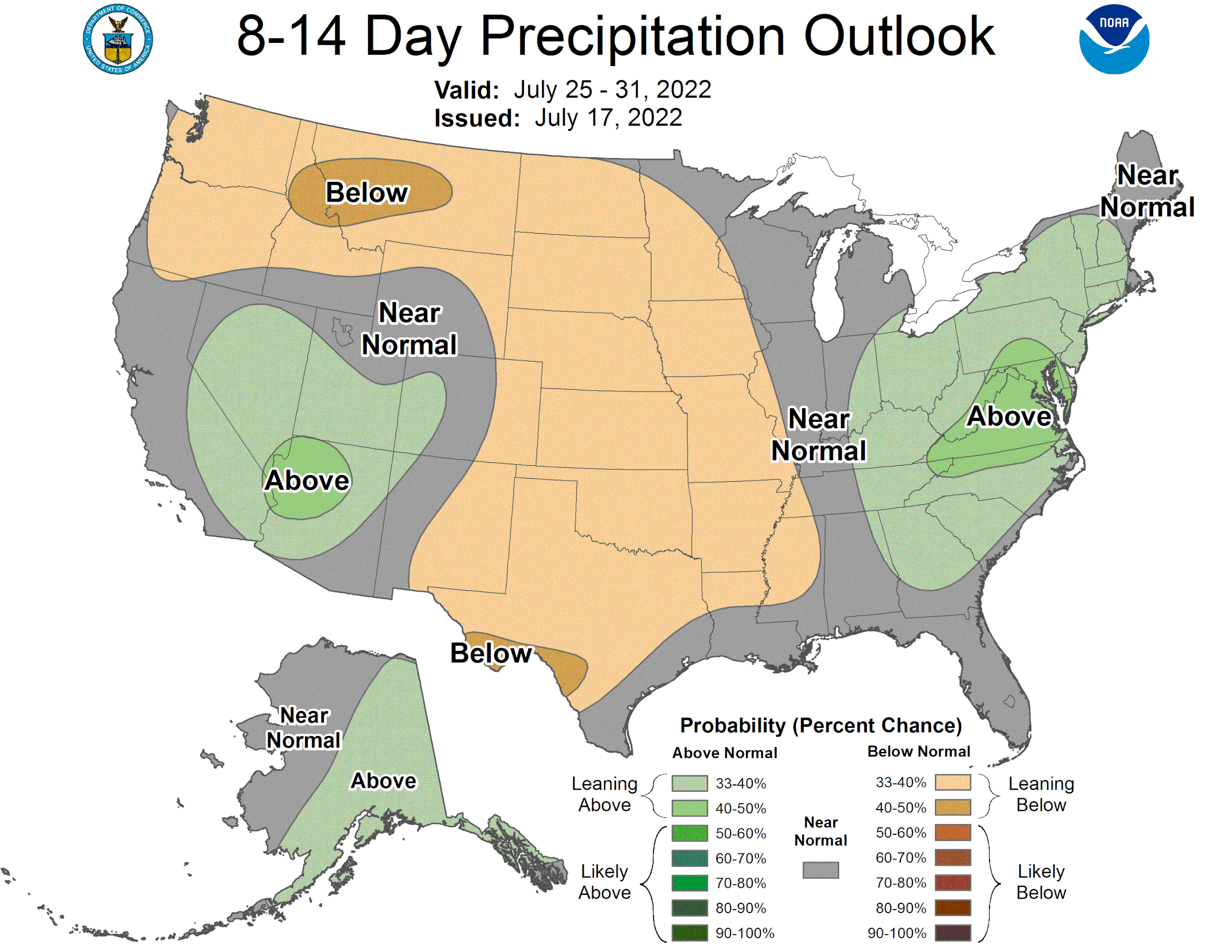
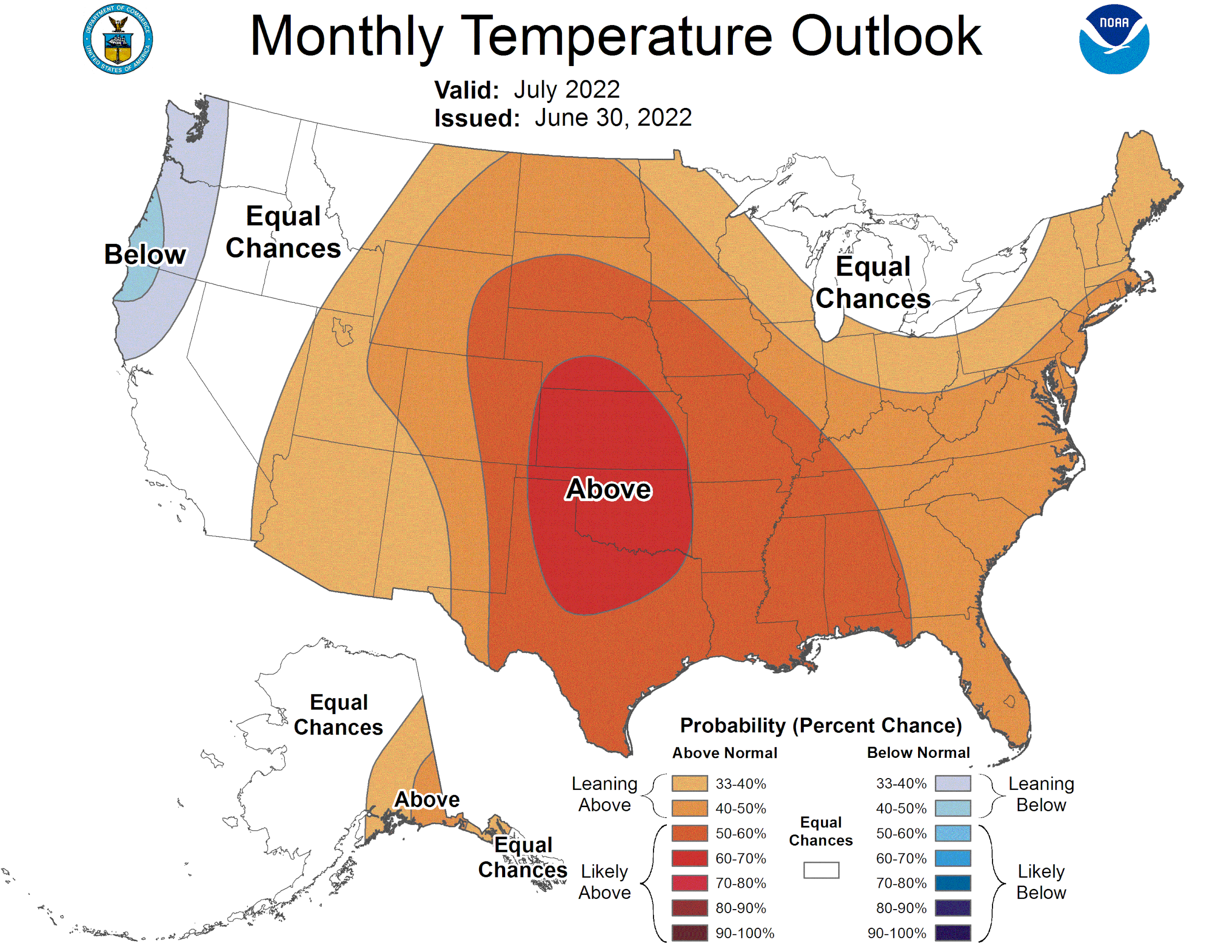
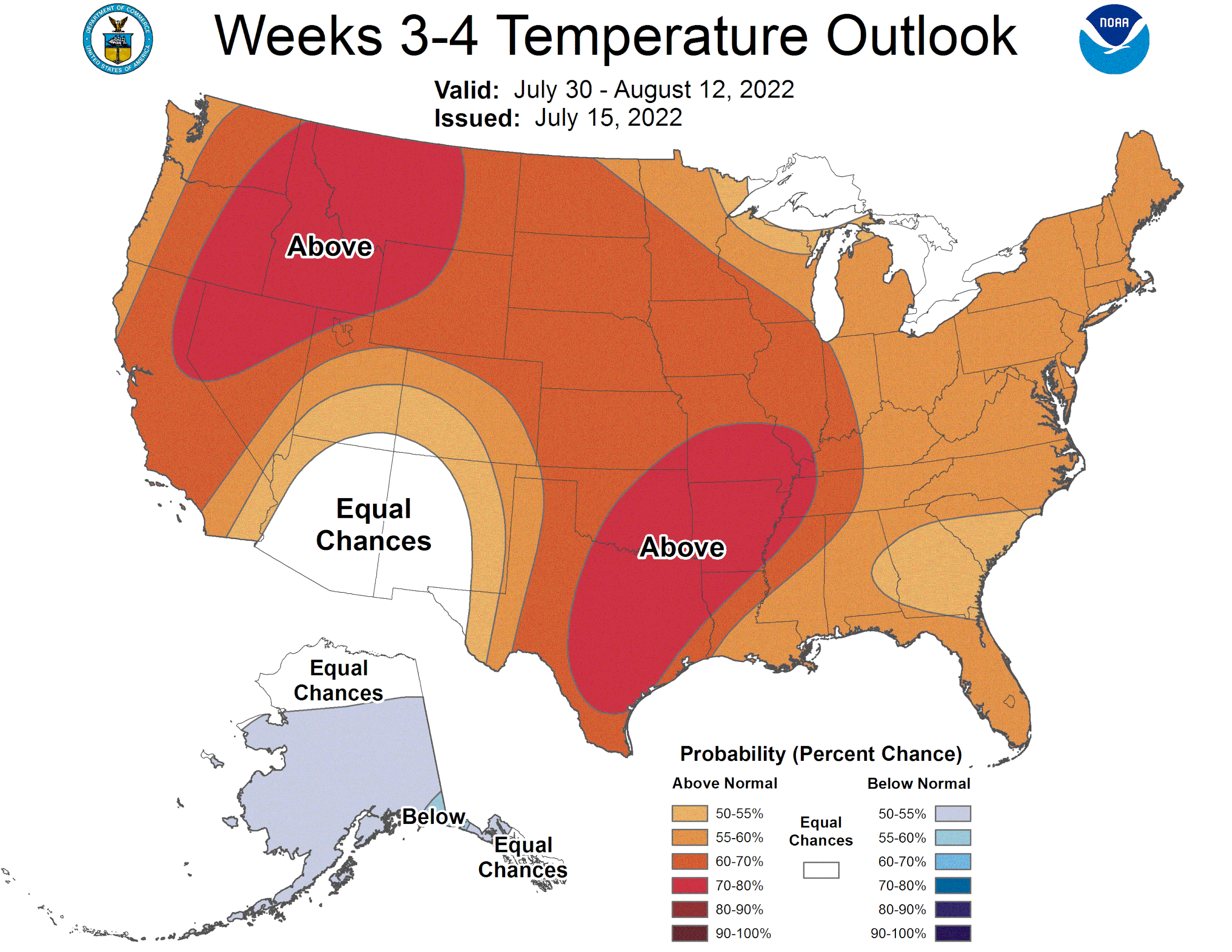
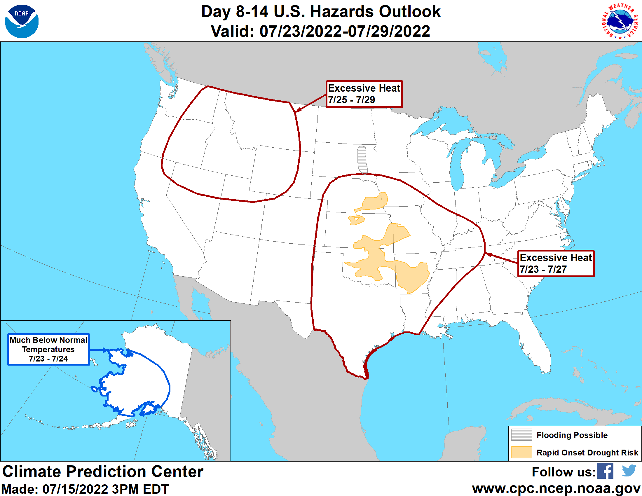
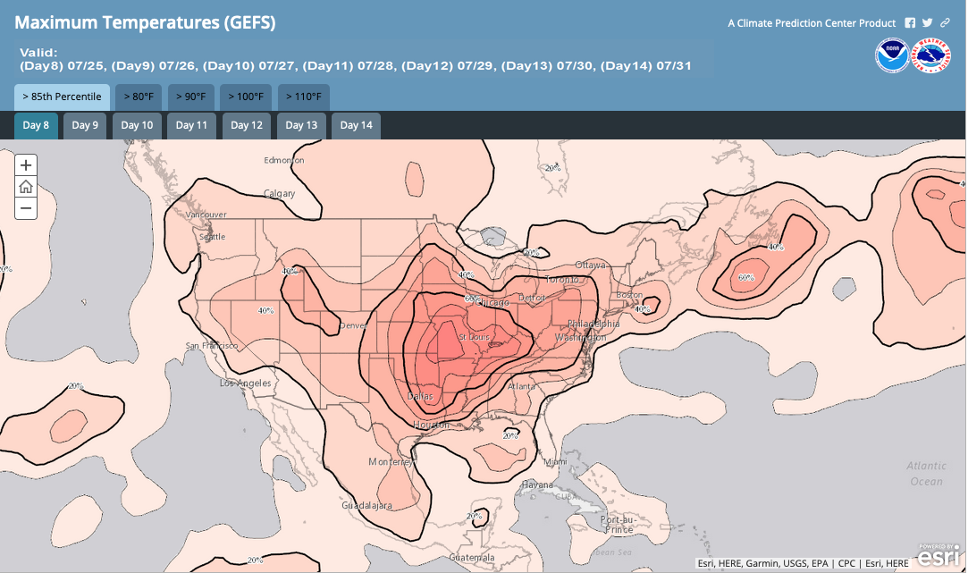
Long-Range Forecasts
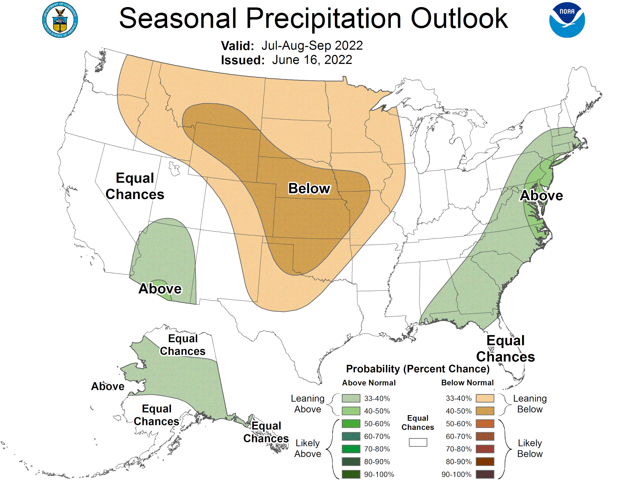
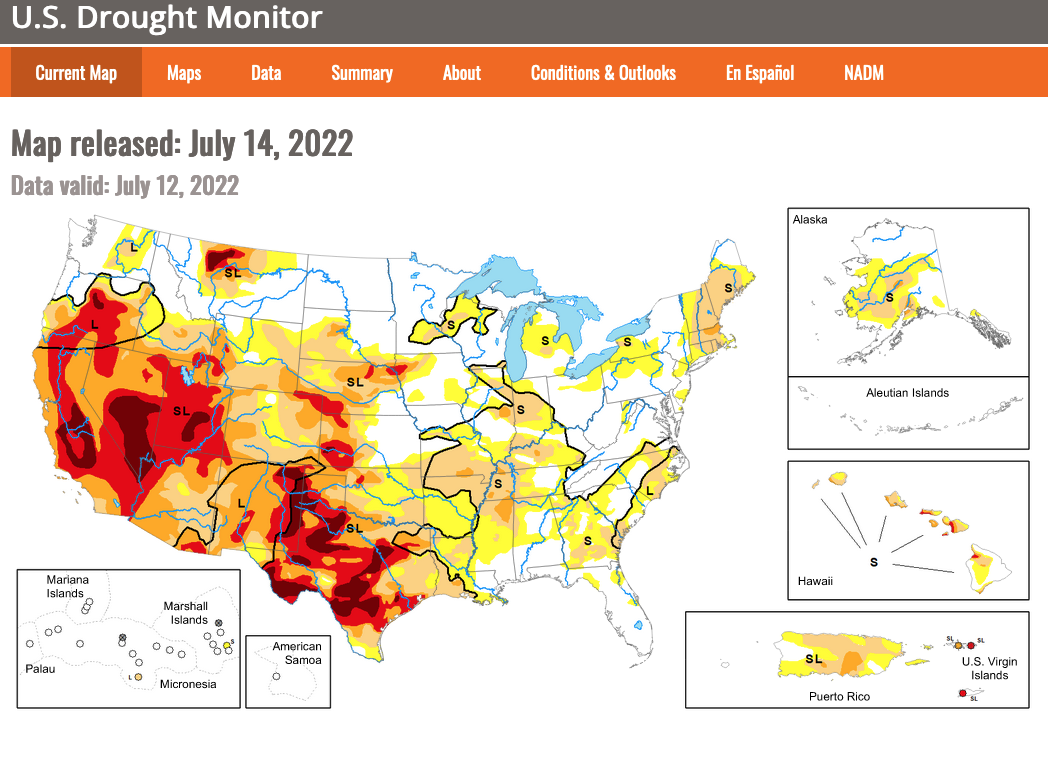
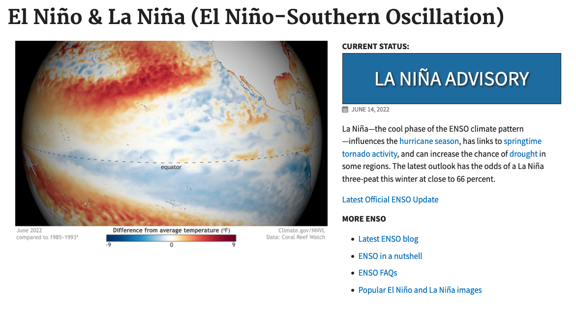
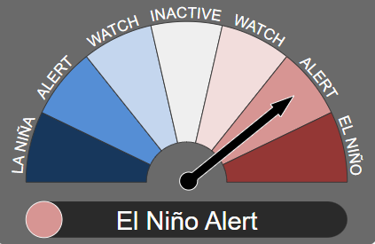
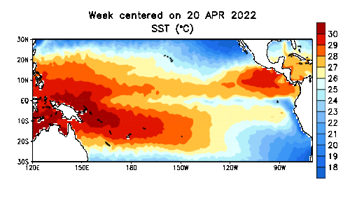
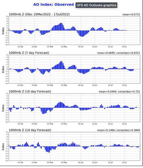
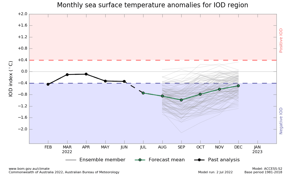
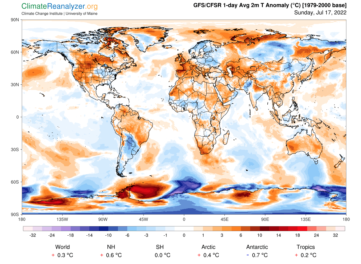
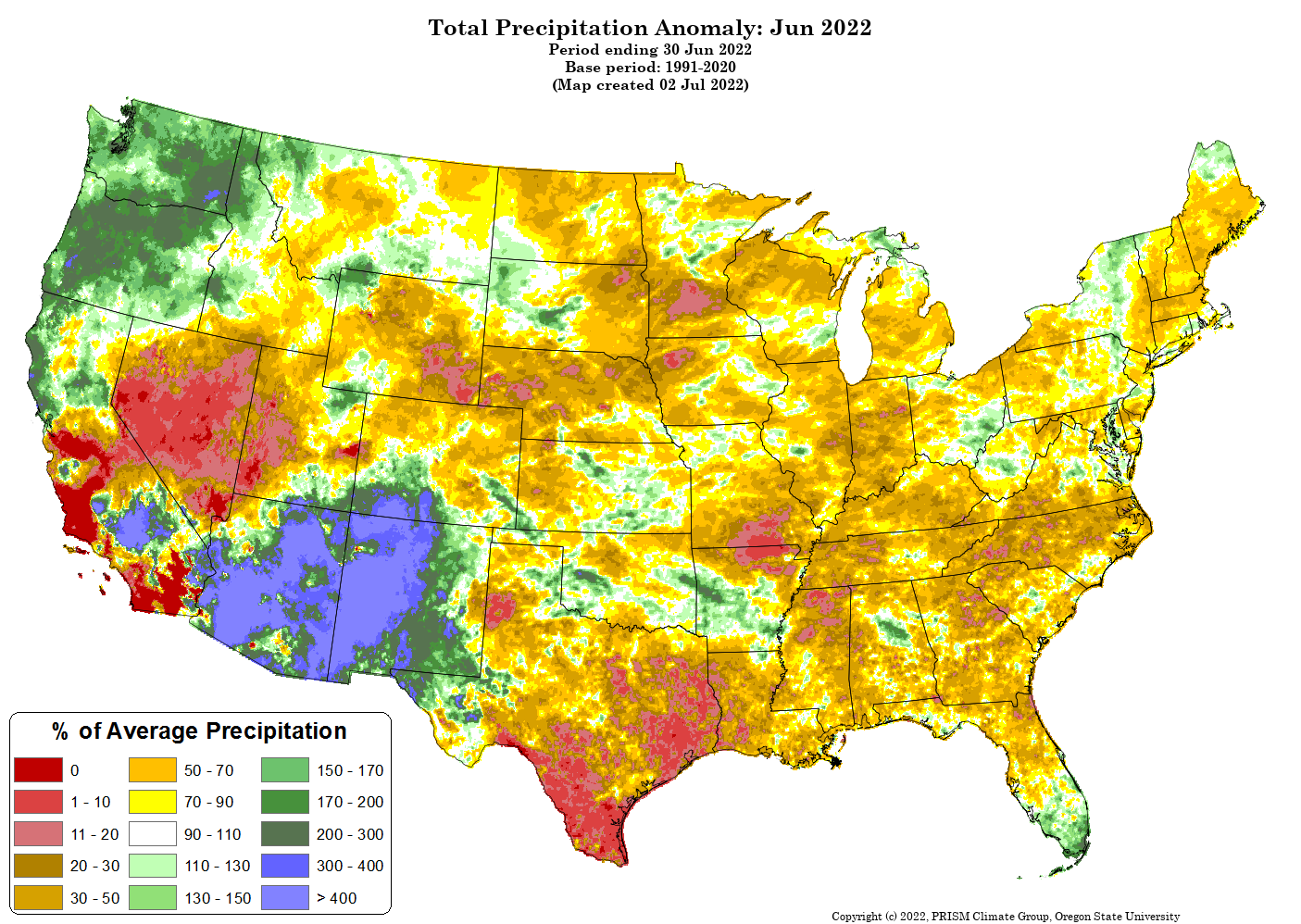
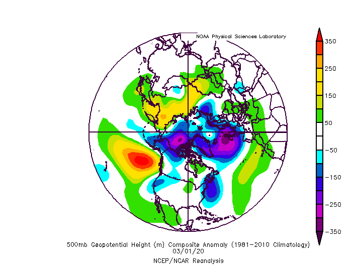
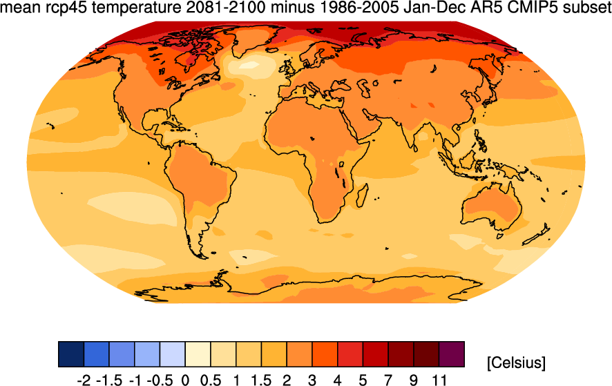
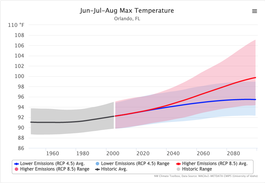
Climate Tools
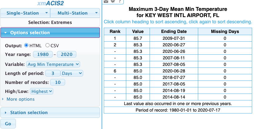

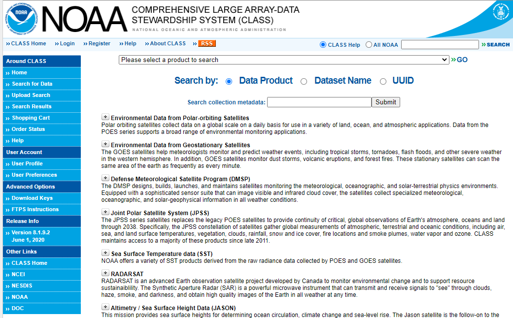
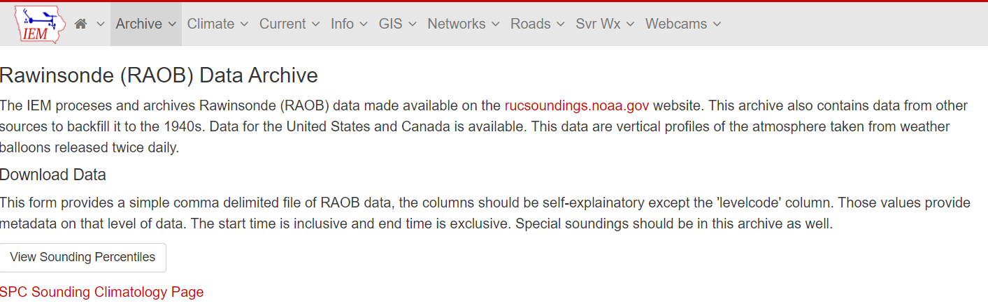
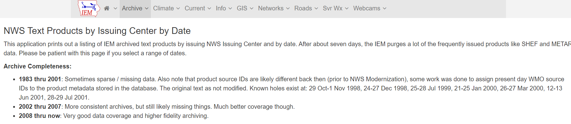
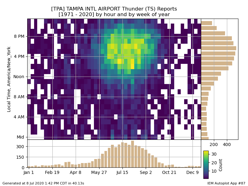
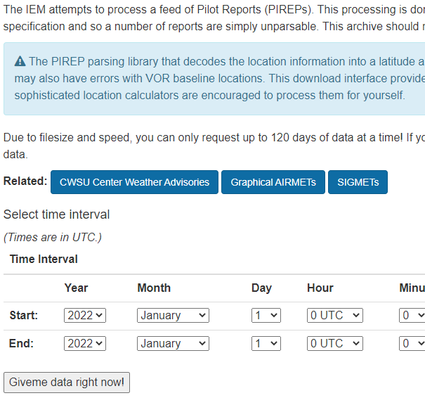
Data Archives
Satellite/Radar


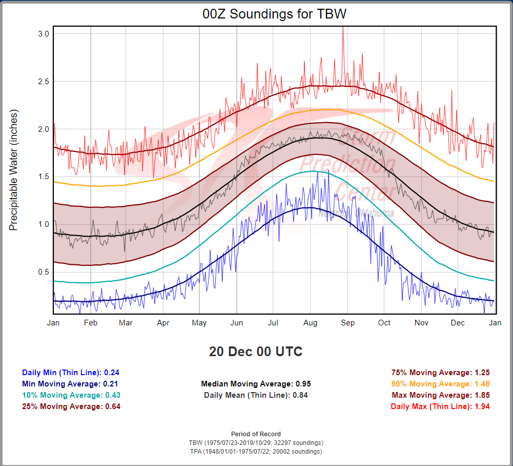
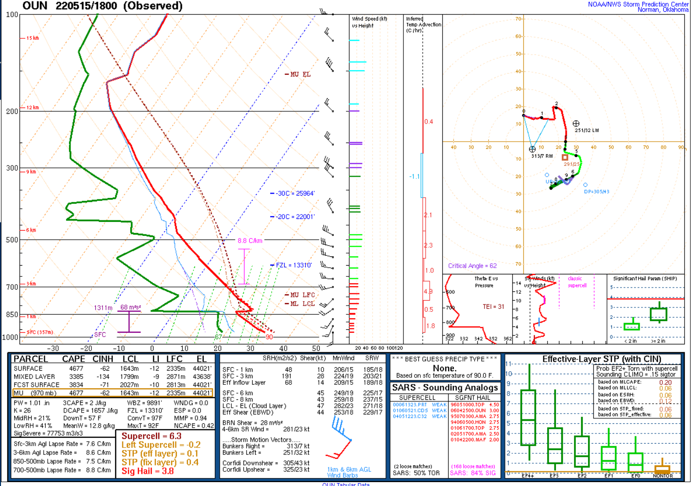
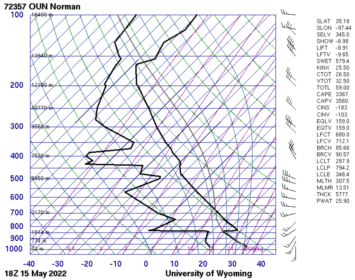
Radiosonde data

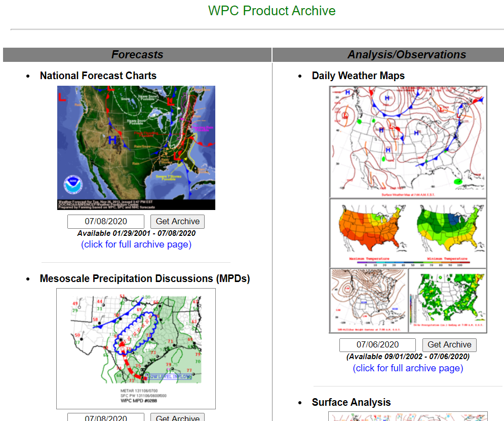
Surface charts and Data


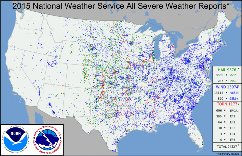
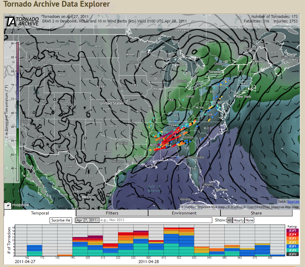
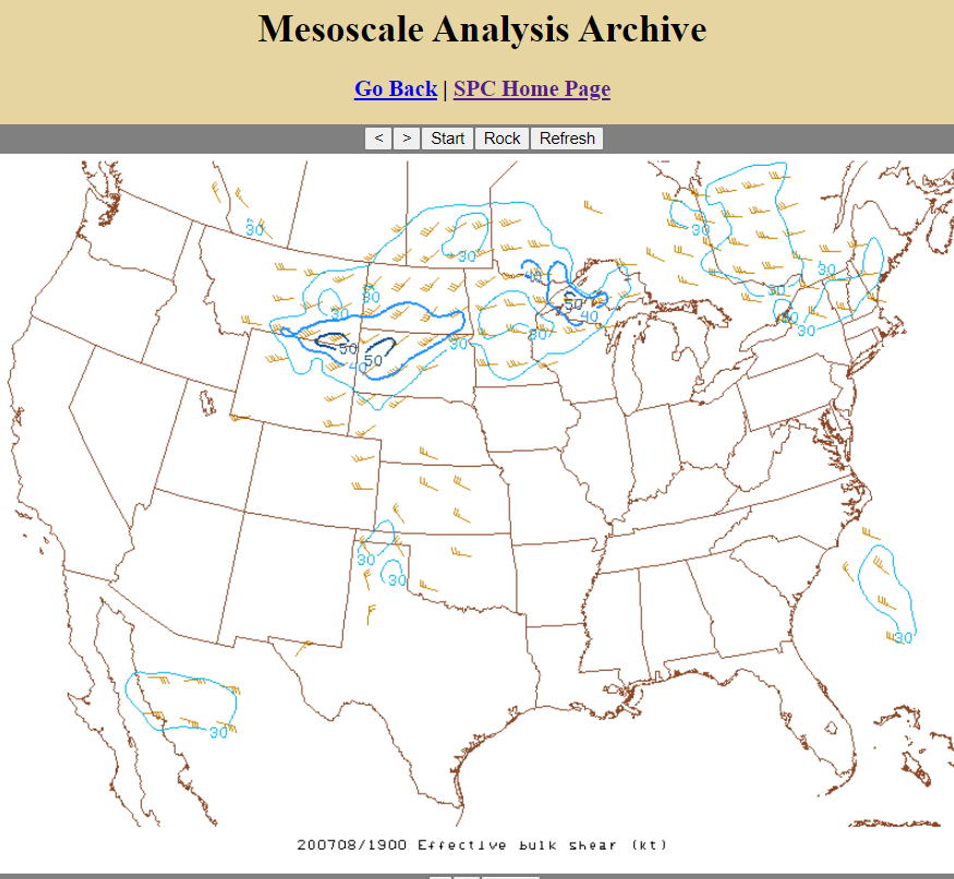
Severe Weather
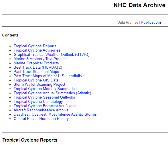
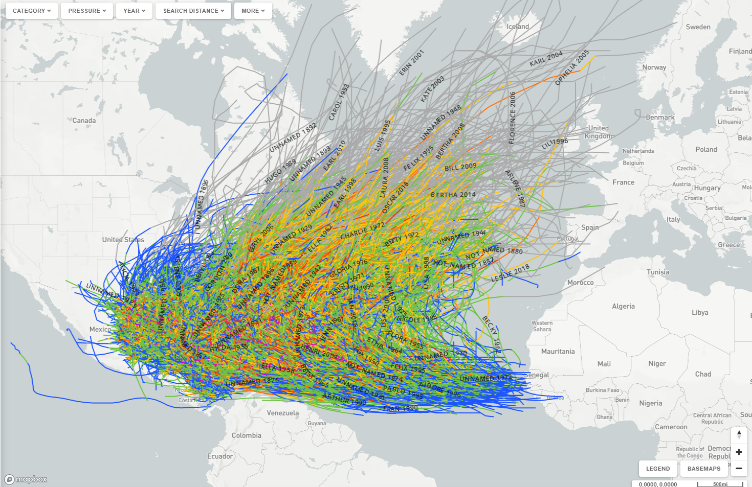
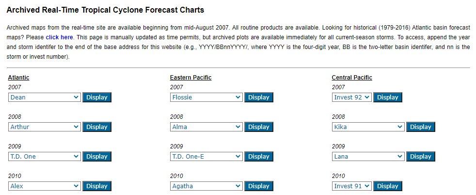
Tropical Cyclones

other useful ARchives
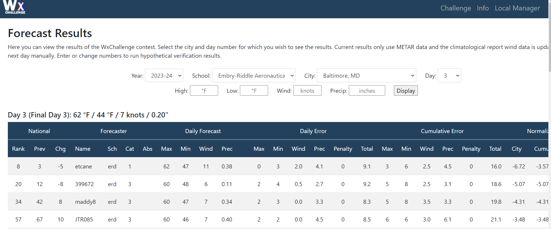
WxChallenge Resources
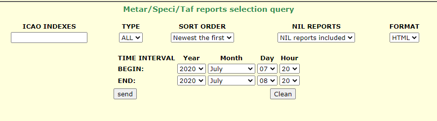
observations
graphical model forecasts
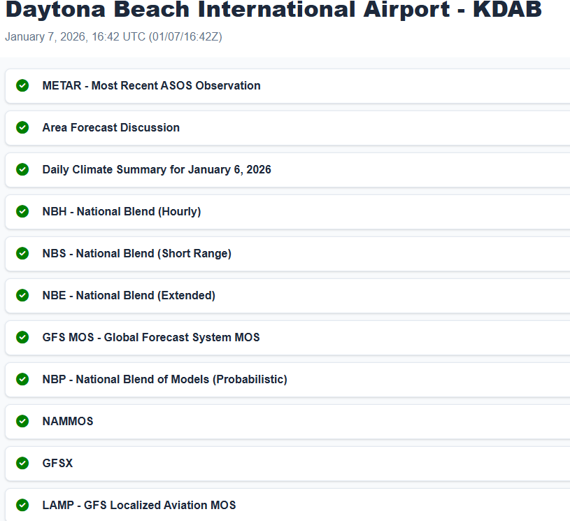
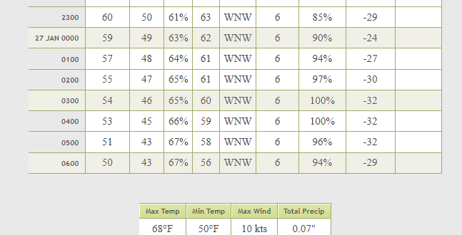
Point forecasting guidance

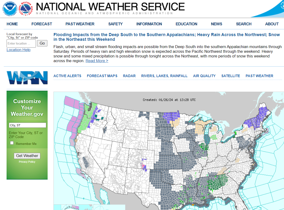
NWS Human Forecasts
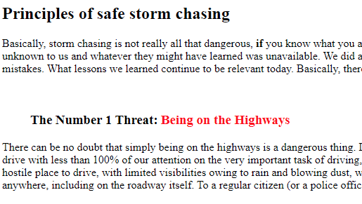
Storm Chasing Resources
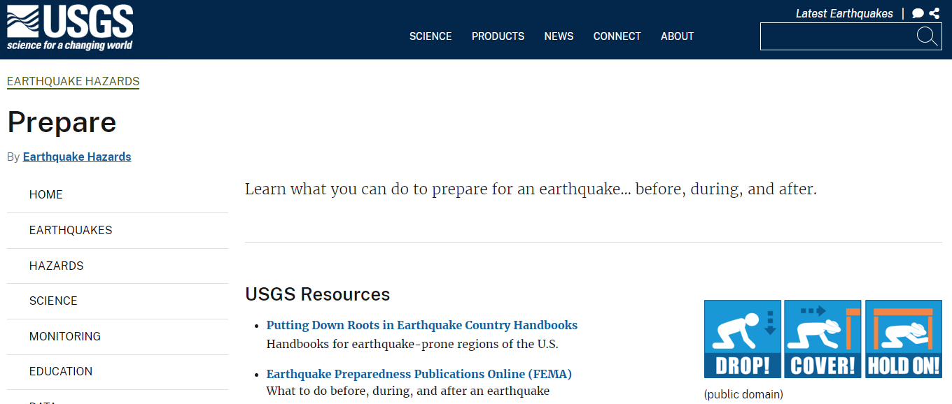
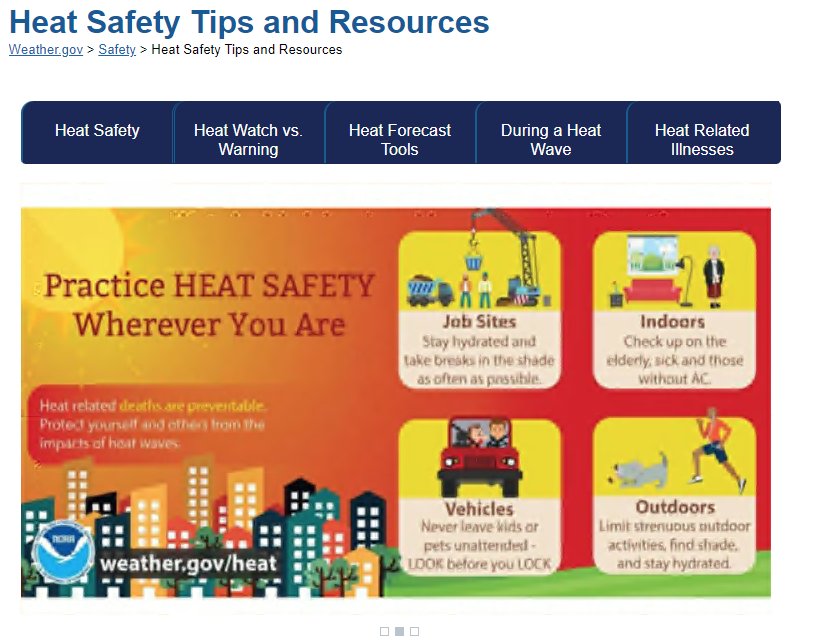
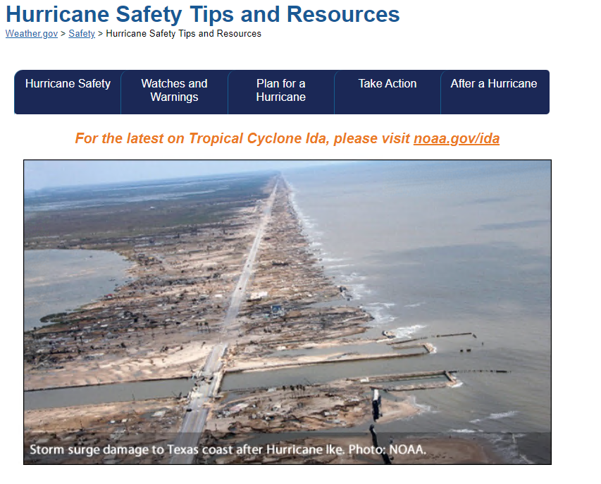
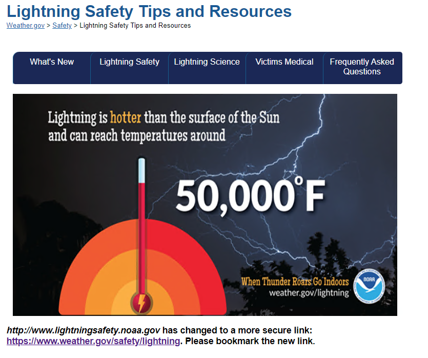
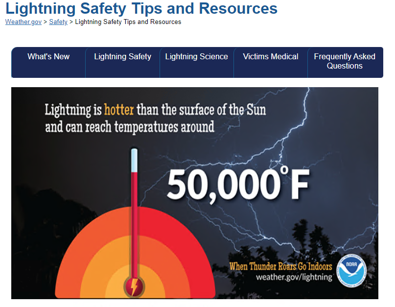
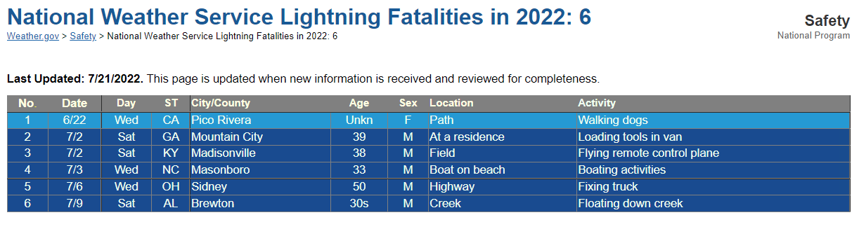
Safety and education
SATELLITE AND RADAR
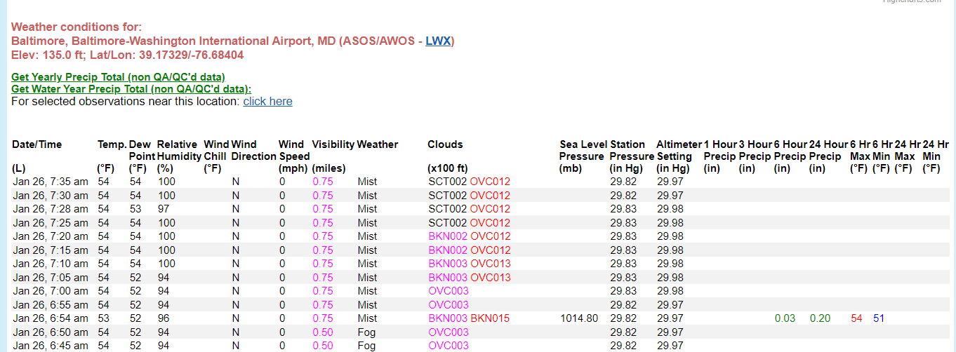
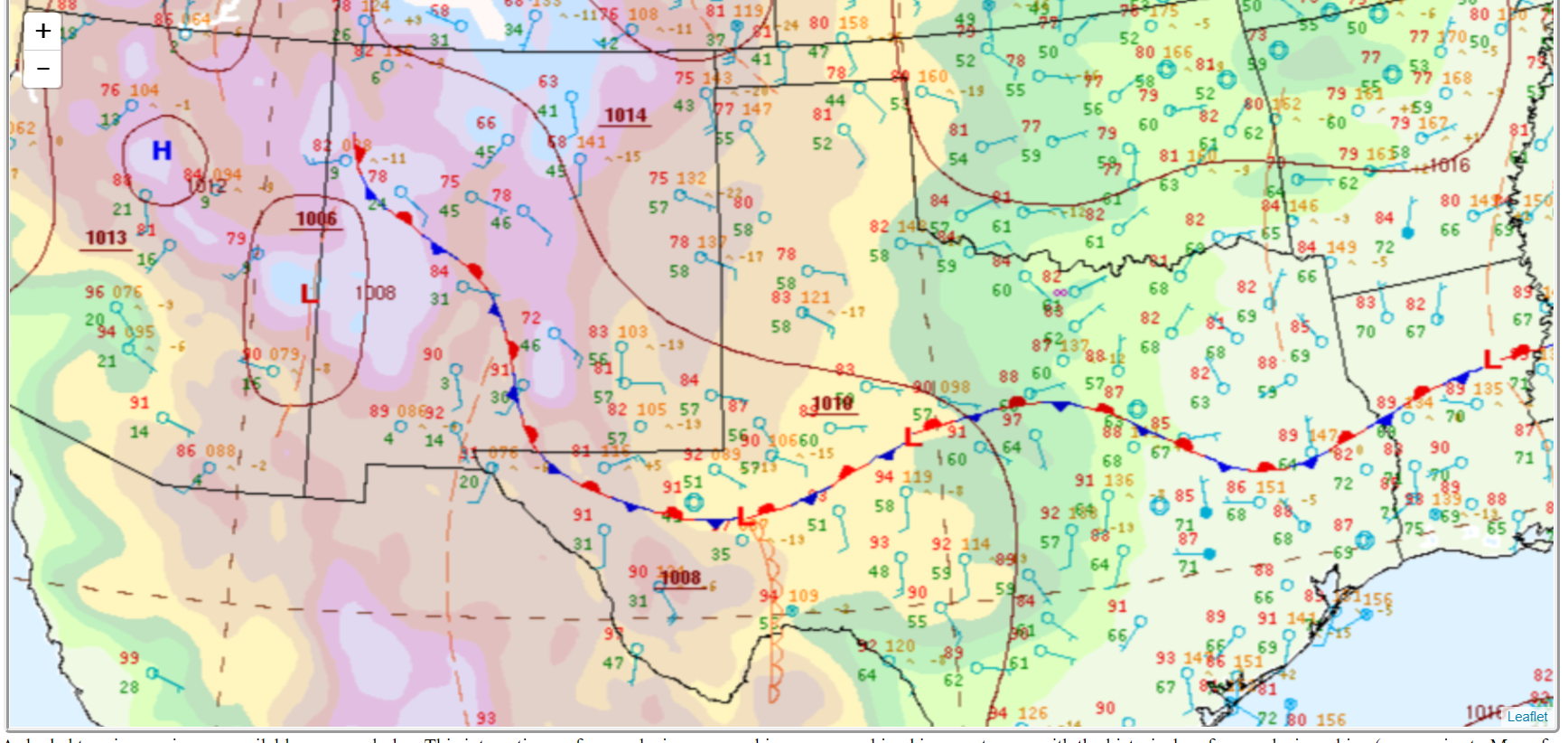
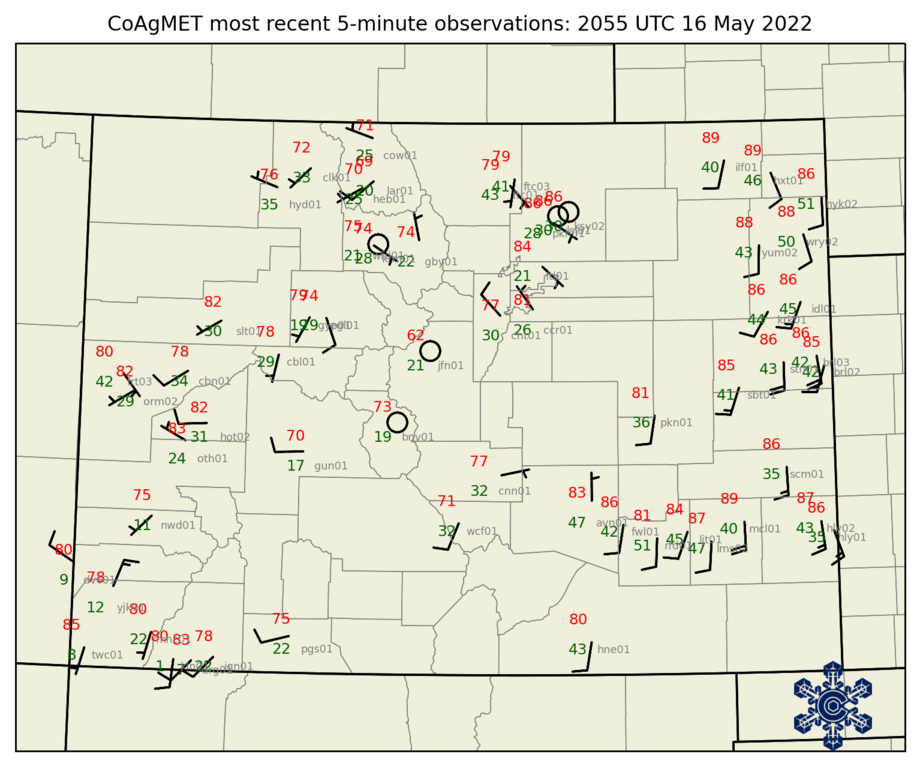
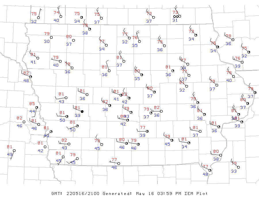
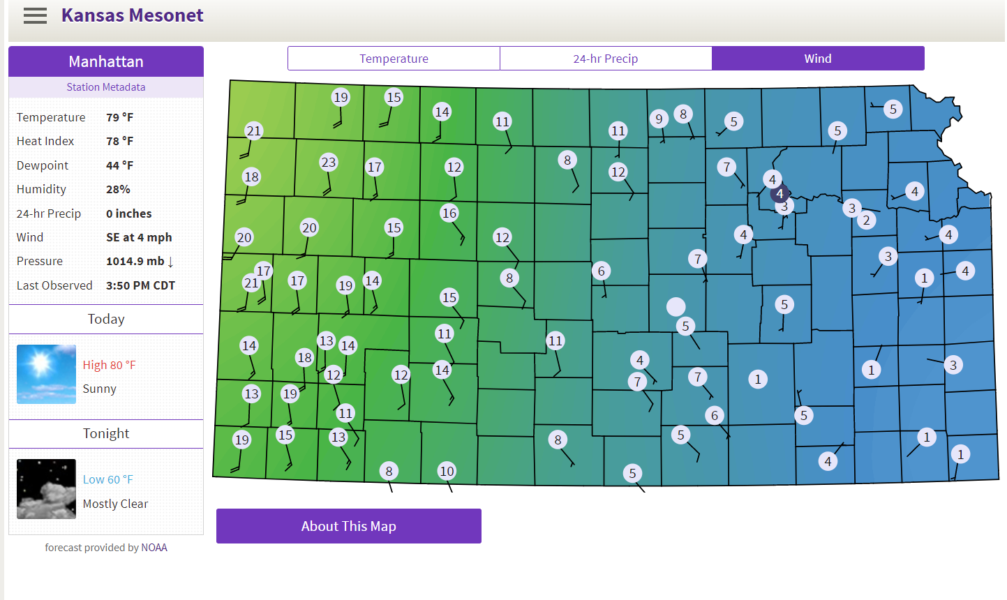
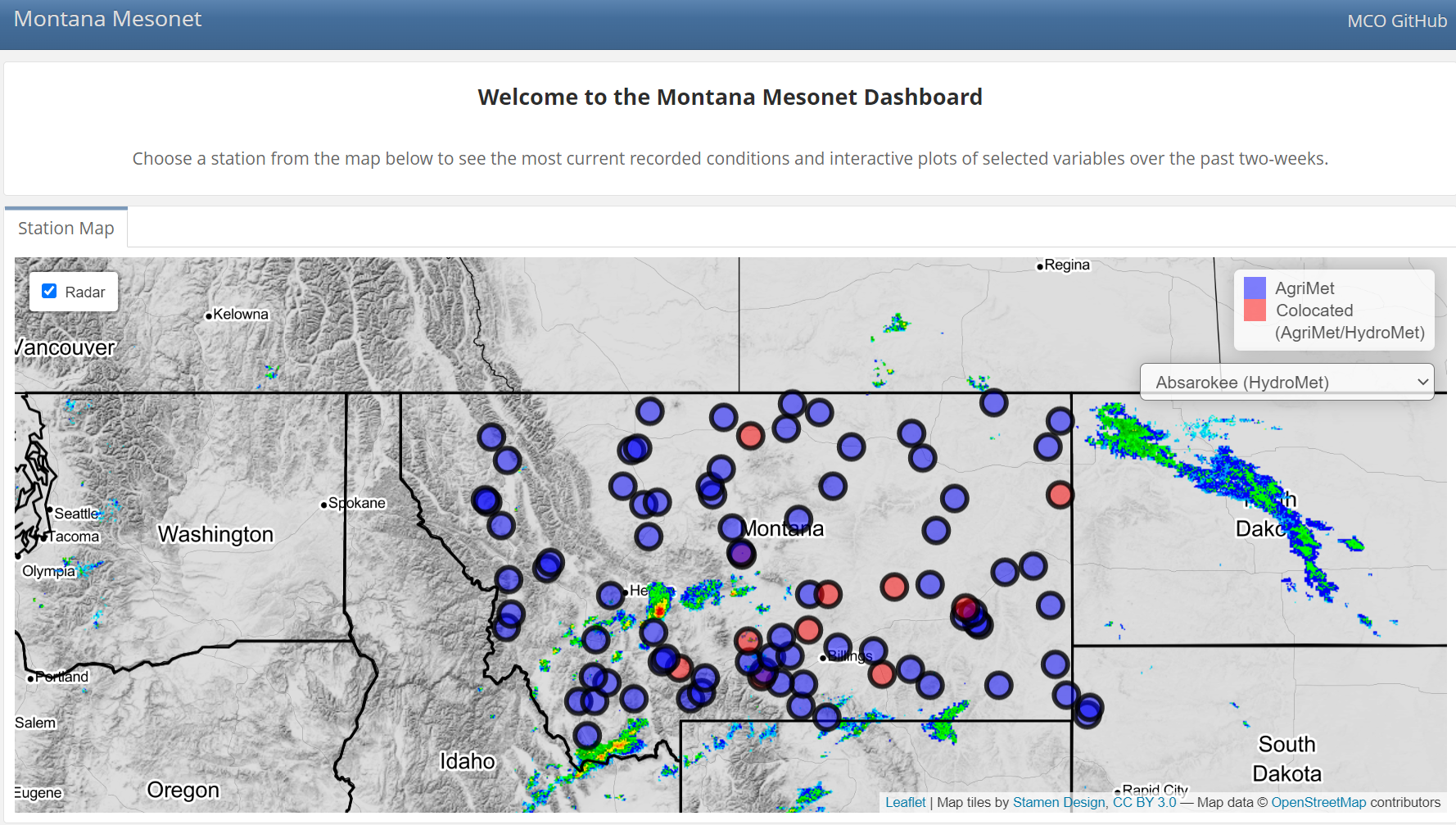
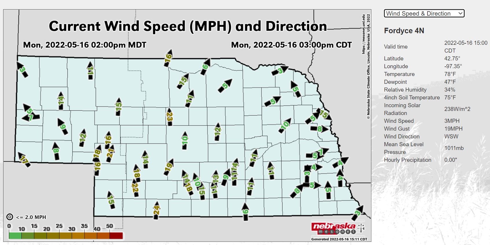
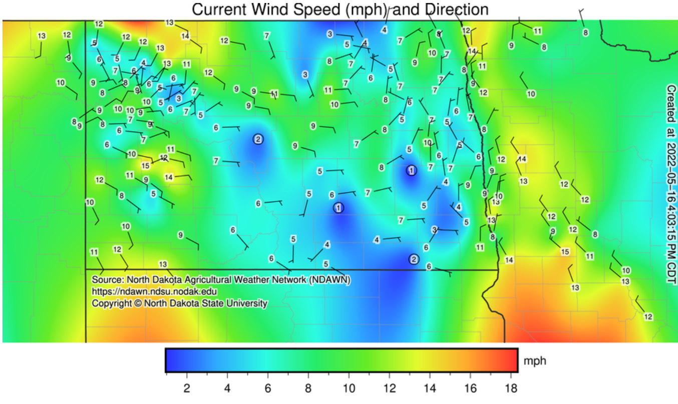
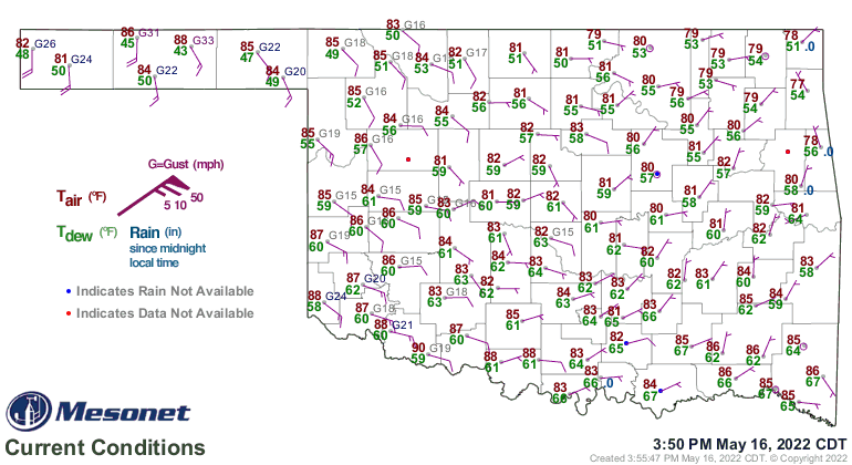
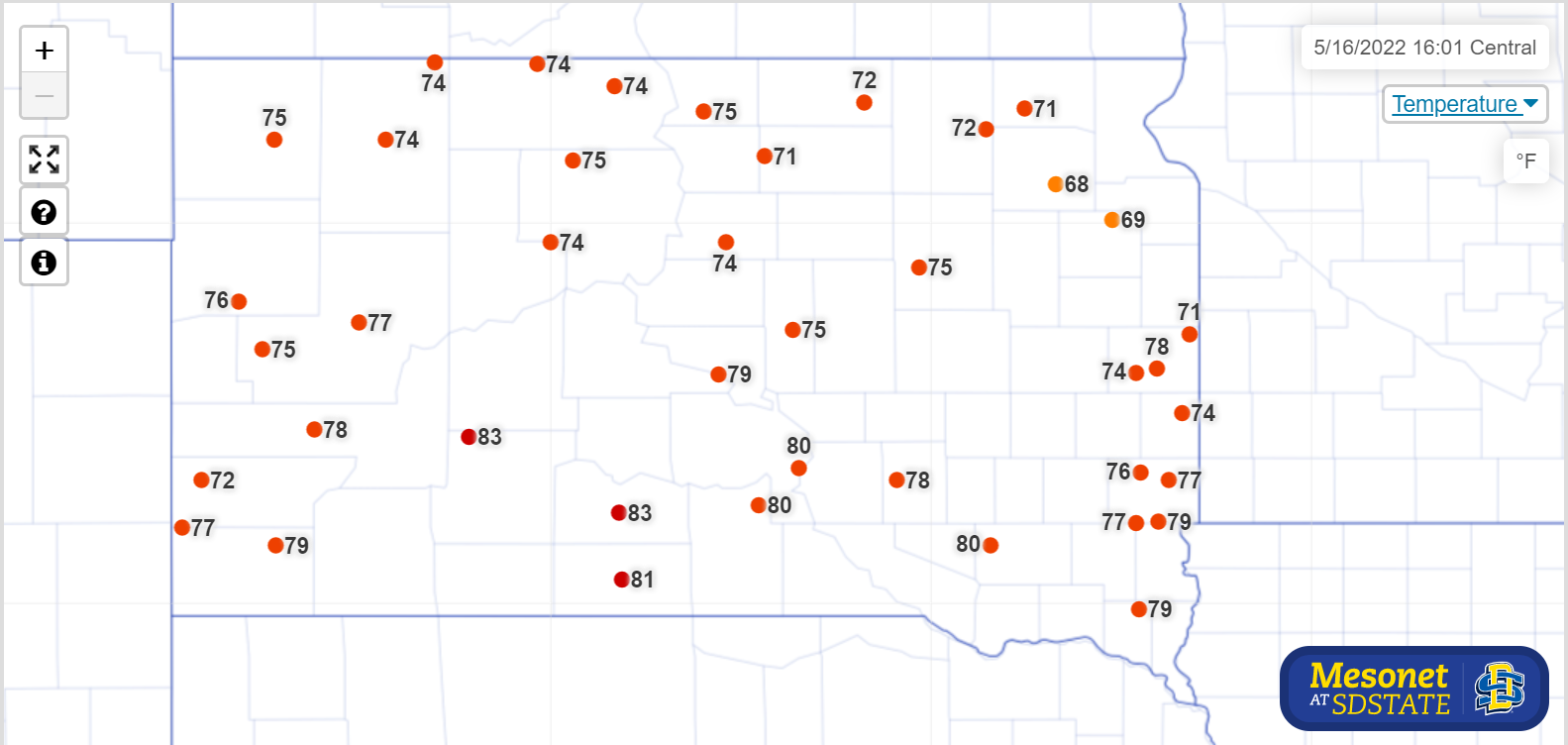
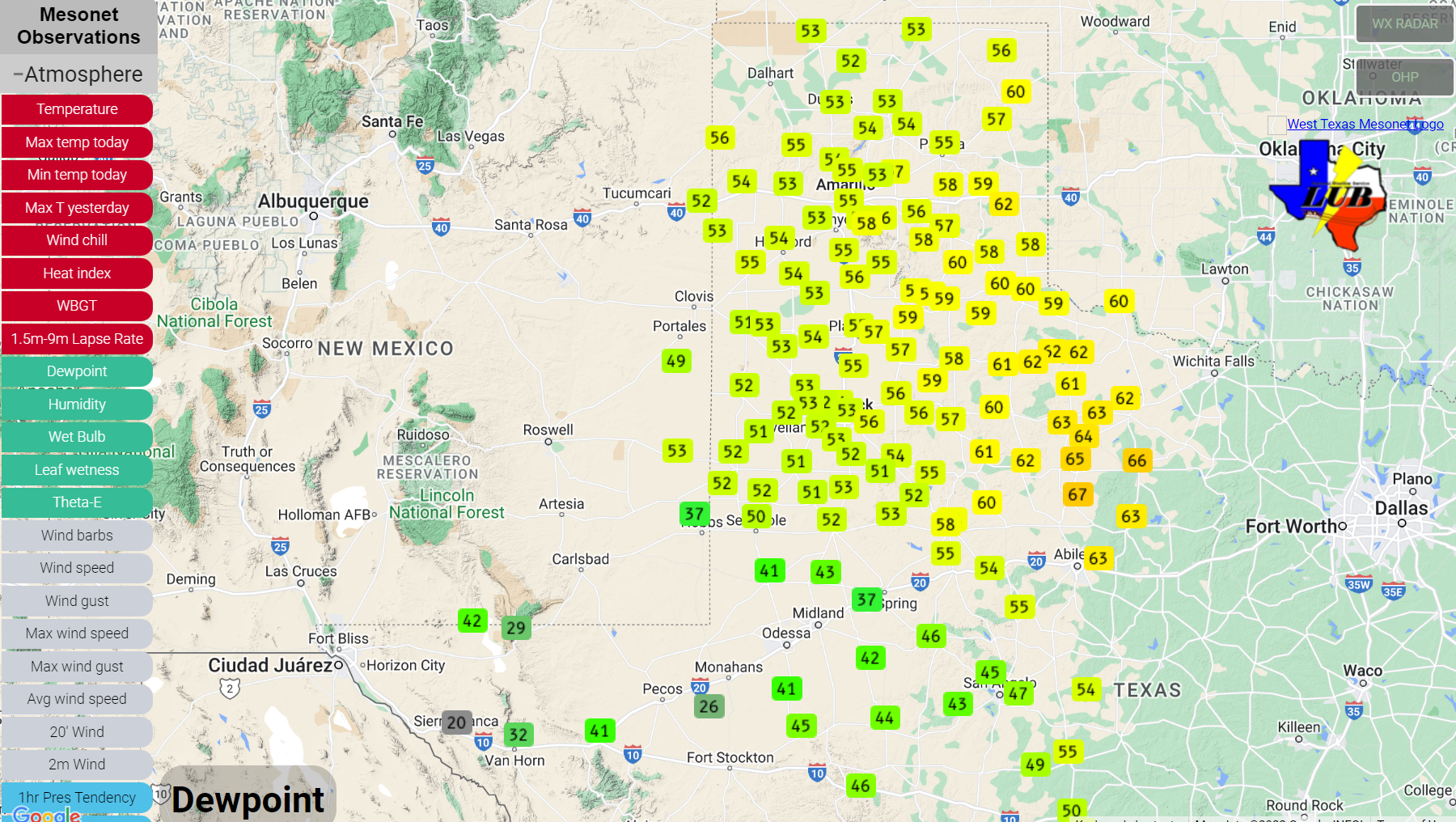
Surface Data (ASOS and Mesonet)

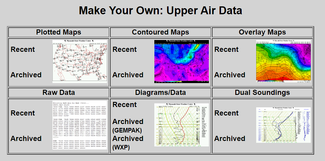
Upper Air Data
Model Forecast Tools
Specialized Forecast Tools
Human Forecast Tools
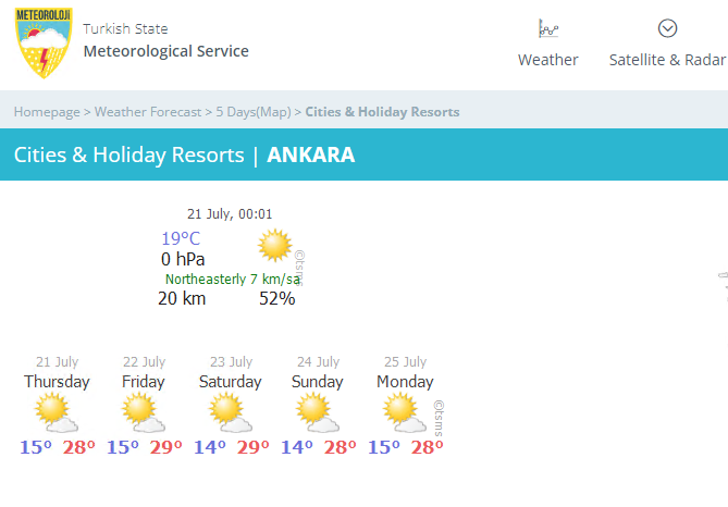
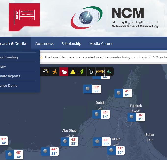
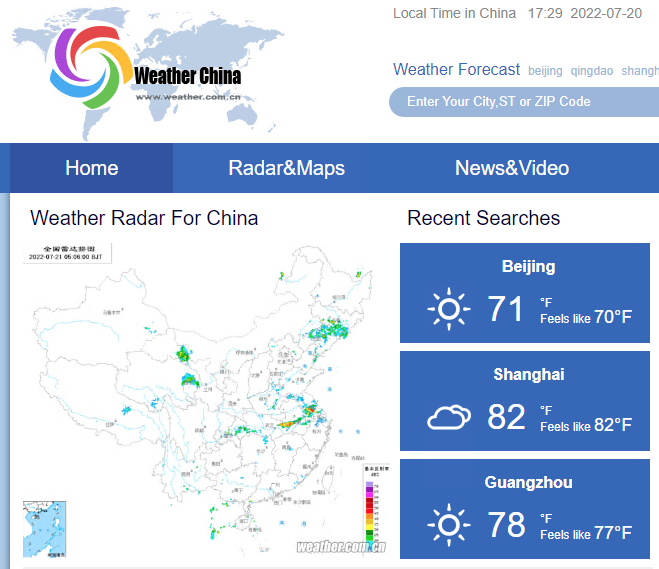
International Weather Organizations
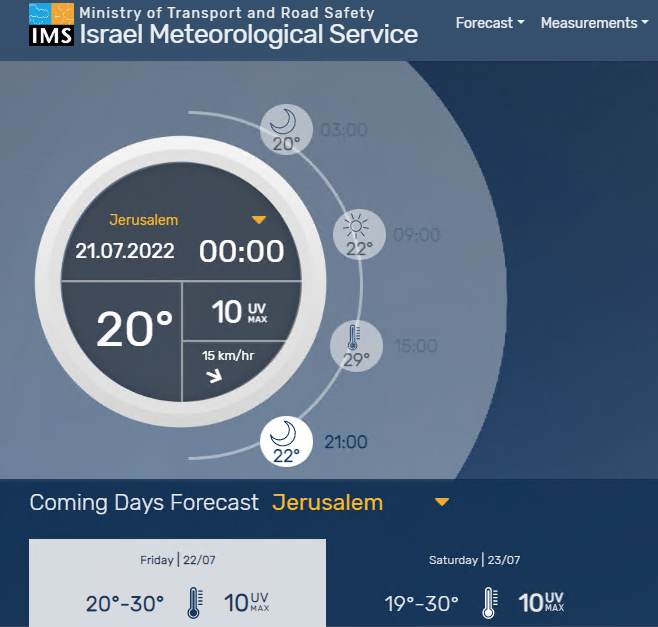
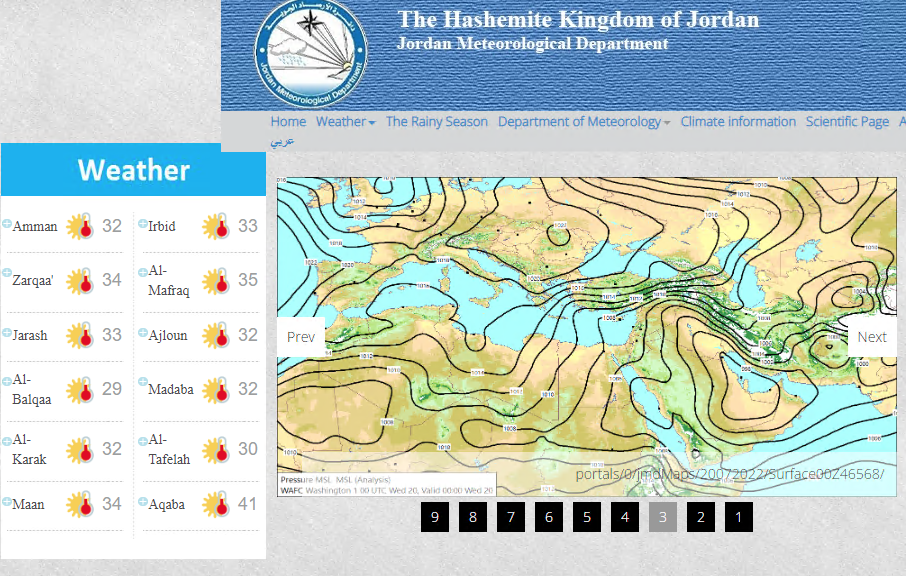
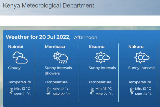
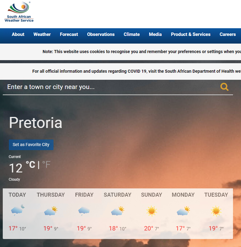
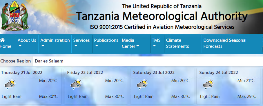
Africa and Middle East
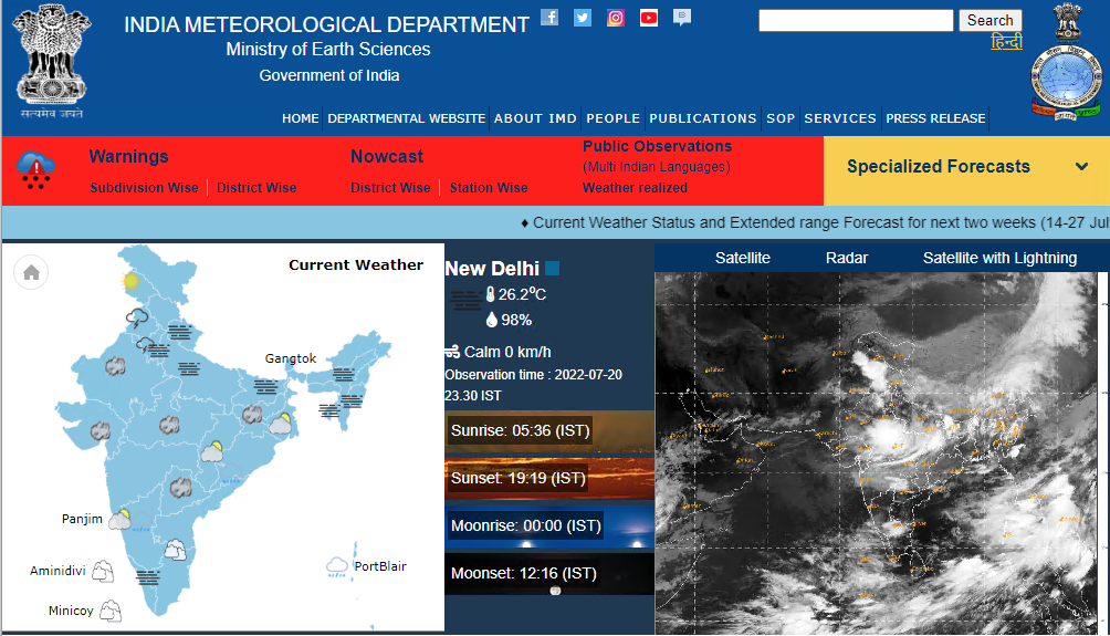
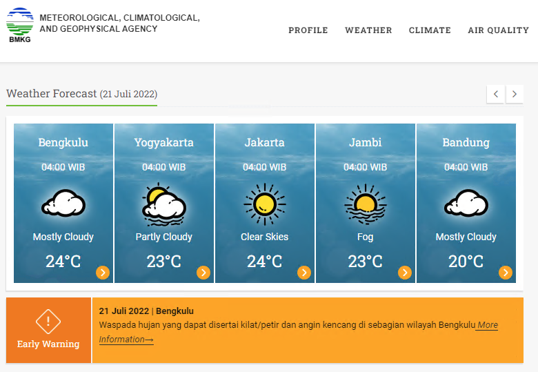
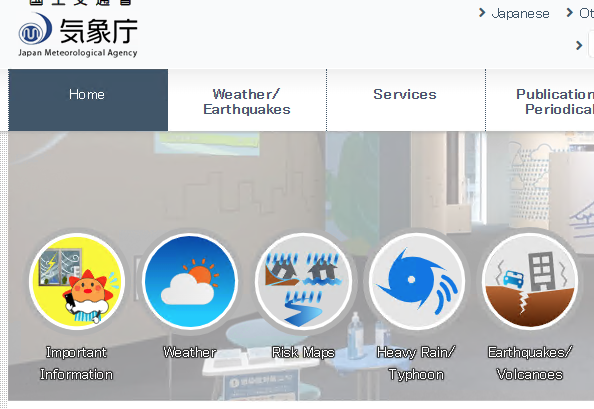
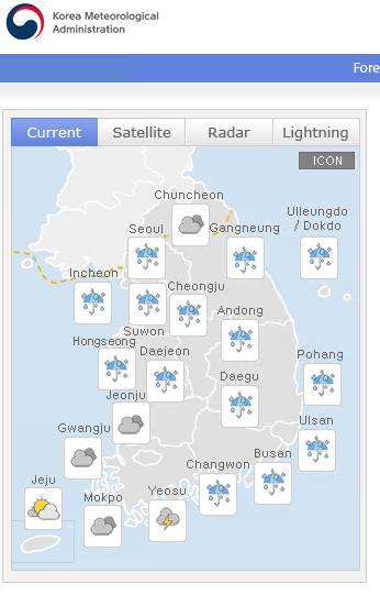
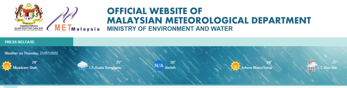
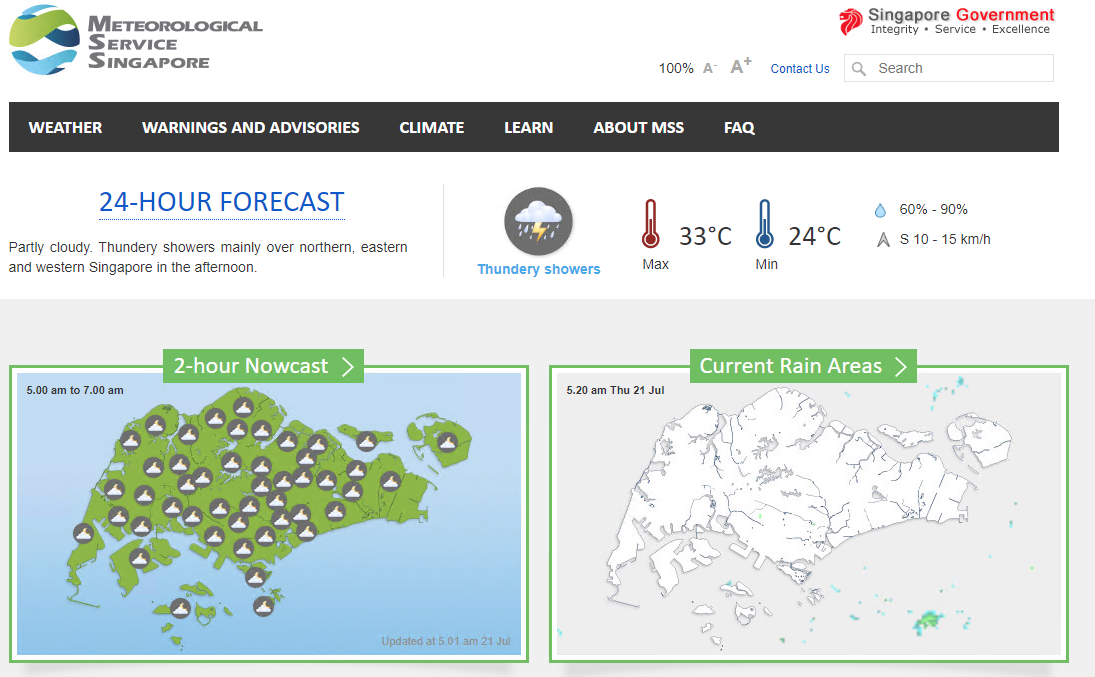
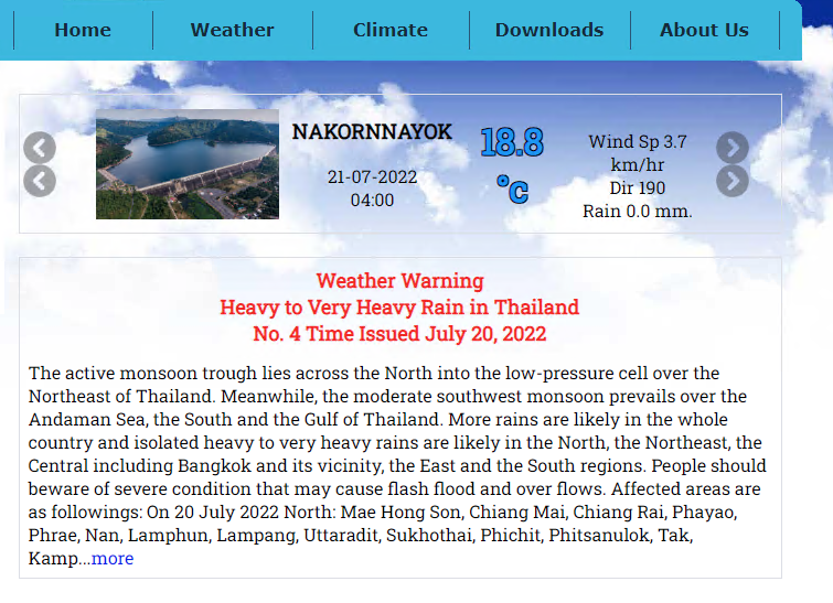
Asia
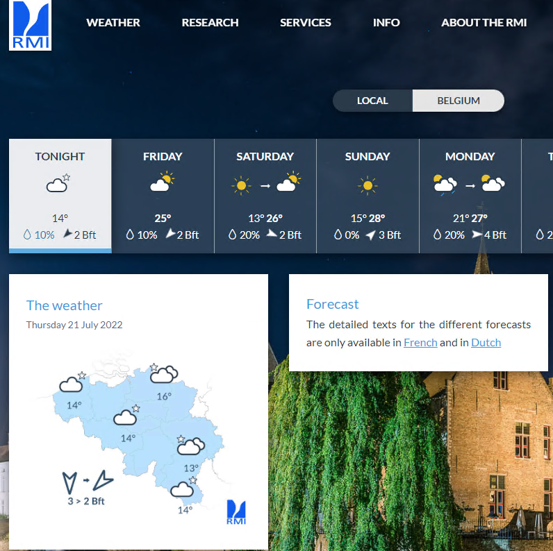
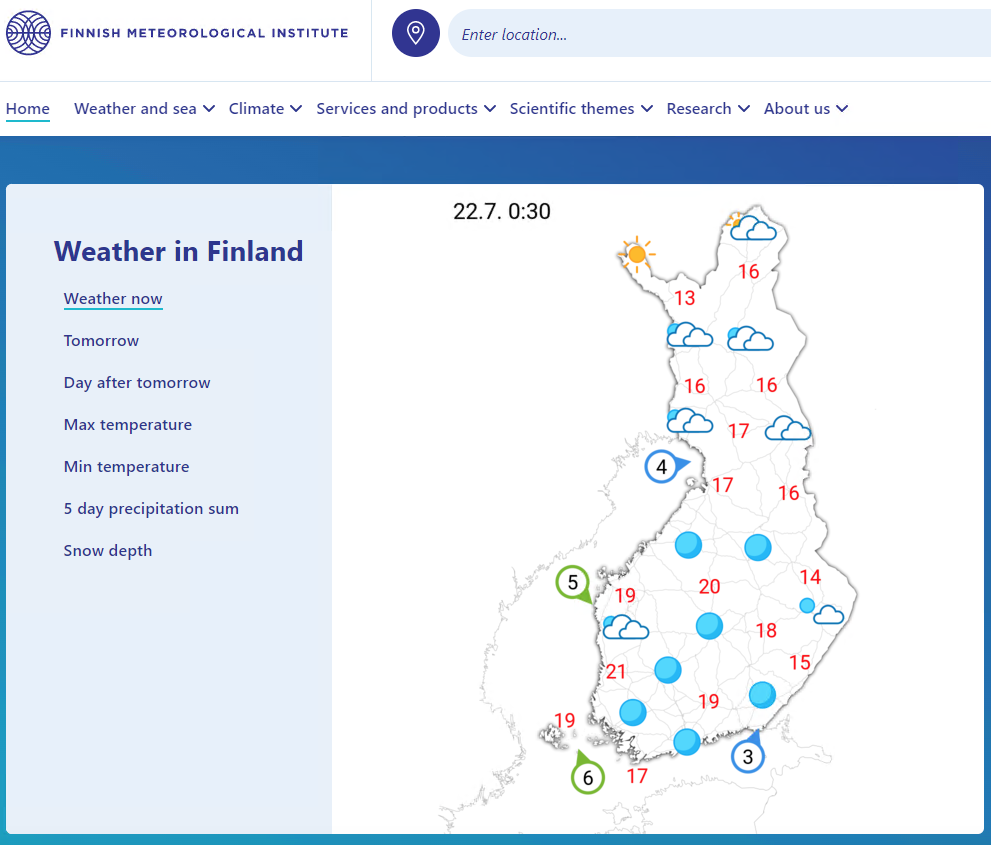
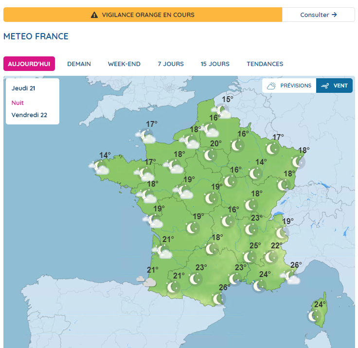
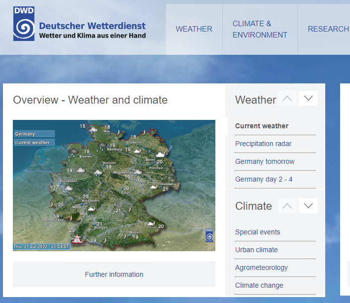
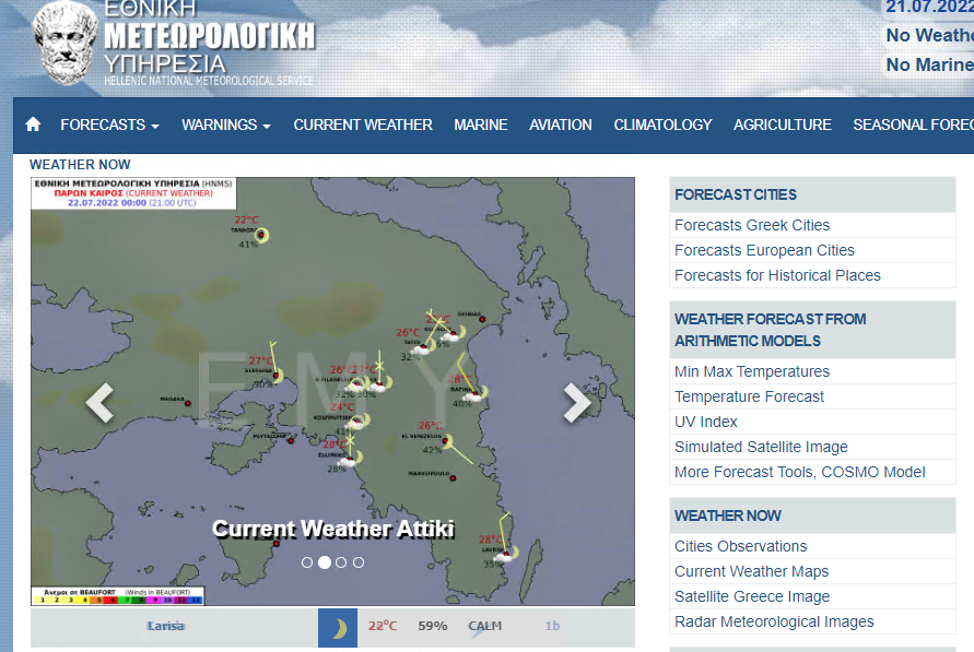
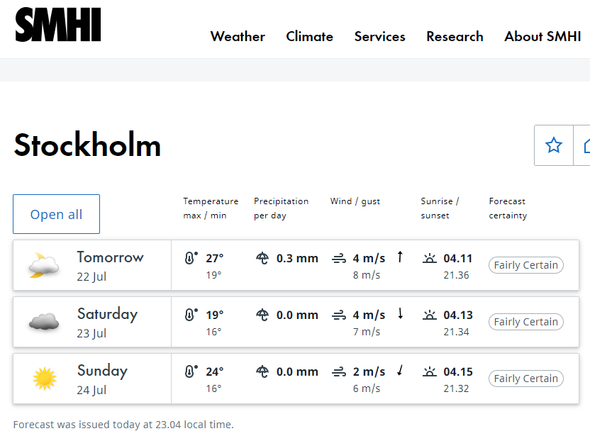
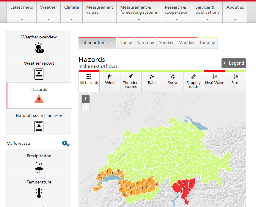
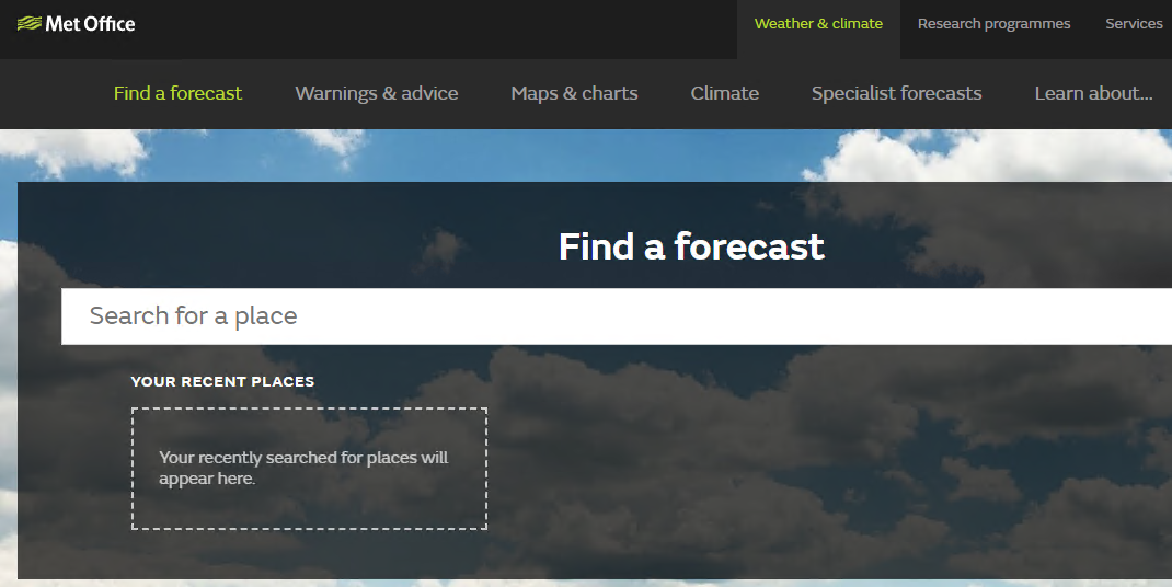
Europe


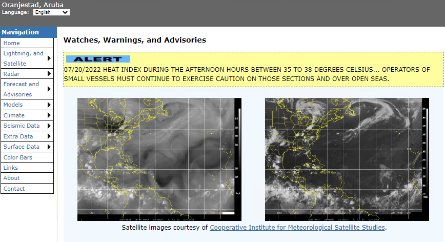
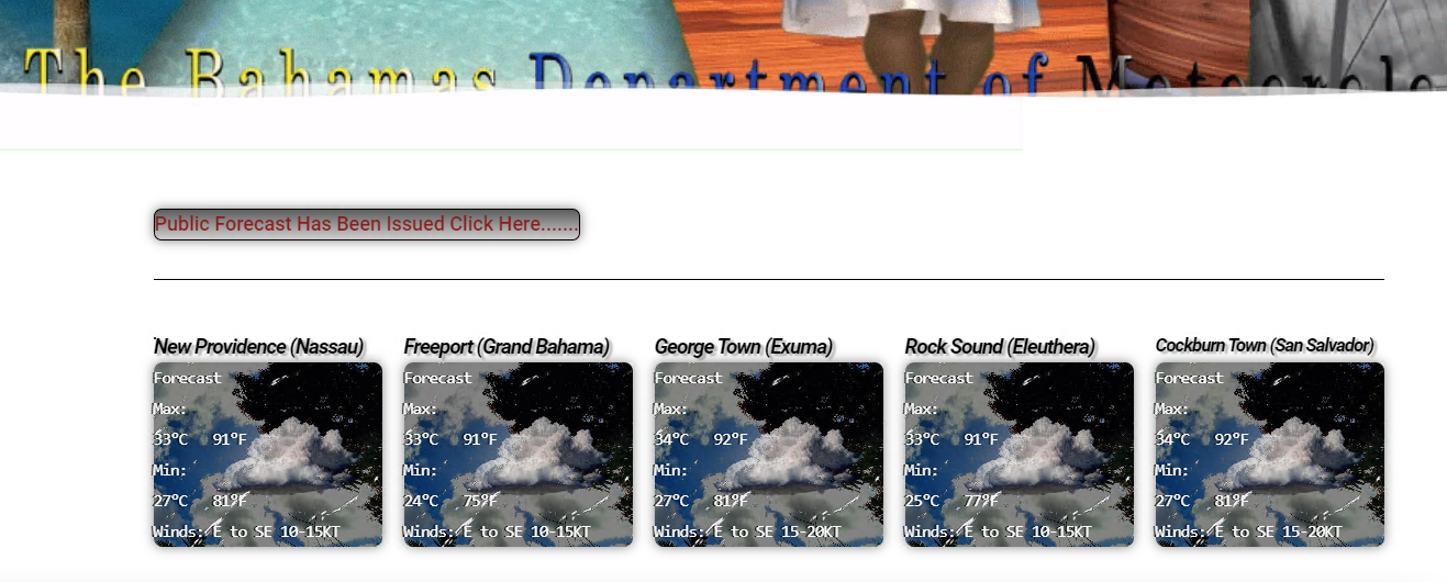
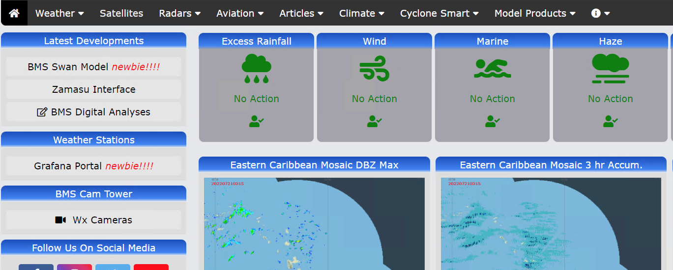
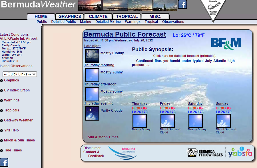
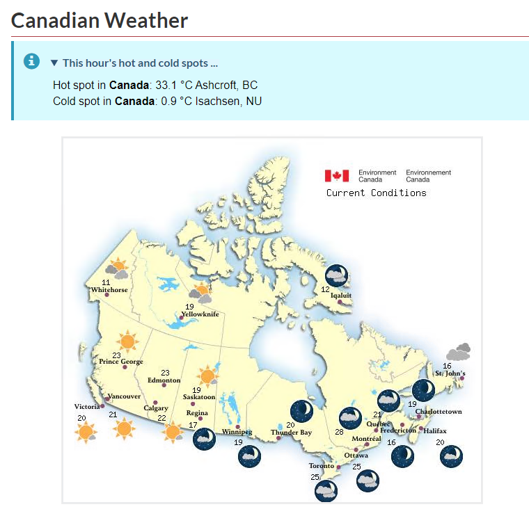
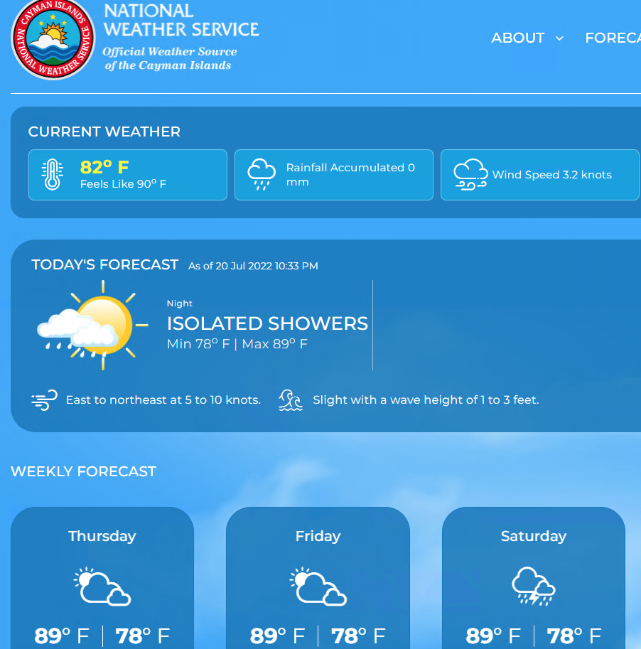
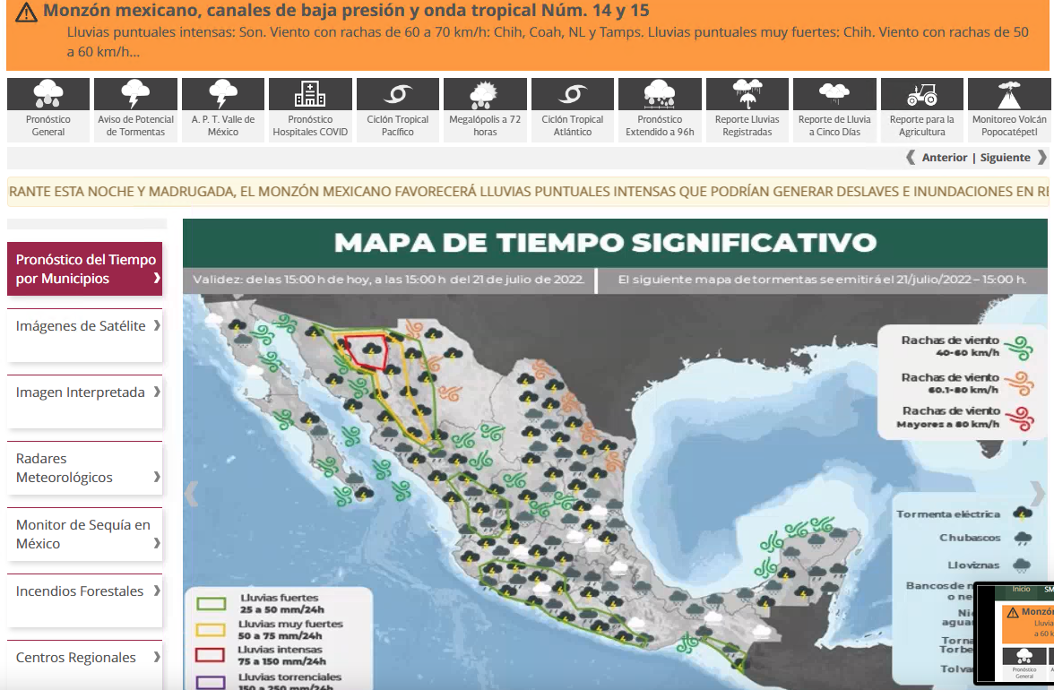
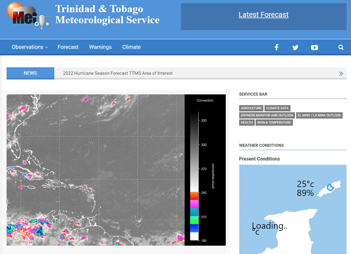
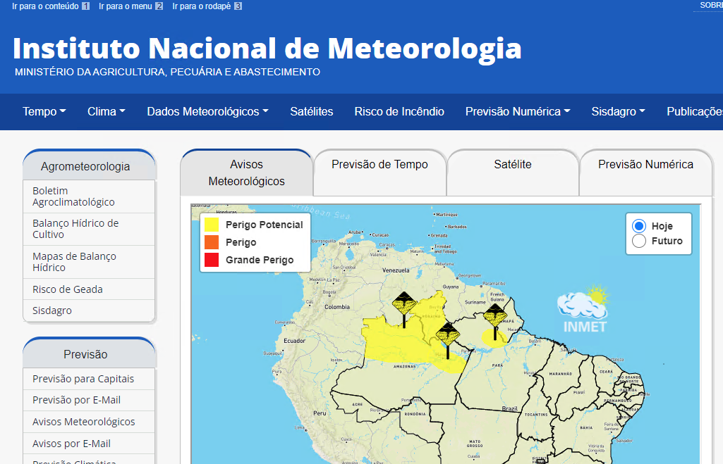
North America and Caribbean
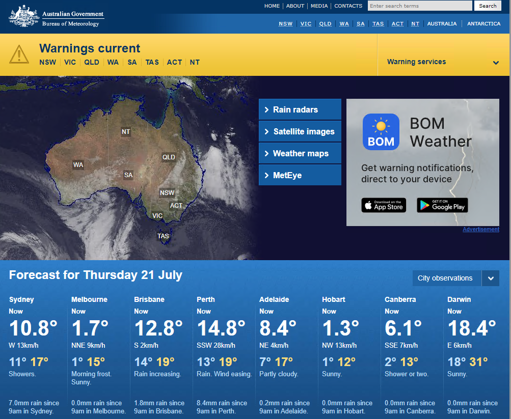
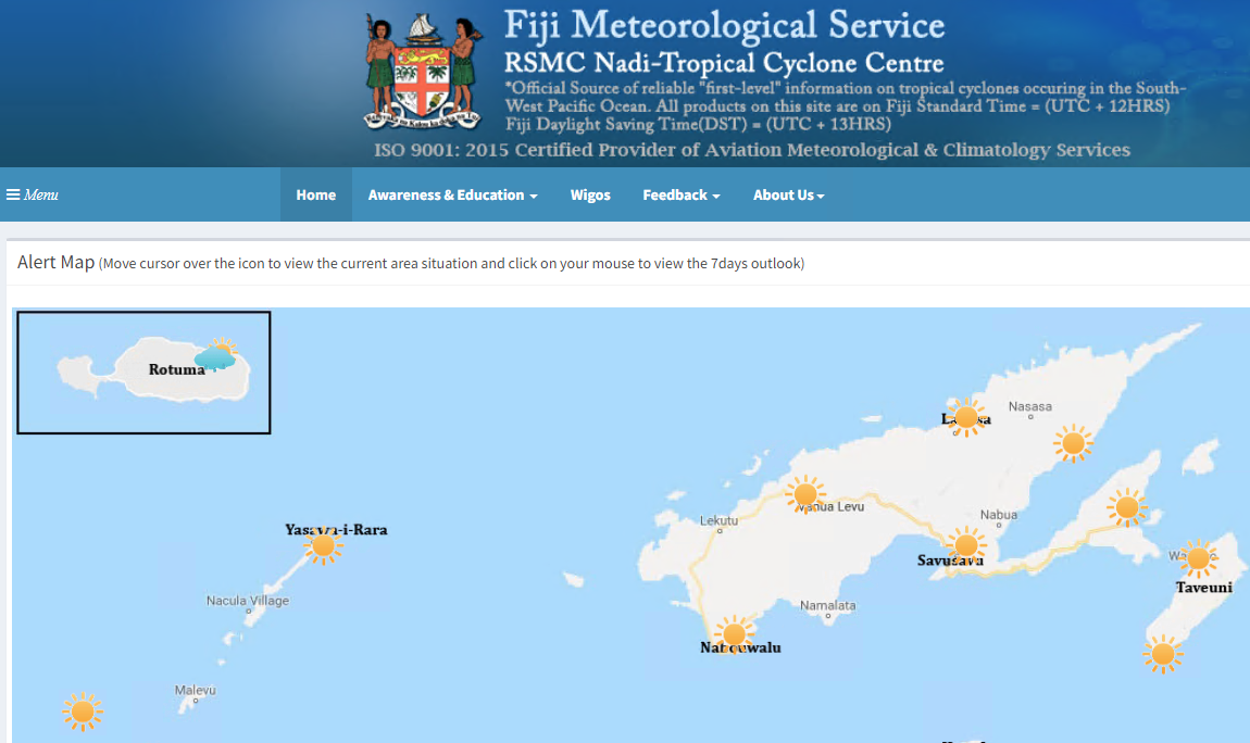
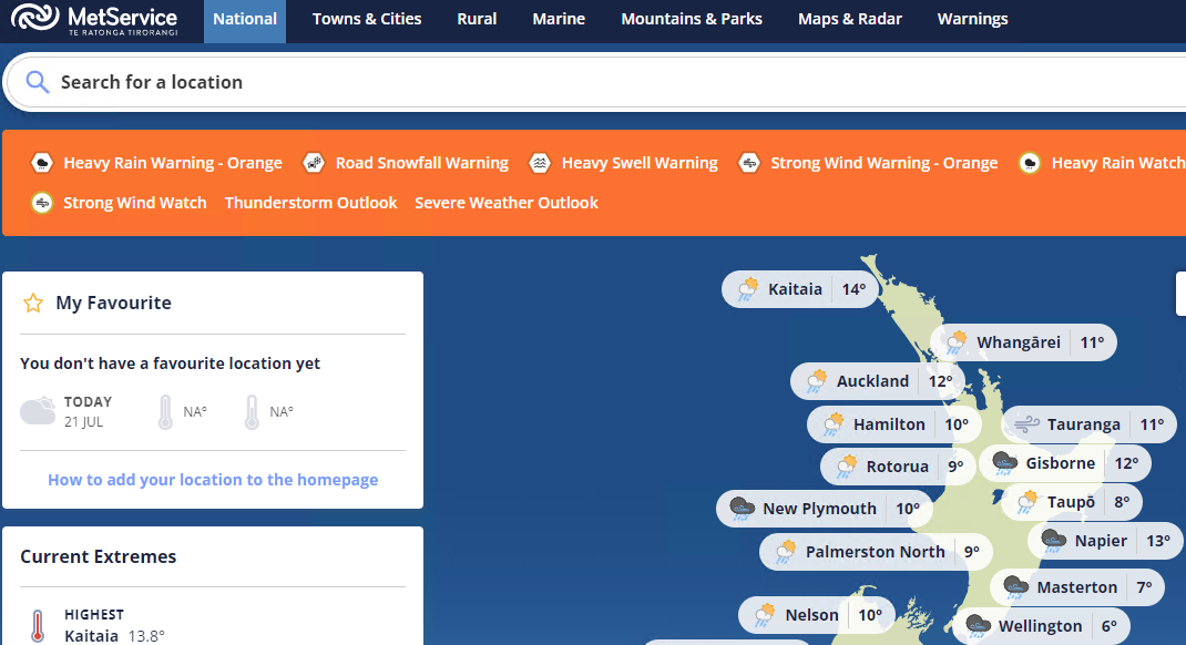
Oceania
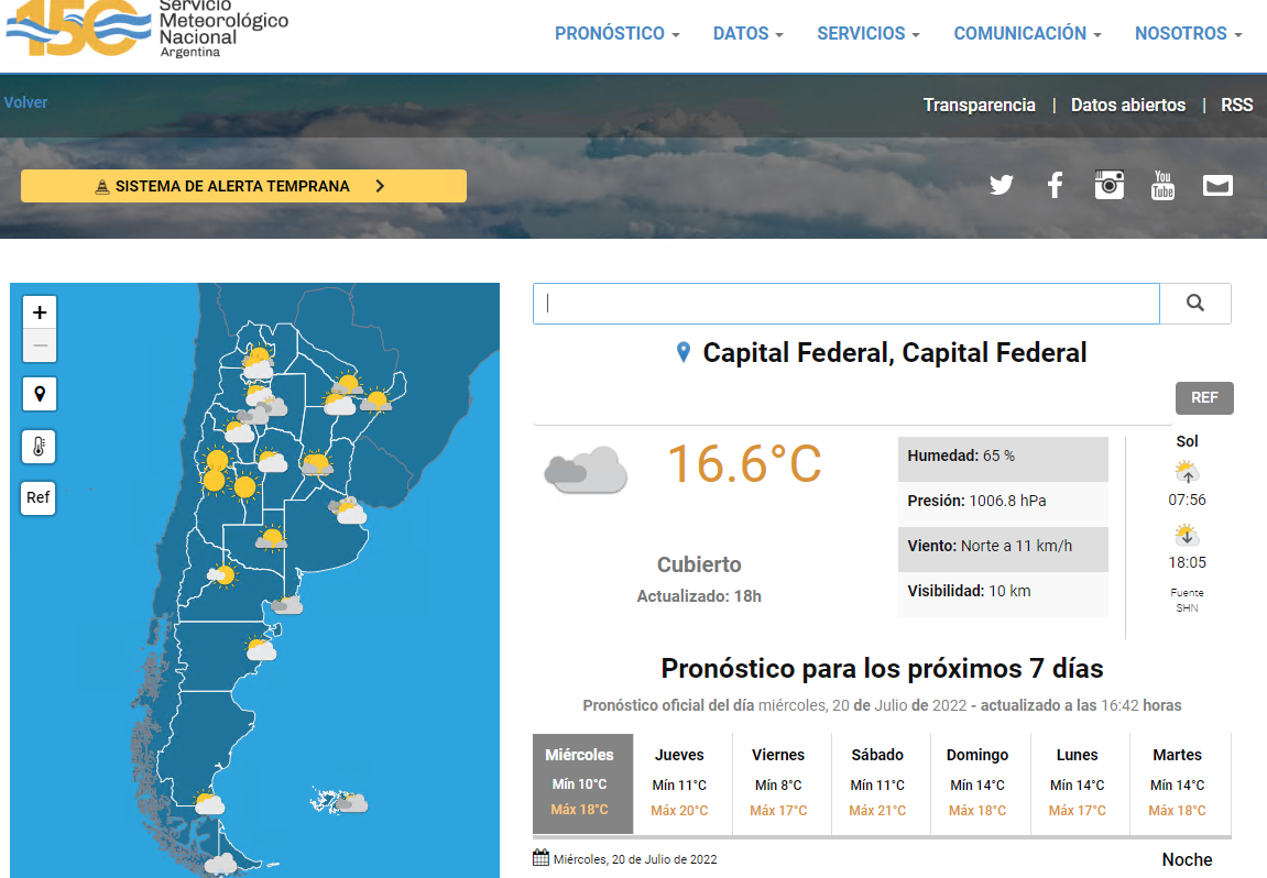
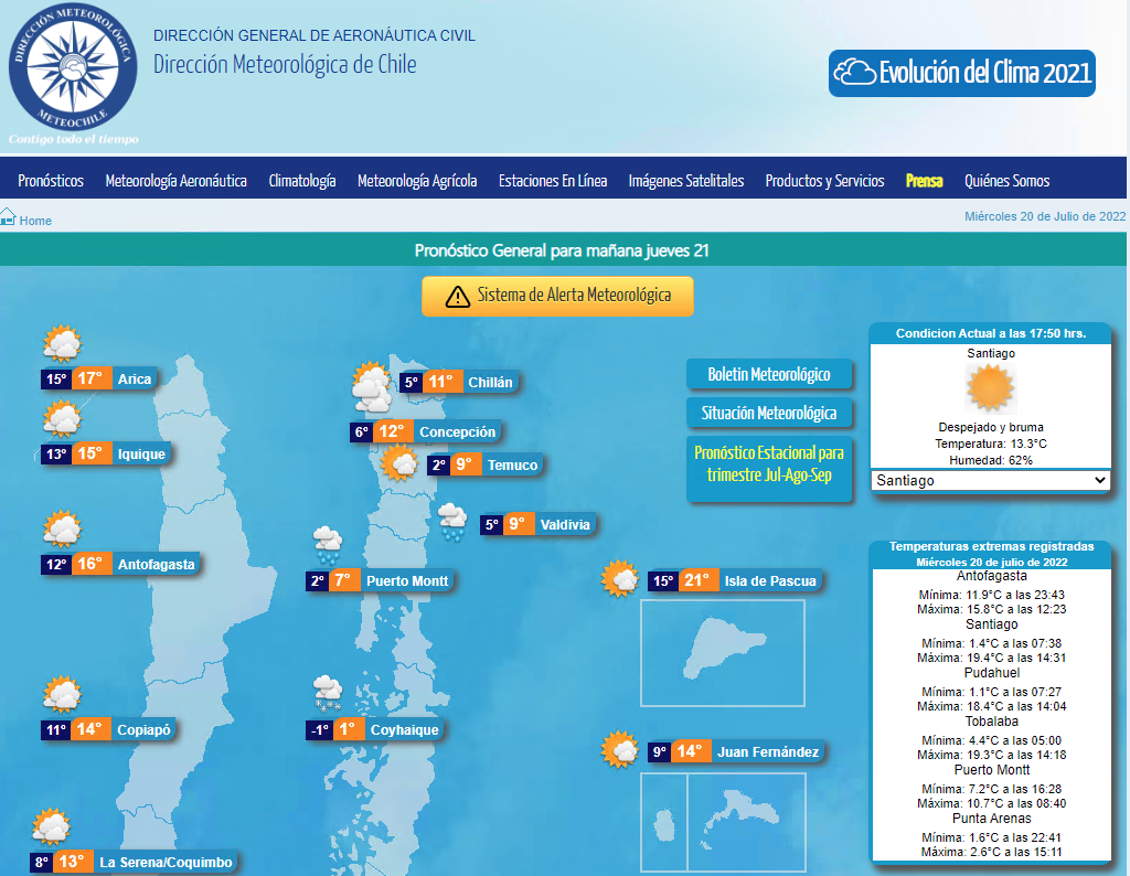
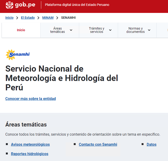
South America
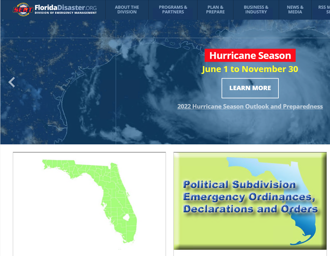
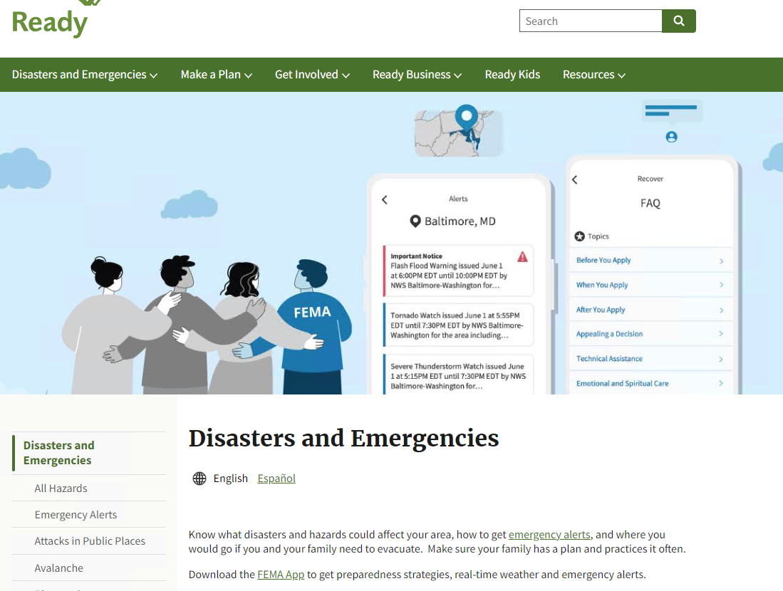
Emergency Management Resources